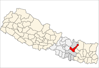
Bamti Bhandar is a former village development committee in Ramechhap District in the Janakpur Zone of north-eastern Nepal. At the time of the 1991 Nepal census it had a population of 2,895.
Betali is a village development committee in Ramechhap District in the Janakpur Zone of north-eastern Nepal. At the time of the 1991 Nepal census it had a population of 3,907 people living in 740 individual households.
Bhirpani is a village development committee in Ramechhap District in the Janakpur Zone of north-eastern Nepal. At the time of the 1991 Nepal census it had a population of 3,877 people living in 662 individual households.
Chisapani, Ramechhap is a village development committee in Ramechhap district in the Janakpur Zone of north-eastern Nepal. At the time of the 1991 Nepal census, it had a population of 3,058 people living in 579 individual households.
Chuchure is a village development committee in Ramechhap District in the Janakpur Zone of north-eastern Nepal. At the time of the 1991 Nepal census it had a population of 2,226 people living in 452 individual households.
Deurali, Ramechhap is a village development committee in Ramechhap District in the Janakpur Zone of north-eastern Nepal. At the time of the 1991 Nepal census it had a population of 3,459.
Wapti is a village development committee in Ramechhap District in the Janakpur Zone of north-eastern Nepal. At the time of the 1991 Nepal census it had a population of 3,015 people living in 602 individual households.
Hiledevi is a village development committee in Ramechhap District in the Janakpur Zone of north-eastern Nepal. At the time of the 1991 Nepal census it had a population of 2,816 people living in 597 individual households.
Lakhanpur is a Village Development Committee in Ramechhap District in the Janakpur Zone of north-eastern Nepal. At the time of the 1991 Nepal census it had a population of 6,058 people residing in 1,100 individual households.

Tokarpur is a village development committee in Ramechhap District in the Bagmati Province of north-eastern Nepal. At the time of the 1991 Nepal census it had a population of 3,260 people living in 632 individual households.
Maluwajor is a village development committee in Ramechhap District in the Janakpur Zone of north-eastern Nepal. At the time of the 1991 Nepal census it had a population of 3,129 people living in 539 individual households.
Piukhuri is a village development committee in Ramechhap District in the Janakpur Zone of north-eastern Nepal. At the time of the 1991 Nepal census it had a population of 2,026 people living in 358 individual households.
Puranagau is a village development committee in Ramechhap District in the Janakpur Zone of north-eastern Nepal. At the time of the 1991 Nepal census it had a population of 2,866 people living in 242 individual households.
Rampur is a village development committee in Ramechhap District in the Janakpur Zone of north-eastern Nepal. At the time of the 2001 Nepal census it had a population of 4,400 people living in 724 individual households.

Okhreni was a village development committee in Ramechhap District in the Janakpur Zone of north-eastern Nepal now it has included on Ramechhap municipalicy. At the time of the 1991 Nepal census it had a population of 3,007 people living in 549 individual households.
Pakarbas is a village development committee in Ramechhap District in the Janakpur Zone of north-eastern Nepal. At the time of the 1991 Nepal census it had a population of 5,274 people living in 898 individual households.
Salupati is a village development committee in Ramechhap District in the Janakpur Zone of north-eastern Nepal. At the time of the 1991 Nepal census it had a population of 3,852 people living in 745 individual households.
Sanghutar is a village development committee in Ramechhap District in the Janakpur Zone of north-eastern Nepal. At the time of the 1991 Nepal census it had a population of 2,177 people living in 394 individual households. The VDC has a small market called Sanghutar Bazaar, situated in the bank of the Likhu River and bordering Okhaldhunga District. The bazaar is flat land near to the bridge ; therefore, its name is Sanghutar. It is a main commercial center of many neighboring villages of Ramechhap and Okhaldhunga District with a higher secondary school called Himaganga.
Sukajor is a village development committee in Ramechhap District in the Janakpur Zone of north-eastern Nepal. At the time of the 1991 Nepal census it had a population of 3,719 people living in 611 individual households.
Tilpung is a village development committee in Ramechhap District in the Janakpur Zone of north-eastern Nepal. At the time of the 1991 Nepal census, it had a population of 3,511 people, living in 650 individual households.


