Nandhaur Wildlife Sanctuary | |
---|---|
IUCN category IV (habitat/species management area) | |
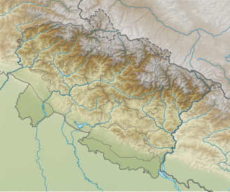
Location | Uttarakhand, India |
Coordinates | 29°02′00″N79°48′00″E / 29.03333°N 79.80000°E |
Established | 2012 |
Nandhaur Wildlife Sanctuary is a wildlife sanctuary in Uttarakhand, India that was created in 2012. It is located in the Terai Arc Landscape, a forest zone that stretches from Uttarakhand in India and extends into Nepal. [1]
Nandhaur Wildlife Sanctuary lies between the Gola and Sharda Rivers in the Haldwani forest division and links the forests of Ramnagar and Terai central forest division with Shuklaphanta National Park in Nepal. [1] It extends over an area of 269.96 km2 (104.23 sq mi). Since 2002, Nandhaur Wildlife Sanctuary has been a part of the Shivalik Elephant Reserve. The Wildlife Institute of India in 2004 recognised Nandhaur Wildlife Sanctuary as one of three viable habitats key to the long-term future of the tiger. [2] [3]
Nandhaur Wildlife Sanctuary is primarily a sal forest with more than 100 species of trees including shisham, bamboo, teak and chir pine. [2] Over 30 species of shrubs and about 35 species of climbers and grasses were recorded. [4]
Nandhaur Wildlife Sanctuary hosts about 25 species of mammals, 250 species of birds, 15 species of reptiles and 20 species of fishes. The major mammalian species include Asian elephant, leopard, tiger and sloth bear. [5]
Nandhaur Wildlife Sanctuary is threatened by illegal logging and boulder mining, poaching and the diversion of forest land for non-forestry related developmental activities. [6]
The Bengal tiger or Royal Bengal tiger is a population of the Panthera tigris tigris subspecies and the nominate tiger subspecies. It ranks among the biggest wild cats alive today. It is estimated to have been present in the Indian subcontinent since the Late Pleistocene for about 12,000 to 16,500 years. Its historical range covered the Indus River valley until the early 19th century, almost all of India, western Pakistan, southern Nepal, Bangladesh, Bhutan and southwestern China. Today, it inhabits India, Bangladesh, Nepal, Bhutan, and southwestern China. It is threatened by poaching, habitat loss and habitat fragmentation.
The rusty-spotted cat is one of the cat family's smallest members, of which historical records are known only from India and Sri Lanka. In 2012, it was also recorded in the western Terai of Nepal. Since 2016, the global wild population is listed as Near Threatened on the IUCN Red List as it is fragmented and affected by loss and destruction of its prime habitat, deciduous forests.
Jim Corbett National Park is a national park in India located in the Nainital district of Uttarakhand state. The first national park in India, it was established in 1936 during the British Raj and named Hailey National Park after William Malcolm Hailey, a governor of the United Provinces in which it was then located. In 1956, nearly a decade after India's independence, it was renamed Corbett National Park after the hunter and naturalist Jim Corbett, who had played a leading role in its establishment and had died the year before. The park was the first to come under the Project Tiger initiative.
The Terai or Tarai is a lowland region in parts of southern Nepal and northern India that lies to the south of the outer foothills of the Himalayas, the Sivalik Hills and north of the Indo-Gangetic Plain. This lowland belt is characterised by tall grasslands, scrub savannah, sal forests and clay rich swamps. In North India, the Terai spreads from the Yamuna River eastward across Haryana, Uttarakhand, Uttar Pradesh, Bihar and West Bengal. The Terai is part of the Terai-Duar savanna and grasslands ecoregion. Nepal's Terai stretches over 33,998.8 km2 (13,127.0 sq mi), about 23.1% of Nepal's land area, and lies at an elevation of between 67 and 300 m. The region comprises more than 50 wetlands. North of the Terai rises the Bhabar, a narrow but continuous belt of forest about 8–12 km (5.0–7.5 mi) wide.
The Gandaki River, also known as the Narayani and Gandak, is one of the major rivers in Nepal and a left-bank tributary of the Ganges in India. Its total catchment area is 46,300 km2 (17,900 sq mi), most of it in Nepal. In the Nepal Himalayas, the Gandaki is notable for its deep canyon. The basin also contains three mountains over 8,000 m (26,000 ft), namely Dhaulagiri, Manaslu and Annapurna Massif. Dhaulagiri is the highest point of the Gandaki basin. In its upper reaches, the river is known as Kali Gandaki as it flows through the Mustang district and the famous Kali Gandaki Gorge in Nepal. When the river reaches the Terai plains of Nepal, it is referred to as the Narayani River. This name change typically occurs near the confluence with the Trishuli River at Devghat in Chitwan. Upon entering India, the river is known as the Gandak River.
Gorumara National Park is a national park in northern West Bengal, India. Located in the Dooars region of the Himalayan foothills, it is a medium-sized park with grasslands and forests. Gorumara National Park was established in 1992. It is primarily known for its population of Indian rhinoceros. The park was declared as the best among the protected areas in India by the Ministry of Environment and Forests for the year 2009.
Valmiki National Park is a national park and tiger reserve in the West Champaran District of Bihar, India covering 898.45 km2 (346.89 sq mi). It is the only national park in Bihar.
Kalesar National Park and adjacent Kalesar Wildlife Sanctuary (13,209 acres are protected areas in Kalesar of Yamunanagar district of Haryana state in India, 46 kilometres from Yamunanagar city, 122 kilometres from Chandigarh. Kalesar National Park was established in 2003. Kalesar National Park and Kalesar Wildlife Sanctuary are contiguous to Simbalbara National Park in Himachal Pradesh and Rajaji National Park in Uttarakhand. Kalesar is a popular destination for leopards, panthers, elephants, red jungle fowl and bird-watching. This forested area in the Shivalik foothills is covered primarily with sal with smattering of Semul, Amaltas and Bahera trees as well. Wildlife jeep safaris are available on 3 tracks. Park is closed July to September and during the remaining months visiting hours are 6 am to 10 am and 4 pm to 7 pm during summers, and 7 am to 11 am and 3.30 pm to 6 pm during winters.
Rajaji National Park is a national park and tiger reserve in the Indian state of Uttarakhand. that encompasses the Shivaliks, near the foothills of the Himalayas. It covers 820 km2 (320 sq mi) and is included in three districts of Uttarakhand—Haridwar, Dehradun and Pauri Garhwal. In 1983, three wildlife sanctuaries in the area were merged into one.
The Terai–Duar savanna and grasslands is a narrow lowland ecoregion at the base of the Himalayas, about 25 km (16 mi) wide, and a continuation of the Indo-Gangetic Plain in India, Nepal and Bhutan. It is colloquially called Terai in the Ganges Basin east to Nepal, then Dooars in West Bengal, Bhutan and Assam east to the Brahmaputra River. It harbours the world's tallest grasslands, which are the most threatened and rare worldwide.
Askot Musk Deer Sanctuary is located 54 km (34 mi) from Pithoragarh near Askot in Uttarakhand state of India. This sanctuary has been set up primarily with the object of conserving the musk deer (Moschus leucogaster) and its habitat. Intensive efforts have been initiated to conserve this rare species. Other mammals found in this sanctuary include the Bengal tiger, Indian leopard, Himalayan jungle cat, civet, barking deer, serow, goral and Himalayan brown bear. Many species of high altitude birds are also found in this sanctuary.
The Upper Gangetic Plains moist deciduous forests is a tropical and subtropical moist broadleaf forests ecoregion of northern India.
Uttar Pradesh is India's fourth largest state by land area, and most populous state, located in the north-central part of the country. It spreads over a large area, and the plains of the state are quite distinctly different from the high mountains in the north. The climate of this state can also vary widely - primarily due to it being far from the moderating effect of the sea and the occasional cold air arising due to western disturbances.it has been seen that in uttar pradesh there is very hot climate wright now
The Himalayan subtropical broadleaf forests is an ecoregion that extends from the middle hills of central Nepal through Darjeeling into Bhutan and also into the Indian States of Uttar Pradesh and Bihar. It represents the east–west-directed band of subtropical broadleaf forest at an altitude of between 500 and 1,000 m along the Outer Himalayan Range, and includes several forest types traversing an east to west moisture gradient.
Conservation Areas in India refer to well-demarcated large geographical entities with an established conservation plan, and were part of a joint Indo-US project on "landscape management and protection". The project ran from 1996 to 2002. These areas are home to many Conservation reliant species.
Pilibhit Tiger Reserve is located in Pilibhit district of Uttar Pradesh and was notified as a tiger reserve in 2014. It forms part of the Terai Arc Landscape in the upper Gangetic Plain along the India-Nepal border. The habitat is characterized by sal forests, tall grasslands and swamp maintained by periodic flooding from rivers. The Sharda Sagar Dam extending up to a length of 22 km (14 mi) is on the boundary of the reserve.
Shuklaphanta National Park is a national park in the Terai of the Far-Western Region, Nepal, covering 305 km2 (118 sq mi) of open grasslands, forests, riverbeds and wetlands at an elevation of 174 to 1,386 m. It is bounded by the Mahakali river in the west and south. A small part extends north of the Mahendra Highway to create a wildlife corridor for seasonal migration of wildlife into the Sivalik Hills. It was gazetted in 1976 as Royal Shuklaphanta Wildlife Reserve and was enlarged to its present size in the late 1980s. A buffer zone of 243.5 km2 (94.0 sq mi) was added in 2004. It receives a mean annual rainfall of 1,579 mm (62.2 in) and harbours 700 floral, 456 bird, 56 reptile and 15 amphibian species.
Sathyamangalam Tiger Reserve is a protected area and tiger reserve located along the area straddling both the Western Ghats and Eastern Ghats in the Erode district of the Indian state of Tamil Nadu. The Sathyamangalam Forest Division is part of the Bramhagiri-Nilgiris-Eastern Ghats Elephant Reserve notified in 2003. In 2008, part of the Sathyamangalam Forest Division was declared a wildlife sanctuary, which was further enlarged in 2011 to cover a forest area of 1,411.6 km2 (545.0 sq mi). It is the largest wildlife sanctuary in Tamil Nadu. In 2013, an area of 1,408.6 km2 (543.9 sq mi) of the erstwhile sanctuary was notified as a tiger reserve and it was the fourth tiger reserve established in the state as a part of Project Tiger.
Govind Pashu Vihar National Park and Wildlife Sanctuary is a national park in Supin Range, near Uttarkashi town in the district and state of the same name in India. It was established initially as a wildlife sanctuary in 1955, and was later converted into a national park. It is named after prominent Indian freedom fighter and politician Govind Ballabh Pant, who became Home Minister in 1955 and is credited for establishing Hindi as an official language of India.
Terai Arc Landscape (TAL) is composed of 14 Indian and Nepalese trans-border protected ecosystems of the Terai and nearby foothills of the Himalayas. and encompassing 14 protected areas of Nepal and India. The area spans approximately 12.3 million acres and includes Nepal's Bagmati River to the east and India's Yamuna River to the west. The TAL is home to many endangered mammals including the Bengal tiger, the Indian rhinoceros, the gaur, the wild Asian elephant, the hispid hare, the sloth bear, the South Asian river dolphin and the chital, as well as over 500 species of birds, many endangered. Examples of birds are the endangered Bengal florican, the sarus crane, and the black stork.