
Kitale is an agricultural town in the northern Rift Valley, situated between Mount Elgon and the Cherangany Hills.The town has an elevation of around 1,900 metres (6,200 ft) Its population is 162,174 as of 2019. Kitale is the headquarter town of Trans-Nzoia County. Kitale is reachable by air through Kitale Airport. The postal code for Kitale is 30200.

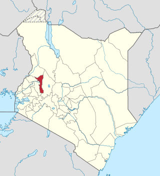
Trans-Nzoia County is a county in the former Rift Valley Province, Kenya, located between the Nzoia River and Mount Elgon, 380 km northwest of Nairobi. At its centre is the town of Kitale which is the capital and largest town. The county borders Bungoma to the west, Uasin Gishu and Kakamega to the south, Elgeyo-Marakwet to the east, West Pokot to the north and the republic of Uganda to the Northwest. Trans Nzoia covers an area of 2495.5 square kilometres.

The Luhya are a bantu people and the second largest ethnic group in Kenya. The Luhya belong to the larger linguistic stock known as the Bantu. The Luhya are located in western Kenya and Uganda. They are divided into 20 culturally and linguistically united clans. Once known as the Bantu Kavirondo, multiple small tribes in North Nyanza came together under the new name Baluhya between 1950 and 1960.Bukusu is the largest luhya subtribe and account almost 50% of entire luhya population. They dominates other luhya small subtribes and they live in both Bungoma and Trans nzoia counties

Uasin Gishu County is one of the 47 counties of Kenya located in the former Rift Valley Province. Eldoret has the county's largest population centre as well as its administrative and commercial centre. “It lies between longitudes 34 degrees 50’ east and 35 degrees 37’ West and latitudes 0 degrees 03’ South and 0 degrees 55’ North. It is a highland plateau with altitudes falling gently from 2,700 meters above sea level to about 1,500 meters above sea level. The topography is higher to the east and declines gently towards the western border”.

Busia is a county in the former Western Province of Kenya. It borders Kakamega County to the east, Bungoma County to the north, Lake Victoria and Siaya County to the south and Busia District, Uganda to the west. The county has about 893,861 people and spans about 1,700 square kilometers making it one of the smallest counties in Kenya. Busia is inhabited by the Luhya tribe of Kenya and the Teso of Kenya, and small groups of the Luo. The Luhya communities include the Abakhayo, Marachi, Samia and Abanyala communities.

Bungoma County is a county in the former Western Province of Kenya with its capital in Bungoma town. It has a population of 1,670,570 of which 812,146 are males 858,389 females as per the 2019 census and an area of 2,069 km2. It has nine constituencies, namely: Bumula, Kabuchai, Kanduyi, Kimilili, Mt. Elgon, Sirisia, Tongaren, Webuye East and Webuye West.
Marakwet District is a defunct administrative district in the former Rift Valley Province of Kenya. Its capital town was Kapsowar. The district had a population of 140.629. Local people are predominantly of the Marakwet tribe.

Nandi County is a county in Kenya in the North Rift, occupying an area of 2,884.4 square kilometres. Its capital, Kapsabet, is the largest town in the county while other towns include Mosoriot, Tinderet, Kobujoi, Kaiboi, Kabiyet and Nandi Hills. According to a 2019 census, the county had a population of 885,711, made up of a number of Kenyan communities, the majority of whom belong to the native tribe called Nandi.
Tiriki or Hamisi is home to the Tiriki subtribe of the Abaluyia. Hamisi Constituency is an electoral constituency in Kenya. It is one of five constituencies in Vihiga County. Hamisi Constituency includes seven electoral wards: Shiru Ward, Gisambai Ward, Shamakhokho Ward, Banja Ward, Muhudu Ward, Tambua ward, and Jepkoyai Ward. It has a population of 159,241 people.

Tiriki is one of sixteen clans and dialects of the Abaluyia people of Western Kenya. The word Tiriki is also used to refer to their Geographical Location in Hamisi Division, Vihiga County, in the Western province of Kenya. Hamisi Constituency now Hamisi Sub County is one of the longest in Kenya stretching from kiboswa(Ny'angori) to Shiru which borders Kapsabet and Musunji which borders Kakamega Forest. Some also moved to nandi county and occupied aldai and other parts of nandi county.

Sub-counties, formerly known as Districts, are the decentralised units through which government of Kenya provides functions and services. Except for the parts which fall under urban areas, sub-counties will coincide with the constituencies created under article 89 of the Constitution of Kenya. Most sub-counties have a sub-county administrator, appointed by a County Public Service Board. Even though the sub-counties are divisions of counties, powers to create new sub-counties lies with the national government. As of 2023, there are 314 sub-counties, compared to 290 constituencies. A deputy county commissioner is appointed by the state to lead each sub-county.
Elgeyo-Marakwet County is one of Kenya's 47 counties, which is located in the former Rift Valley Province with its capital and largest town as Iten. It borders the counties of West Pokot to the north, Baringo County to the east, southeast and south, Uasin Gishu to the southwest and west, and Trans Nzoia to the northwest.
West Pokot District, formerly known as West Suk or Kacheliba District, was an administrative district in the Rift Valley Province of Kenya. Its capital town was Kapenguria.
Uasin Gishu District, also known as Eldoret District, was one of the districts of Kenya, located in the Rift Valley Province. The town of Eldoret was its capital, administrative and commercial centre. It bordered the Trans-Nzoia District.
Trans-Nzoia District was an administrative district of Rift Valley Province, Kenya, located between the Nzoia River and Mount Elgon with its centre at the town of Kitale.
Samburu District was a district in Rift Valley Province, Kenya. It covered an area of roughly 21,000 km2 (8,000 mi2) in northern Kenya where the Samburu tribe live. The district had a population of 143,547 in the 1999 census. It stretched north from the Wuaso Ng'iro River to the south of Lake Turkana and also includes Mount Kulal which lies just east of Lake Turkana.
Narok District was an administrative district in Kenya. The Narok District is located in the Rift Valley Province, and has a population of 365,750. Its capital town is Narok.
Laikipia District was a district of Kenya, located on the Equator in the Rift Valley Province of the country. The district had two major urban centres: Nanyuki to the southeast, and Nyahururu to the southwest. Its capital was Nanyuki.
Kericho was a district in the Rift Valley Province of Kenya. Its capital was Kericho. It had a population of 468,493 and an area of 2,111 km2.
Isiolo District was an administrative district in Eastern Province of Kenya, with its capital at Isiolo town.