Ōmagari was a city located in Akita Prefecture, Japan.
Kamioka was a town located in Senboku District, Akita Prefecture, Japan.
Nishisenboku was a town located in Senboku District, Akita Prefecture, Japan.

Kyōwa was a town located in Senboku District, Akita Prefecture, Japan.

Nangai was a village located in Senboku District, Akita Prefecture, Japan.
Ōta was a town located in Senboku District, Akita Prefecture, Japan.

Senboku District is a rural district located in Akita, Japan.

The Shinano River, known as the Chikuma River in its upper reaches, is the longest and widest river in Japan and the third largest by basin area. It is located in northeastern Honshu, rising in the Japanese Alps and flowing generally northeast through Nagano and Niigata Prefectures before emptying into the Sea of Japan.
Nakasen was a town located in Senboku District, Akita Prefecture, Japan.
The Kuma River is a river in Kumamoto Prefecture, central Western part of Kyūshū, Japan. It is sometimes referred as Kumagawa River. It is the longest river in Kyushu, with the length of 115 km long and has a drainage area of 1,880 km2 (730 sq mi). The tidal flat of the Kuma River estuary is approximately 1000 hectares.

Saru River is a river in Hokkaidō, Japan.

Malampuzha Dam is the largest dam and reservoirs in Kerala, located near Palakkad, in the state of Kerala in South India, built post independence by the then Madras state. Situated in the scenic hills of the Western Ghats in the background it is a combination of a masonry dam with a length of 1,849 metres and an earthen dam with a length of 220 metres making it the longest dam in the state. The dam is 355 feet high and crosses the Malampuzha River, a tributary of Bharathappuzha, Kerala's second longest river. There is a network of two canal systems that serve the dam's reservoir of 42,090 hectares.
Niikappu River is a river in Hokkaidō, Japan.

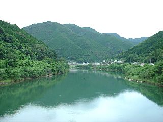
The Gōnokawa River is a river that runs through Hiroshima and Shimane prefectures in Japan. It is the largest river in the Chūgoku region. It is also called the Gōgawa River and, in Hiroshima, the Enokawa River.

Sri Sundareswarar temple, situated at Nangavaram, 20 kilometres off Tiruchirapalli, is more than 1,000 years old.
Senboku was a town located in Senboku District, Akita Prefecture, Japan.

FM Hanabi (FMはなび) is a Japanese FM station that is run by TMO Omagari in Daisen, Akita, Japan.
Naalaiya Pozhuthum Unnodu is a 2007 Indian Tamil language romantic drama film directed by K. Moorthy Kannan. The film stars Prithvi Rajan and Karthika, with Velu Prabhakaran, Rohini, J. Livingston, Venu Arvind, Sugi, Kathaka Thirumavalavan, Gowri and Kovai Guna playing supporting roles. The film, produced by P. R. Suresh Kumar, had musical score by Srikanth Deva and was released on 12 October 2007.