
Omaha is the largest city in the U.S. state of Nebraska and the county seat of Douglas County. Omaha is in the Midwestern United States on the Missouri River, about 10 mi (15 km) north of the mouth of the Platte River. The nation's 39th-largest city, Omaha's 2020 census population was 486,051.

Saunders County is a county in the U.S. state of Nebraska. As of the 2010 United States Census, the population was 20,780. Its county seat is Wahoo.

Cass County is a county in the U.S. state of Nebraska. As of the 2010 United States Census, the population was 25,241. Its county seat and largest city is Plattsmouth. The county was formed in 1855, and was named for General Lewis Cass.

Fairbury is a city and county seat of Jefferson County, Nebraska, United States. The population was 3,942 at the 2010 census.

Samuel Maxwell was a Populist politician in the U.S. state of Nebraska.

The history of Omaha, Nebraska, began before the settlement of the city, with speculators from neighboring Council Bluffs, Iowa staking land across the Missouri River illegally as early as the 1840s. When it was legal to claim land in Indian Country, William D. Brown was operating the Lone Tree Ferry to bring settlers from Council Bluffs to Omaha. A treaty with the Omaha Tribe allowed the creation of the Nebraska Territory, and Omaha City was founded on July 4, 1854. With early settlement came claim jumpers and squatters, and the formation of a vigilante law group called the Omaha Claim Club, which was one of many claim clubs across the Midwest. During this period many of the city's founding fathers received lots in Scriptown, which was made possible by the actions of the Omaha Claim Club. The club's violent actions were challenged successfully in a case ultimately decided by the U.S. Supreme Court, Baker v. Morton, which led to the end of the organization.

The Moses Merrill Mission, also known as the Oto Mission, was located about eight miles west of Bellevue, Nebraska. It was built and occupied by Moses and Eliza Wilcox Merrill, the first missionaries resident in Nebraska. The first building was part of facilities built in 1835 when the United States Government removed the Otoe about eight miles southwest of Bellevue. Merrill's goal was to convert the local Otoe tribe to Christianity; he had learned the language and translated the Bible and some hymns into Otoe.
The Lone Tree Ferry, later known as the Council Bluffs and Nebraska Ferry Company, was the crossing of the Missouri River at Council Bluffs, Iowa, and Omaha, Nebraska, US, that was established in 1850 by William D. Brown. Brown was the first pioneer to see the potential for a city on the site, and the landing became a popular gathering site for the first settlers of the Nebraska Territory. Named after a solitary tree on the Nebraska bank of the river, the Lone Tree Ferry became central to the founding and development of the City of Omaha.
William D. Brown was the first pioneer to envision building a city where Omaha, Nebraska sits today. Many historians attribute Brown to be the founder of Omaha, although this has been disputed since the late nineteenth century. Alfred D. Jones, the first postmaster of Omaha, laid strong claims to the title himself, suggesting that he told Brown about the potential for a town. Brown was also a member of the Second Territorial Legislature for the Nebraska Territory.
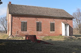
Rock Bluff is a ghost town in Cass County located approximately three miles east of Murray in the U.S. state of Nebraska. Once the home of an influential college called the Naomi Institute, Rock Bluff was instrumental in the 1866 vote that gave Nebraska statehood.

John Andrew Creighton was a pioneer businessman and philanthropist in Omaha, Nebraska who founded Creighton University. The younger brother of Edward Creighton, John was responsible for a variety of institutions throughout the city of Omaha, and was ennobled by Pope Leo XIII in recognition of his contributions to Creighton University, the Catholic community in Omaha, and the city of Omaha in general.

Fontanelle is an unincorporated community and census-designated place (CDP) in Washington County, Nebraska, United States. The site of repeated incursions by the neighboring Pawnee tribe, Fontanelle was an early boom town in the Nebraska Territory, but waned in importance after failing to secure a railroad connection in the late 19th century. The 1860 Federal Census showed the town having dozens of residents, including farmers, carpenters, blacksmiths, clergymen, lawyers, and other professions. The town dwindled from a population of 500 to a few dozen after an early university left in the 1870s, it failed to get a railroad connection, and the nation suffered a financial depression.
The Omaha Horse Railway was a private transportation company in early Omaha, Nebraska. The company was founded in 1867 by Omaha pioneers Ezra Millard, Andrew J. Hanscom and Augustus Kountze to provide horsecar service in the city. On February 19 of that year the Nebraska Territory Legislature awarded the company a 50-year franchise and exclusive rights to run tracks on Omaha's streets in its closing session. The company was noted for an 1888 United States District Court trial in which they sued another company for infringing on the exclusive rights to Omaha's streets granted to them by the Nebraska Territory Legislature.

Peter Abadie Sarpy (1805–1865) was the French-American owner and operator of several fur trading posts, essential to the development of the Nebraska Territory, and a thriving ferry business. A prominent businessman, he helped lay out the towns of Bellevue and Decatur, Nebraska. Nebraska's legislature named Sarpy County after him in honor of his service to the state.
Gambling in Omaha, Nebraska has been significant throughout the city's history. From its founding in the 1850s through the 1930s, the city was known as a "wide-open" town, meaning that gambling of all sorts was accepted either openly or in closed quarters. By the mid-20th century, Omaha reportedly had more illicit gambling per capita than any other city in the nation. From the 1930s through the 1970s, the city's gambling was controlled by an Italian criminal element.
The Otoe Reservation was a twenty-four square-mile section straddling the Kansas-Nebraska state line. The majority of the reservation sat in modern-day southeast Jefferson County, Nebraska.

This is a list of the National Register of Historic Places listings in Cass County, Nebraska.

Charles Sumner "Cy" Sherman was an American journalist and is known as the "father of the Cornhuskers" after giving the Nebraska Cornhuskers football team the name "Cornhuskers" in 1899. At his suggestion in 1936, Associated Press (AP) sports editor Alan J. Gould created the first AP Poll for ranking college football teams. Sherman began his career writing at the Nebraska State Journal in Lincoln, spent a short time at the Red Lodge, Montana Pickett before returning to Lincoln and the Lincoln Star where he spent most of his career. At his death he was called by the Star the "Dean of American Sportswriters".

Antioch is a tiny, unincorporated hamlet in Sheridan County, Nebraska, United States. Located approximately 15 miles east of Alliance on Nebraska Highway 2, the town was once nicknamed "the potash capital of Nebraska." The town took its name from Antioch, Ohio. There are now only a handful of houses, fewer than 25 residents, and a trash dump.
The Danish people in Omaha, Nebraska, were a predominant ethnic group in the city in the 1920s, and were notable for that compared to other cities across the United States. Omaha, as well as its neighbor, Council Bluffs, had "major colonies of Danes for many years."


