Tomiszewo is a village in the administrative district of Gmina Ostrowite, within Słupca County, Greater Poland Voivodeship, in west-central Poland. It lies approximately 14 kilometres (9 mi) north-east of Słupca and 72 km (45 mi) east of the regional capital Poznań.
Polanowo is a village in the administrative district of Gmina Powidz, within Słupca County, Greater Poland Voivodeship, in west-central Poland. It lies approximately 4 kilometres (2 mi) south of Powidz, 12 km (7 mi) north of Słupca, and 70 km (43 mi) east of the regional capital Poznań.
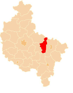
Powidz-Osiedle is a village in the administrative district of Gmina Powidz, within Słupca County, Greater Poland Voivodeship, in west-central Poland. It lies approximately 5 kilometres (3 mi) south-west of Powidz, 12 km (7 mi) north of Słupca, and 66 km (41 mi) east of the regional capital Poznań.
Bielawy is a village in the administrative district of Gmina Słupca, within Słupca County, Greater Poland Voivodeship, in west-central Poland. It lies approximately 4 kilometres (2 mi) east of Słupca and 69 km (43 mi) east of the regional capital Poznań.
Cienin Zaborny is a village in the administrative district of Gmina Słupca, within Słupca County, Greater Poland Voivodeship, in west-central Poland. It lies approximately 9 kilometres (6 mi) south-east of Słupca and 75 km (47 mi) east of the regional capital Poznań.
Czesławowo is a village in the administrative district of Gmina Słupca, within Słupca County, Greater Poland Voivodeship, in west-central Poland. It lies approximately 8 kilometres (5 mi) east of Słupca and 73 km (45 mi) east of the regional capital Poznań.
Drążna is a village in the administrative district of Gmina Słupca, within Słupca County, Greater Poland Voivodeship, in west-central Poland. It lies approximately 9 kilometres (6 mi) east of Słupca and 74 km (46 mi) east of the regional capital Poznań.
Grobla is a village in the administrative district of Gmina Słupca, within Słupca County, Greater Poland Voivodeship, in west-central Poland. It lies approximately 3 kilometres (2 mi) south-east of Słupca and 69 km (43 mi) east of the regional capital Poznań.
Józefowo is a village in the administrative district of Gmina Słupca, within Słupca County, Greater Poland Voivodeship, in west-central Poland. It lies approximately 7 kilometres (4 mi) north-east of Słupca and 70 km (43 mi) east of the regional capital Poznań.
Korwin is a village in the administrative district of Gmina Słupca, within Słupca County, Greater Poland Voivodeship, in west-central Poland. It lies approximately 6 kilometres (4 mi) north-east of Słupca and 69 km (43 mi) east of the regional capital Poznań.
Koszuty is a village in the administrative district of Gmina Słupca, within Słupca County, Greater Poland Voivodeship, in west-central Poland. It lies approximately 4 kilometres (2 mi) east of Słupca and 70 km (43 mi) east of the regional capital Poznań.
Marcewek is a village in the administrative district of Gmina Słupca, within Słupca County, Greater Poland Voivodeship, in west-central Poland. It lies approximately 9 kilometres (6 mi) north-east of Słupca and 73 km (45 mi) east of the regional capital Poznań.
Meszna is a village in the administrative district of Gmina Słupca, within Słupca County, Greater Poland Voivodeship, in west-central Poland. It lies approximately 6 kilometres (4 mi) north-east of Słupca and 71 km (44 mi) east of the regional capital Poznań.
Piotrowice is a village in the administrative district of Gmina Słupca, within Słupca County, Greater Poland Voivodeship, in west-central Poland. It lies approximately 3 kilometres (2 mi) north-east of Słupca and 68 km (42 mi) east of the regional capital Poznań.
Pokoje is a village in the administrative district of Gmina Słupca, within Słupca County, Greater Poland Voivodeship, in west-central Poland. It lies approximately 8 kilometres (5 mi) east of Słupca and 73 km (45 mi) east of the regional capital Poznań.
Posada is a village in the administrative district of Gmina Słupca, within Słupca County, Greater Poland Voivodeship, in west-central Poland. It lies approximately 8 kilometres (5 mi) north of Słupca and 67 km (42 mi) east of the regional capital Poznań.
Róża is a village in the administrative district of Gmina Słupca, within Słupca County, Greater Poland Voivodeship, in west-central Poland. It lies approximately 3 kilometres (2 mi) east of Słupca and 69 km (43 mi) east of the regional capital Poznań.
Rozalin is a village in the administrative district of Gmina Słupca, within Słupca County, Greater Poland Voivodeship, in west-central Poland. It lies approximately 6 kilometres (4 mi) east of Słupca and 72 km (45 mi) east of the regional capital Poznań.
Zastawie is a village in the administrative district of Gmina Słupca, within Słupca County, Greater Poland Voivodeship, in west-central Poland. It lies approximately 6 kilometres (4 mi) north-east of Słupca and 70 km (43 mi) east of the regional capital Poznań.
Żelazków is a village in the administrative district of Gmina Słupca, within Słupca County, Greater Poland Voivodeship, in west-central Poland. It lies approximately 7 kilometres (4 mi) east of Słupca and 73 km (45 mi) east of the regional capital Poznań.