Related Research Articles

Bastar is a district in the state of Chhattisgarh in Central India. Jagdalpur is the district headquarters. Bastar is bounded on the northwest by Narayanpur District, on the north by Kondagaon district, on the east by Nabarangpur and Koraput Districts of Odisha State, on the south and southwest by Dantewada and Sukma. The district possesses a unique blend of tribal and Odia culture.

Darrang is an administrative district in the state of Assam in India. The district headquarters are located at Mangaldoi. The district occupies an area of 1585 km2.

Kanpur Nagar district, meaning Urban Kanpur District is one of the districts of the Uttar Pradesh state of India. It is a part of Kanpur division and its district headquarters is Kanpur. Kanpur was formerly spelled Cawnpore.
Dantewada District, also known as Dantewara District or Dakshin Bastar District, is a district in the Indian state of Chhattisgarh. Dantewada is the district headquarters. The district is part of Bastar Division. Until 1998, Dantewada District was a tehsil of the larger Bastar District.

Rajnandgaon is a district of the state of Chhattisgarh in central India. The administrative headquarters the district is Rajnandgaon town.

Bastar division is an administrative division of Chhattisgarh state in central India. It includes the districts of Bastar, Dantewada, Bijapur, Narayanpur, Sukma, Kondagaon and Kanker.
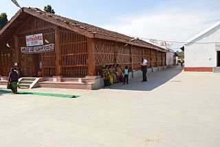
Kanker is a municipality and the headquarters of Kanker District, in the Indian state of Chhattisgarh. It is the second largest city of Bastar division after Jagdalpur.
Uttar Bastar Kanker District is located in the southern region of the state of Chhattisgarh, India within the longitudes 20.6-20.24 and latitudes 80.48-81.48. The total area of the district is 6432 square kilometers. The population is 748,941.

Dhamtari is a district of the Indian state of Chhattisgarh. This district is situated at 20°42' N latitude and 81°33' E longitude. Dhamtari district was officially formed on 6 July 1998 by trifurcating Raipur district into Raipur, Dhamtari and Mahasamund districts.
Kanker is a Lok Sabha parliamentary constituency in Chhattisgarh.
Kanker Legislative Assembly constituency is one of the 90 Legislative Assembly constituencies of Chhattisgarh state in India.

Kanker State was one of the princely states of India during the period of the British Raj. Its last ruler signed the accession to the Indian Union in 1947.
Gunderdehi is one of the 90 Legislative Assembly constituencies of Chhattisgarh state in India. It is in Balod district and is a part of Kanker Lok Sabha constituency.
Charama is a Nagar Panchayat city in the Kanker district of Chhattisgarh state, central India. The 2011 Census of India recorded 9,707 inhabitants in this town.
Tarasgaon is a village in the Kanker district of Chhattisgarh state, central India. The 2011 Census of India recorded 1,437 inhabitants in this town.
Antagarh Legislative Assembly constituency is one of the 90 Legislative Assembly constituencies of Chhattisgarh state in India.
Bhanupratappur Legislative Assembly constituency is one of the 90 Legislative Assembly constituencies of Chhattisgarh state in India.
Ajodhya Nagar is a census town in the Berhampore CD block in the Berhampore subdivision of the Murshidabad district in the state of West Bengal, India.
Jadupur is a census town in the Kaliachak I CD block in the Malda Sadar subdivision of Malda district in the state of West Bengal, India.
References
- ↑ "District Census Handbook: Uttar Bastar Kanker," Census of India 2011, Government of India