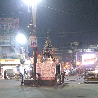
New Tehri is a city and a municipal board in Tehri Garhwal District in the Indian state of Uttarakhand. It is the administrative headquarters of Tehri Garhwal District. This urban municipality area has 11 wards, from Vidhi Vihar to Vishwakarma Puram. Mrs Seema Krishali is the chairperson of Nagar Palika Tehri, and is the first female chairperson of Tehri. She won as an independent. Shri Umesh Gusain of the BJP was Chairman of the Tehri Nagarpalika before Mrs Seema Krishali. He is the only Chairman who won this seat two times consecutively in 61 years. Tehri is represented by the Tehri assembly seat of Uttarakhand and the Tehri Lok Sabha seat of India, which are represented by Dhan Singh Negi and Mala Rajya Laxmi Shah respectively.

Champawat is a town and a Nagar Palika Parishad in Champawat district in the state of Uttarakhand, India. It is the administrative headquarters of Champawat district. The town was the former capital of the Kumaon Kingdom.
Sikar is a city in the state of Rajasthan in India. It is part of the Shekhawati region, which consists of Sikar, Churu and Jhunjhunu.
Nawalgarh is a heritage city in Jhunjhunu district of Indian state Rajasthan. It is part of the Shekhawati region and is midway between Jhunjhunu and Sikar. It is 30 km from Sikar and 39 km from Jhunjhunu. Nawalgarh is famous for its fresco and havelis and considered as Golden City of Rajasthan. It is also the motherland of some great business families of India.
Beawar is a city in Ajmer district of Rajasthan, India. Beawar was the financial capital of Merwara state of Rajputana. As of 2011, the population of Beawar is 342,935. It is located 70 kilometres from Ajmer the district headquarter, 184 kilometres (114 mi) southwest of the state capital Jaipur, amidst Aravali hills. The city used to be a major center for trade, especially in raw cotton, and used to have cotton presses and the Krishna cotton mills. Currently, major industries include mineral-based units, machine-based units, machine tools and accessories, pre-stressed concrete pipes, plastic products, textiles, wooden furniture and asbestos cement pipes. Beawar is the largest producer of cement in northern India and home to Shree Cement. It is situated in a mineral-rich region having reserves of feldspar, quartz, asbestos, soapstone, magnesite, calcite, limestone, mica, emerald, granite, and masonry stone. Reserves of barytes, fluorite, wollastonite and vermiculite have also been found. Nearest airports are Jodhpur (145 km), Kishangarh and Jaipur (190 km). It is also connected by RSRTC operated buses to all parts of Rajasthan, and neighboring Delhi NCR, Ahmedabad (Gujarat), Gwalior. It also has railway connectivity with Delhi, Mumbai, Ahmadabad, Bangalore (bi-weekly), Haridwar, Dehradun (weekly), Bareilly and Muzzafarpur.
Jind is one of the largest and oldest cities in the Indian state of Haryana. Rani Talab is the main destination for tourists while Pandu-Pindara and Ramrai are the main religious spots, attracting devotees for the holy bath during Amavasya.
Kashipur is a city of Udham Singh Nagar district in the Indian state of Uttarakhand, and one of its seven subdivisions. Located in the western part of Udham Singh Nagar district, it is Kumaun's third most populous city and the sixth most populous in Uttarakhand. According to the 2011 Census of India, the population is 121,623 for the city of Kashipur and 283,136 for Kashipur Tehsil. Kashipur also has IIM Kashipur, one of the thirteen Indian Institutes of Managements the government has set up during the Eleventh Five-year Plan.
Budhana is a town, block, tehsil, Nagar Panchayat, and one of the constituencies of the Uttar Pradesh Legislative Assembly in Muzaffarnagar district in the state of Uttar Pradesh, India.

Uttarkashi, meaning Kashi of the north, is a town located in Uttarkashi district in Uttarakhand, India. Uttarkashi town is headquarters of the district. Uttarkashi is also known as Somya Kashi. Uttarkashi is a religious place for spiritual and adventurous tourism. Uttarkashi town is also called as Shivnagri. The town has number of temples and ashrams. Uttarkashi is known for its religious people, weather, education.
Gola Gokaran Nath or Gola is the largest city/town, municipal board, thana and tehsil in Lakhimpur Kheri district in the Indian state of Uttar Pradesh.
Nawa is a city, tehsil headquarters, panchayat samiti, and a municipality in Nagaur district in the Indian state of Rajasthan. It is the Biggest Salt Market of Rajasthan.

Ramgarh Cantonment, usually referred to as Ramgarh Cantt or just Ramgarh is a cantonment town, belonging to the Ramgarh district of the Indian state of Jharkhand. Historically, a subdivision of the larger Hazaribag district, Ramgarh was finally elevated to a district status on 12 September 2007 largely to ease administrative hardships.

Srinagar is a city and muncipal council in Pauri Garhwal district in the Indian state of Uttarakhand. It is located about 33 km from Pauri town, the administrative headquarters of Pauri Garhwal district, Uttrakhand, India.

Dabra is town and a municipality in Gwalior district in the state of Madhya Pradesh, India located near NH-75 national highway. It serves the headquarters for both a tehsil and a coterminous community development block.
Ramgarh district is one of the 24 districts in the Indian state of Jharkhand. It was also a military district during the British Regime, referred to then as Ramgahr district.
Aryapur Khera is the village. Mainpuri city is an administrative headquarters of this village. Mainpuri is located to the north-east of Agra.
Hartola is a small village located in the Nainital district in the state of Uttarakhand in India. Situated near by places like Ramgarh and Nathuakhan, and at a distance of 50 km from Nainital, it known for its orchards. The village has a population of about 680. The village is adjoining Mukteshwar forest reserve, which has the largest population of Banjh along with Burash, devdaar trees and various Himalayan flora and fauna. The geographical altitude of the location is around 8345 ft. It is known for its varieties of fruits like apples, plums, apricots, pears and peaches.
Chitarpur is a census town in the Chitarpur CD block in the Ramgarh subdivision of the Ramgarh district in the Indian state of Jharkhand.
Junnardeo, formerly known as Jamai, is a city and a municipality in Chhindwara district in the Indian state of Madhya Pradesh, India. Junnardeo is the head office of the Kanhan area of WCL. It has Asia's largest Coal Wash Plant.
Kalakote is a tehsil located in Rajouri district of Jammu region in the Indian union territory of Jammu and Kashmir. Kalakote is noted for its coal mines and has first Thermal Power Plant of North India.

