Makakilo or Makakilo City is a census-designated place and residential area located in the ʻEwa District on the island of Oʻahu in the City & County of Honolulu, United States. In Hawaiian, maka kilo means "observing eyes". As of the 2010 Census, the CDP had a population of 18,248.

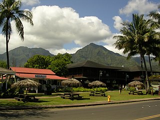
Hanalei is a census-designated place (CDP) in Kauaʻi County, Hawaiʻi, United States. The population was estimated at 254 in 2017. Hanalei means "lei making" in Hawaiian. Alternatively, the name Hanalei also means "crescent bay" and may be indicative of the shape of Hanalei Bay. Hanalei can also be translated as lei valley, referring to the rainbows that color the valley and encircle Hanalei like a wreath.

Poʻipū is a census-designated place (CDP) in Kauaʻi County on the southern side of the island of Kauaʻi in the U.S. state of Hawaiʻi. The population was 979 at the 2010 census. The town features a group of high-end hotels, resorts and one main shopping center.

Kapalua is a census-designated place (CDP) in Maui County, Hawaiʻi, United States. A resort development by the Maui Land & Pineapple Company extends inland from Kapalua Bay and Honolua Bay. The population was 353 at the 2010 census.

Makapuʻu is the extreme eastern end of the Island of Oʻahu in the Hawaiian Islands, comprising the remnant of a ridge that rises 647 feet (197 m) above the sea. The cliff at Makapuʻu Point forms the eastern tip and is the site of a prominent lighthouse. The place name of this area, meaning "bulging eye" in Hawaiian, is thought to derive from the name of an image said to have been located in a cave here called Keanaokeakuapōloli. The entire area is quite scenic and a panoramic view is presented at the lookout on Kalanianaole Highway where the roadway surmounts the cliff just before turning south towards leeward Oʻahu and Honolulu.

Hāpuna Beach State Recreation Area is a large park and sandy beach on the Big Island of Hawaii. The Hapuna Beach Prince Hotel is also located adjacent to the beach. Hāpuna is popular with residents and visitors.

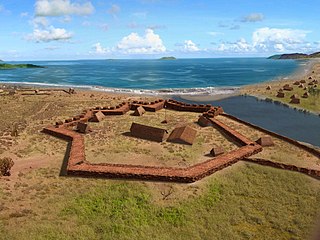
Russian Fort Elizabeth is a National Historic Landmark and is administered as the Russian Fort Elizabeth State Historical Park just southeast of present-day Waimea on the island of Kauaʻi in Hawaiʻi. It is located at the site of the former Fort Elizabety, the last remaining Russian fort on the Hawaiian islands, built in the early 19th century by the Russian-American Company as the result of an alliance with High Chief Kaumualiʻi. The star fort was employed by the Kingdom of Hawaii in the 19th century under the name Fort Hipo.

Hāʻena State Park is a state park located on the north shore of the Hawaiian island of Kauaʻi. It is often referred to as the "end of the road" and marks the end point of the Kuhio Highway. The park provides access to beaches, trails, and several ancient Hawaiian sites, including sea caves estimated to be more than 4,000 years old. Archaeological sites associated with the hula, including a heiau (shrine) dedicated to Laka, are located above the park's beaches.

Curling is a mainly residential neighbourhood of the city of Corner Brook, Newfoundland and Labrador. It is situated just west of the main part of the city. Located in the Humber Arm of the Bay of Islands, Curling was originally a fishing community. It is the oldest section of Corner Brook.
Māhāʻulepū Beach is a beach on the southeast coast of the Hawaiian island of Kauai. It is two miles long and goes from Punahoa point to Paʻoʻo point. The beach is separated into three different parts: Gillin's Beach, Kawailoa Bay, and Hāʻula Beach. Gillin's Beach, the center section, is known for petroglyphs that are carved into the rocks, though they are rarely exposed. Fossils of extinct birds have been found in sand dunes along the shoreline, including the Kauaʻi Stilt-owl, a flightless rail, and three species of goose. Close to the beach is the paleontologically important Makauwahi Cave.
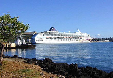
Niumalu Beach Park is a county beach park in the district of Niumalu on the south-east coast of the island of Kauaʻi in the Hawaiian Islands. It is located on Nāwiliwili Bay, about 2.2 miles (3.5 km) south of Līhuʻe. The Hulēʻia National Wildlife Refuge is adjacent to the west, and Nāwiliwili Beach Park and harbor are adjacent to the east. Through much of the 19th century, it was home of Paul Kanoa, his son Paul P. Kanoa, and family. The hill above the beach later became county offices and then Kauai High School. For a while mangrove trees were taking over the beach. The Boy Scouts were part of the clean-up crew who volunteered to renovate the beach in 2014.

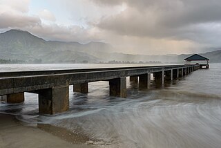
Hanalei Bay is the largest bay on the north shore of Kauaʻi island in Hawaii. The town of Hanalei is at the midpoint of the bay.

Morningside Drive is a roughly north-south bi-directional street in the Morningside Heights neighborhood of the New York City borough of Manhattan. It runs from 110th Street in the south, where it forms the continuation of Columbus Avenue, to 122nd Street-Seminary Row in the north, which Morningside Drive becomes after turning to the west and crossing over Amsterdam Avenue.
Route 58 is a two-mile (3.2 km) road that stretches from Route 50 in Lihue to the junction of Wapaa Road with Hawaii 51 near Nawiliwili Harbor on Kauaʻi island.
Moloaʻa Bay is on the northeast shore on the island of Kauaʻi in Hawaii. The bay is 0.44 miles (710 m) long.

Kekaha Kai State Park, formerly known as Kona Coast State Park, is a beach park located along the north Kona coast on the island of Hawaiʻi. The main beach areas are Maniniʻowali Bay, Makalawena beach at Puʻu Aliʻi Bay, and Mahaiʻula Bay. The park's name originates from the Hawaiian language words ke kaha kai which translate to "the shore line" in English.
Golovnin Bay is a waterway in the U.S. state of Alaska. It is a part of Norton Sound. It is named in honor of Vasily Golovnin. Fish River empties into the bay. Situated on the Seward Peninsula, it is the only protected waterway south of Port Clarence.
Beaver Island is a heavily forested and uninhabited island located on the Deerfield River in Rowe, Massachusetts.
Beach is an unincorporated community in northwestern Webster County, in the U.S. state of Missouri. The community is located on Missouri Route W, approximately six miles north-northwest of Marshfield.


