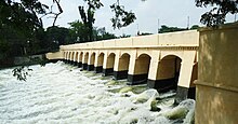
Kumbakonam, or Kudanthai, is a city municipal corporation in the Thanjavur district in the Indian state of Tamil Nadu. It is located 40 km (25 mi) from Thanjavur and 282 km (175 mi) from Chennai and is the headquarters of the Kumbakonam taluk of Thanjavur district. It is the second largest city in the district after Thanjavur. The city is bounded by two rivers, the Kaveri River to the north and Arasalar River to the south. Kumbakonam is known as a "Temple town" due to the prevalence of a number of temples here and is noted for its Mahamaham festival, which happens once in 12 years, attracting people from all over the country.

Thanjavur, also known as Thanjai, previously known as Tanjore, is a city in the Indian state of Tamil Nadu. It is the 12th biggest city in Tamil Nadu. Thanjavur is an important center of southern Indian religion, art, and architecture. Most of the Great Living Chola Temples, which are UNESCO World Heritage Monuments, are located in and around Thanjavur. The foremost among these, the Brihadeeswara Temple, built by the Chola emperor Rajaraja I, is located in the centre of the city. This temple has one of the largest bull statues in India carved out of a single granite rock. Thanjavur is also home to Tanjore painting, a painting style unique to the region. Thanjavur is the headquarters of the Thanjavur District. The city is an important agricultural centre located in the Kaveri Delta and is known as the Rice bowl of Tamil Nadu. Thanjavur is administered by a municipal corporation covering an area of 36.31 km2 (14.02 sq mi) and had a population of 222,943. Roadways are the major means of transportation, while the city also has rail connectivity. The nearest airport is Tiruchirapalli International Airport, located 59.6 km (37.0 mi) away from the city. The nearest seaport is Karaikal, which is 94 km (58 mi) away from Thanjavur. The city first rose to prominence during the reign of the Cholas when it served as the capital of the empire. After the fall of the Cholas, the city was ruled by various dynasties such as the Mutharaiyar dynasty, the Pandyas, the Vijayanagar Empire, the Madurai Nayaks, the Thanjavur Nayaks, the Thanjavur Marathas and the British Empire. It has been a part of independent India since 1947.
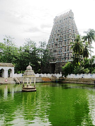
Mayiladuthurai is a special grade municipality and district headquarters of Mayiladuthurai district in Tamil Nadu, India. The town is located at a distance of 256 km (159 mi) from the state capital, Chennai.

Nagapattinam is a town in the Indian state of Tamil Nadu and the administrative headquarters of Nagapattinam district. The town came to prominence during the period of Medieval Cholas and served as their important port for commerce and east-bound naval expeditions. The Chudamani Vihara in Nagapattinam constructed by the Srivijayan king Sri Mara Vijayattungavarman of the Sailendra dynasty with the help of Rajaraja Chola I was an important Buddhist structure in those times. Nagapattinam was settled by the Portuguese and, later, the Dutch under whom it served as the capital of Dutch Coromandel from 1660 to 1781. In November 1781, the town was conquered by the British East India Company. It served as the capital of Tanjore district from 1799 to 1845 under Madras Presidency of the British. It continued to be a part of Thanjavur district in Independent India. In 1991, it was made the headquarters of the newly created Nagapattinam District. Nagapattinam is administered by a Special grade municipality covering an area of 17.92 km2 (6.92 sq mi) and had a population of 102,905 as of 2011.

Mannargudi is a Municipality in Thiruvarur district in the Indian state of Tamil Nadu. It is the headquarters of the Mannargudi taluk. The town is located at a distance of 28 km (17 mi) from the district headquarters Thiruvarur, 12 km from Needamangalam, 36 km from Kumbakonam, 40 km from Thanjavur, and 310 km (190 mi) from the state capital Chennai. Mannargudi is known for the Rajagopalaswamy temple, a prominent Vaishnavite shrine.
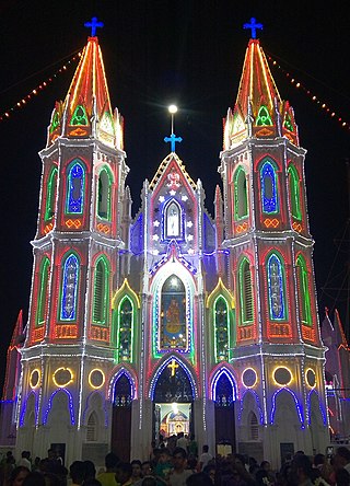
Velankanni (Vēḷāṅkaṇṇi), is a Special Grade Panchayat Town in Nagapattinam district in the Indian state of Tamil Nadu. It lies on the Coromandel Coast of the Bay of Bengal, 350 km south of Chennai (Madras), 12 km south of Nagapattinam, and 33 km southeast of Thiruvarur.

Chola Nadu is an ancient region spanning on the current state of Tamil Nadu and union territory of Puducherry in southern India. It encompasses the lower reaches of the Kaveri River and its delta, and formed the cultural homeland and political base of the Chola Dynasty which ruled large parts of India and Sri Lanka between the 9th and 13th centuries CE. Uraiyur served as the early Chola capital, then medieval Cholas shifted to Thanjavur and later cholas king Rajendra Chola I moved the capital to Gangaikonda Cholapuram in Ariyalur district in the 11th century CE. Chola Nadu is therefore larger than the Tanjore region or the Cauvery delta in the strict sense. Although it essentially corresponds to these two overlapping areas.

Thiruvarur also spelt as Tiruvarur is a municipality in the Indian state of Tamil Nadu. It is the administrative headquarters of Thiruvarur district and Thiruvarur taluk. The temple chariot of the Thyagaraja temple, weighing 360 tonnes (790,000 lb) and measuring 96 feet (29 m) tall is the largest temple chariot in India. Thiruvarur is the birthplace of Tyagaraja, Muthuswami Dikshitar and Syama Sastri, popularly known as the Trinity of Carnatic music of the 18th century CE. Thiruvarur Thiyagarajaa Swaamy temple is older than Tanjore big temple.
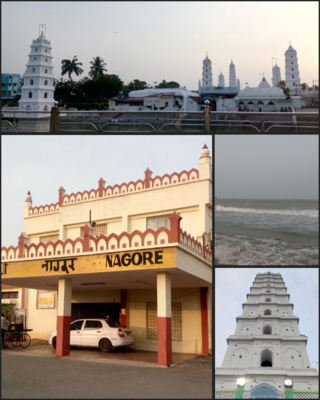
Nagore is a town in the Nagapattinam District, Tamil Nadu, India. It is located approximately 12 km South of Karaikal and 5 km North of Nagapattinam. Nearby towns are Karaikal, Tiruvarur, and Velankanni. It has a population of approximately 39,000. The prime attraction of the town is the Nagore Dargah Shareef. A sixteenth-century Islamic shrine, Nagore Dargah attracts millions of pilgrims irrespective of caste, creed or religion.

Thiruthuraipoondi is a municipality in Tiruvarur district in the Indian state of Tamil Nadu. Thiruthuraipoondi is an agricultural town located south of Thiruvarur district. The town is located at a distance of 28 km (17 mi) from the district headquarters Thiruvarur.

The Vennar River or Vennaaru is a river and distributary of the Kaveri River in the Kaveri delta. It flows through the Thanjavur, Tiruvarur, and Nagapattinam districts of Tamil Nadu, India.
Podakkudi is a village in Thiruvarur district in the South Indian state of Tamil Nadu. The town is located at a distance of 20 km (12 mi) from the district headquarters Thiruvarur and 272 km (169 mi) from the state capital Chennai. Podakkudi is known for the Big Pallivasal, a prominent Islamic shrine. Nearby town is Koothanallur and the nearby villages are Atthikadai and Budamangalam.
Needamangalam Taluk is a taluk in Thiruvarur district of the Indian state of Tamil Nadu. The headquarters of the taluk is the town of Needamangalam.

Thanjavur has a well-developed transport infrastructure. Thanjavur is well connected by Road, and Rail with most cities and towns in India

Koothanallur is a town in Tiruvarur district in the South Indian state of Tamil Nadu. The town is located at a distance of 20 km (12 mi) from the district headquarters Tiruvarur and 350 km (220 mi) from the state capital Chennai.

Thiruvarur Junction is an NSG–5 category Indian railway station in Tiruchirappalli railway division of Southern Railway zone. It is a junction railway station serving Thiruvarur town, headquarters of Thiruvarur district in Tamil Nadu in India and a focal point on the branch line connecting trains from Chennai to Nagapattinam–Velankanni–Nagore–Karaikal on one line and Karaikkudi–Sivganga–Manamadurai–Rameswaram on the second line and Tiruchirappalli–Thanjavur–Thiruvarur–Nagapattinam–Karaikal on the third line and Mayiladuthurai–Thiruvarur on the fourth line that branches out of the station.(I.e the station is situated between mayiladuthurai to Karaikudi section of TPJ divn)The station is a part of the Trichy railway division one of the 6 divisions of the Southern Railway zone.
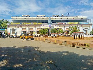
Thanjavur Junction is an NSG–3 category Indian railway station in Tiruchirappalli railway division of Southern Railway zone. It is a junction railway station in Thanjavur district in the Indian state of Tamil Nadu and serves Thanjavur, earlier known as Tanjore.
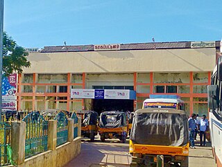
Nagapattinam Junction is an NSG–4 category Indian railway station in Tiruchirappalli railway division of Southern Railway zone. It is a junction railway station serving the town of Nagapattinam in Tamil Nadu, India.

Nidamangalam Junction is an NSG–5 category Indian railway station in Tiruchirappalli railway division of Southern Railway zone. It is a junction railway station serving Needamangalam in Tamil Nadu, India.
The Koraiyar River is a non-perennial river in the Tiruvarur district of the Indian state of Tamil Nadu. It is in the southern part of the Kaveri delta that covers much of the region of Chola Nadu. The Koraiyar begins as a distributary of the Vennaaru River where that river is dammed northwest of Needamangalam in Needamangalam taluk. After branching off from the Vennaaru, it flows southeast to the southwest of Needamangalam. It continues southeast for some distance, then turns sharply to the east. It follows this eastern course for some distance then turns southward west of Podakkudi. It follows a southern course through Mannargudi taluk then turns to the southwest north of Thillaivilagam in Thiruthiraipoondi taluk. Flowing to the east of Muthupet, it turns southeast and subsequently empties into Muthupet Lagoon.


