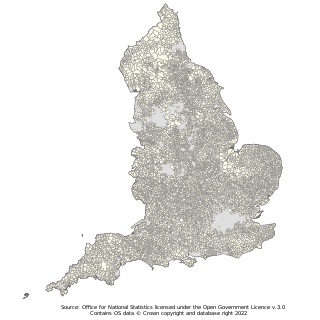
Parish councils are civil local authorities found in England which are the lowest tier of local government. They are elected corporate bodies, with variable tax raising powers, and they carry out beneficial public activities in geographical areas known as civil parishes. There are about 10,480 parish and town councils in England. Parish councils may be known by different styles, they may resolve to call themselves a town council, village council, community council, neighbourhood council, or if the parish has city status, it may call itself a city council. However their powers and duties are the same whatever name they carry.
A councillor is an elected representative for a local government council in some countries.

The Borough of Waverley is a local government district with borough status in Surrey, England. The council is based in the town of Godalming. The borough also contains the towns of Farnham and Haslemere and numerous villages, including the large village of Cranleigh, and surrounding rural areas. At the 2021 Census, the population of the borough was 128,200. The borough is named after Waverley Abbey, near Farnham. Large parts of the borough are within the Surrey Hills Area of Outstanding Natural Beauty.

Derbyshire Dales is a local government district in Derbyshire, England. The district was created in 1974 as West Derbyshire; the name was changed to Derbyshire Dales in 1987. The council is based in the town of Matlock, and the district also includes the towns of Ashbourne, Bakewell, Darley Dale and Wirksworth, as well as numerous villages and extensive rural areas. Much of the district is within the Peak District National Park.

South Hams is a local government district on the south coast of Devon, England. Its council is based in the town of Totnes, although the largest town is Ivybridge. The district also contains the towns of Dartmouth, Kingsbridge and Salcombe and numerous villages and surrounding rural areas.

Dacorum is a local government district with borough status in Hertfordshire, England. The council is based in Hemel Hempstead. The borough also includes the towns of Berkhamsted and Tring and surrounding villages. The borough had a population of 155,081 in 2021. Dacorum was created in 1974 and is named after the ancient hundred of Dacorum which had covered a similar area. The borough of Dacorum is the westernmost of Hertfordshire's ten districts. It borders St Albans, Three Rivers, Buckinghamshire and Central Bedfordshire.

Tandridge is a local government district in east Surrey, England. Its council is based in Oxted, although the largest settlement is Caterham; other notable settlements include Warlingham, Godstone and Lingfield. In mid-2019, the district had an estimated population of 88,129.
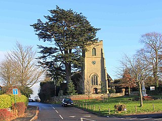
Whitnash is a town and civil parish located southeast of, and contiguous with Leamington Spa and Warwick in Warwickshire, England. In 2001, it had a population of 7,760 which increased to 9,129 in the 2011 census, increasing again to 10,489 in the 2021 census.

In England, a civil parish is a type of administrative parish used for local government. It is a territorial designation which is the lowest tier of local government. Civil parishes can trace their origin to the ancient system of parishes, which for centuries were the principal unit of secular and religious administration in most of England and Wales. Civil and religious parishes were formally split into two types in the 19th century and are now entirely separate. Civil parishes in their modern form came into being through the Local Government Act 1894, which established elected parish councils to take on the secular functions of the parish vestry.
A community council is a public representative body in Great Britain.
Town and country planning in the United Kingdom is the part of English land law which concerns land use planning. Its goal is to ensure sustainable economic development and a better environment. Each country of the United Kingdom has its own planning system that is responsible for town and country planning, which outside of England is devolved to the Northern Ireland Assembly, the Scottish Parliament and the Senedd.
The Town and Country Planning Act 1990 is an act of the United Kingdom Parliament regulating the development of land in England and Wales. It is a central part of English land law in that it concerns town and country planning in the United Kingdom. Repealed in parts by the Planning and Compensation Act 1991, it is now also complemented by the Planning and Compulsory Purchase Act 2004.
A development plan sets out a local authority's policies and proposals for land use in their area. The term is usually used in the United Kingdom. A Local Plan is one type of development plan. The development plan guides and shapes day-to-day decisions as to whether or not planning permission should be granted, under the system known as development control. In order to ensure that these decisions are rational and consistent, they must be considered against the development plan adopted by the authority, after public consultation and having proper regard for other material factors.
The Local Government and Rating Act 1997 is an Act of the Parliament of the United Kingdom that allows a community at the village, neighbourhood, town or similar level beneath a district or borough council to demand its own elected parish or town council. This right only applies to communities within England and outside of Greater London. The Local Government and Public Involvement in Health Act 2007 would later extend the parish petition right to places within Greater London.
The National Association of Local Councils (NALC) is a membership organisation and the only national body representing the interests of local councils. NALC works in partnership with county associations to support, promote and improve local councils.

Leeds, commonly known as the City of Leeds, is a metropolitan borough with city status in West Yorkshire, England. The metropolitan borough includes the administrative centre of Leeds and the towns of Farsley, Garforth, Guiseley, Horsforth, Morley, Otley, Pudsey, Rothwell, Wetherby and Yeadon. It has a population of 811,956 (2021), making it technically the second largest city in England by population behind Birmingham, since London is not a single local government entity. Local governance sits with Leeds City Council and the city's 32 Parish Councils.
In the United Kingdom, the term conservation area almost always applies to an area of special architectural or historic interest, the character of which is considered worthy of preservation or enhancement. It creates a precautionary approach to the loss or alteration of buildings and/or trees, thus it has some of the legislative and policy characteristics of listed buildings and tree preservation orders. The concept was introduced in 1967, and by 2017 almost 9,800 had been designated in England.

The Localism Act 2011 is an Act of Parliament that changes the powers of local government in England. The aim of the act is to facilitate the devolution of decision-making powers from central government control to individuals and communities. The measures affected by the Act include an increase in the number of elected mayors, referendums and the "Local authority’s general power of competence" which states "A local authority has power to do anything that individuals generally may do".


