
Icaria, also spelled Ikaria, is a Greek island in the Aegean Sea, 10 nautical miles (19 km) southwest of Samos.
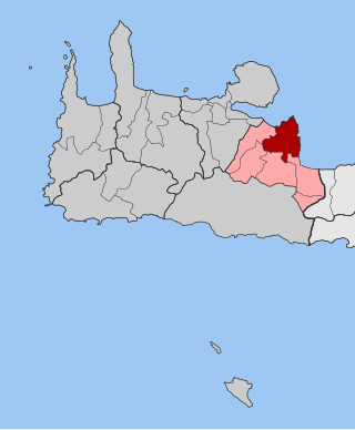
Vamos is a small town and former municipality in the Chania regional unit, Crete, Greece. Since the 2011 local government reform "Kallikratis" it is a municipal unit, part of the municipality of Apokoronas, serving as its historical capital. It is situated on a small hill at an altitude of 190 metres above sea level, about 25 kilometres from Chania. In Vamos, one can find several restaurants, snack bars and shops in the village, as well as many public services, such as a fully equipped health center, schools, police station and the regional court for the regions of Apokoronas and Sfakia.
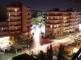
Evosmos is a suburb of the Thessaloniki Urban Area and was a former municipality in the regional unit of Thessaloniki, Macedonia, Greece. Since the 2011 local government reform it is part of the municipality Kordelio-Evosmos, of which it is the seat and a municipal unit. It has a land area of 9.927 square kilometres (3.833 sq mi) and its population is 79,221. Due to rapid development, the population has been growing fast. Most of the new development is taking place in the northern district of the municipality called Nea Politeia.
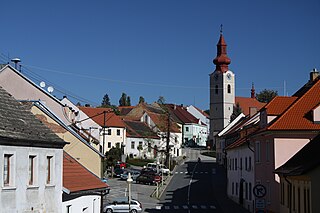
Husinec is a town in Prachatice District in the South Bohemian Region of the Czech Republic. It has about 1,400 inhabitants. It is known as the birthplace of one of the main figures in Czech history, Jan Hus. The historic town centre is well preserved and is protected by law as an urban monument zone.

Agios Nikolaos is a village located 110 kilometers south-east of Thessaloniki on the Chalkidiki peninsula in Macedonia, Greece.

Othonoi is a small inhabited Greek island in the Ionian Sea, located northwest of Corfu, and is the westernmost point of Greece. Othonoi is the largest and most populated of the Diapontian Islands. Since the 2019 local government reform it is part of the municipality of Central Corfu and Diapontian Islands.

Tamassos or Tamasos – names Latinized as Tamassus or Tamasus – was a city-kingdom in ancient Cyprus, one of the ten kingdoms of Cyprus. It was situated in the great central plain of the island, south-east of Soli, on the road from Soli to Tremithus. It is an archaeological site bordering the village of Politiko, about 21 kilometres southwest of Nicosia.

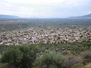
Stylos or Stilos is a village and part of the Apokoronas municipal unit in the Chania regional unit of the Greek island of Crete. The Greek etymology of the name of the village is 'column' or 'pillar'. No existing topographical or surviving architectural feature could account for this naming.

Episkopi is a former municipality in the Heraklion regional unit, Crete, Greece. Since the 2011 local government reform, it has been part of the municipality Hersonissos, of which it is a municipal unit. The municipal unit has an area of 45.500 km2 (17.568 sq mi). The population of Episkopi as of 2021 is 2,291.
Neochori is a village and a community situated on the peninsula of Pelion, Magnesia, eastern Thessaly, Greece. It was the seat of the former municipality Afetes. The village is hidden in the embrace of a vast pine forest 480 meters above sea level, and about 35 km southeast of the city of Volos. The community Neochori consists of the villages Neochori, Agios Dimitrios, Afyssos, Zervochia, Megali Vrysi and Plaka. The community stretches from the Aegean Sea coast of the Pelion peninsula to the Pagasetic Gulf. Agios Dimitrios and Plaka are on the Aegean coast, and the tourist centre Afyssos is on the Pagasetic coast.

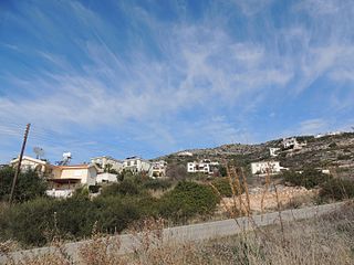
Gavalochori, also spelled Gavalohori, is a 1000-year-old village located in the northwestern part of the island of Crete, Greece. The village lies in a valley about three kilometers inland from the coast. Gavalochori is located in the municipality of Apokoronas and has a population of between 400 and 500, depending on the season.

Kakopetria is a town in Cyprus located 55 kilometres (34 mi) southwest of the capital, Nicosia, on the north-facing foothills of the Troodos Mountains. It stands at an altitude of 667 metres and it is the highest village in the Solea Valley. The community has about 1,200 permanent inhabitants and a couple hundred more who either have a summer house or are originally from Kakopetria but work in Nicosia. Near Kakopetria there is church from 11th century, Agios Nikolaos tis Stegis, UNESCO World Heritage Site.

Delyan is a village in the Sofia Province, western Bulgaria, near the town of Breznik. The old historic name of the village is Karnul. As of 2007, the village has only 18 permanent inhabitants. Delyan is located in the municipality of Bozhurishte, 34 km west of Sofia on the eastern slopes of Viskyar Mountain with an average altitude of 790 meters. Its houses are nestled in a valley between three small peaks of Viskyar. It is named after the leader of the Bulgarian uprising against the Byzantine Empire (1040-1041) and for a short time Tsar (Emperor) of Bulgaria, Peter II Delyan. Administratively, the village is connected to the nearby village Zlatusha to which there is a tarmac road, built in early 1970s. It is close to the railroad Pernik-Voluyak, on the border between Sofia Province and Pernik Province, and nearby Dogandjia (Falconer), a remote neighborhood of Goz is in the Breznik Municipality. The village consists of 3 neighborhoods (mahali): Matsina and Rebrachka Mahala to the north of center, and Vanchina Mahala to the south of center. The church of St Mary, funded and built by local people on a hill near Delyan, was opened in the spring of 2008. To the south-west of Delyan, in the locality Ormana, there is a pine forest, planted in the 1970s. During favorable seasons, one can find there edible mushrooms, like saffron milk cap and sticky bun. Delyan is the birthplace of the writer Spas Antonov.

Kalo Chorio Oreinis is a village located in the Nicosia District of Cyprus, 3 km south of the town of Klirou.
Kontopouli is a village and a community in the municipal unit of Moudros in the northeastern part of the island of Lemnos, Greece. The community includes the small villages Agios Alexandros and Agios Theodoros. Its total area is 37.04 km². Kontopouli is 1 km northwest of Kalliopi, 3 km east of Repanidi and 8 km northeast of Moudros.
Tremithousa is a village in the Paphos District of Cyprus, located 7 km north of Paphos. Tremithousa is located 294 m above sea level. Tremithousa is located near Mesa Chorio and Mesogi Village. Tremithousa receives an average annual rainfall of about 520 millimeters; vines of winemaking varieties, vegetables, cereals, forage plants, citrus, almond, and walnut trees, and legumes are cultivated in the region. The village has a reputation for the aromatic and tasty honey that it produces. Tremithousa connects in the north to the monastery of Agios Neofytos, in the northeast with the village of Tala, and in the east with the main road of Tsada – Polis.
Metamorfosi is a village in Laconia, five kilometers from the center of Molaoi and about seventy-eight kilometers southeast of Sparta. The village is built at the foot of the mountain of Koulochera on the outskirts of the Parnon range. Its altitude is 120 meters. According to the 2021 census, Metamorfosi has 504 residents.

Neo Chorio is a village in the Paphos District of Cyprus, about 8 km west of Polis. Until 1958, it had a mixed Greek- and Turkish Cypriot population with a Greek Cypriot majority. Amid the intercommunal violence, the Turkish Cypriot inhabitants of Neo Chorio fled to Androlykou, a nearby Turkish Cypriot village. In 1975, following the Turkish invasion of the previous year and subsequent division of the island, most Turkish Cypriots of Neo Chorio resettled in Myrtou, now in Northern Cyprus. In 2011, Neo Chorio had a population of 519. Since July 1998, Neo Chorio has also been home to Anassa Hotel, a luxury 5* beach resort owned by the Thanos Hotels Group.

Alepochori is a village in the Evros regional unit, East Macedonia and Thrace, Greece. The village is considered very old and its inhabitants are native Greeks.

Ellinopyrgos, formerly known as Gralista (Γράλιστα), is a village in the central part of Greece with 136 inhabitants in 2021. It is located in the municipality Mouzaki and the regional unit Karditsa in Thessaly.
