Neston is a village and civil parish in the unitary authority of Cheshire West and Chester, England. It is located on the Wirral Peninsula, in Cheshire. Parkgate is located to the north west and the villages of Little Neston and Ness Holt to the south of the village. At the 2001 census the population of Neston ward was recorded as 3,521, increasing to 4,329 at the 2011 census. The town and civil parish also includes Little Neston; Parkgate; and Riverside wards; along with part of Burton and Ness Holt ward, and had a population of 15,162 in 2001, increasing to 15,221 in 2011.
Morecambe and Heysham was a municipal borough in Lancashire, England. It was formed in 1928 by the merging of Morecambe Municipal Borough and Heysham Urban District, and abolished in 1974 when it was absorbed into the City of Lancaster local government district.
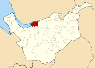
Wirral Urban District was an urban district in Cheshire, England from 1933 to 1974. It was created from part of the disbanded Wirral Rural District and covered an area in the south-west of the Wirral Peninsula. The civil parishes of Barnston, Gayton, Heswall cum Oldfield, Irby, Pensby, and Thurstaston were entirely within its boundaries. Additionally, the district encompassed parts of Arrowe, Brimstage and Thornton Hough civil parishes.
Wirral Rural District was a rural district on the Wirral Peninsula in Cheshire, England from 1894 to 1933. It was created under the Local Government Act 1894 from the Wirral Rural Sanitary District.

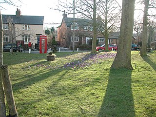
Thornton Hough is a village on the Wirral Peninsula, in Merseyside, England, of pre-Conquest origins. The village grew during the ownership of Joseph Hirst into a small model village and was later acquired by William Lever, founder of Lever Brothers, the predecessor of Unilever. Thornton Hough is roughly 10 miles (16 km) from Liverpool and 12 miles (19 km) from Chester. Administratively, it is part of the Clatterbridge Ward of the Metropolitan Borough of Wirral and is in the parliamentary constituency of Wirral South.

Noctorum is a suburb of Birkenhead, Merseyside, England. Administratively it is within the Metropolitan Borough of Wirral as part of Claughton Ward. Noctorum is in the north east of the Wirral Peninsula, bounded by the Beechwood estate to the north, Claughton and Oxton to the east and south east, and the River Fender and M53 motorway to the west.

Wirral was a county constituency which returned one Member of Parliament (MP) to the House of Commons of the Parliament of the United Kingdom from 1885 to 1983, elected by the first past the post voting system.
Puddington is a village and civil parish on the Wirral Peninsula, in the unitary authority of Cheshire West and Chester and the ceremonial county of Cheshire, England. It is located to the south east of the town of Neston and close to the border with Wales.
The Municipal Borough of Leigh was, from 1899 to 1974, a local government district of the administrative county of Lancashire, England, consisting of the townships of Pennington, Westleigh, Bedford and part of the township of Atherton and named after the ancient ecclesiastical parish. The area contained the market town of Leigh that served as its administrative centre until its dissolution in 1974. The borough council built Leigh Town Hall which was completed in 1907.

The Municipal Borough of Farnworth was a local government district centred on the town of Farnworth in the administrative county of Lancashire, England. A local board of health had been established for Farnworth in 1863, which was reconstituted as an urban district in 1899, before being granted a charter of incorporation to become a municipal borough in 1939. Following abolition of the local authority in 1974, Farnworth became an unparished area of the Metropolitan Borough of Bolton in Greater Manchester.
Bletchley Urban District was an urban district covering the town of Bletchley in the administrative county of Buckinghamshire, England from 1911 to 1974. The district had been created in 1895 as Fenny Stratford Urban District, being renamed to Bletchley Urban District in 1911.

Bebington was a local government district on the Wirral Peninsula, in Cheshire, England.

Hoylake Urban District was an urban district in Cheshire, England. It was formerly known as West Kirby and Hoylake Urban District (1894–97), then Hoylake and West Kirby Urban District (1897–1933). It was the local authority for the towns of Hoylake and West Kirby, in the north-west of the Wirral Peninsula.
Runcorn Urban District was an urban district centred around the town of Runcorn in Cheshire, England from 1894 until 1974.
Horwich was, from 1872 to 1974, a local government district centred on the town of Horwich in the administrative county of Lancashire, England.
Kearsley was, from 1865 to 1974, a local government district centred on the town of Kearsley in the administrative county of Lancashire, England.

Westhoughton was, from 1872 to 1974, a local government district centred on the town of Westhoughton in the administrative county of Lancashire, England.
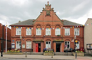
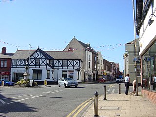
Neston Town Hall is a municipal building on High Street, Neston, Cheshire, England. The structure accommodates the offices and the meeting place of Neston Town Council.

