Hildesheim is a district (Landkreis) in Lower Saxony, Germany. It is bounded by the districts of Hanover, Peine, Wolfenbüttel, Goslar, Northeim, Holzminden and Hamelin-Pyrmont.
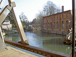
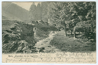
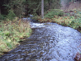
The Innerste is a river in Lower Saxony, Germany. It is a right tributary of the Leine river and 101 km (63 mi) in length.

The Vorholz is a ridge up to 243 m high in the districts of Hildesheim and Wolfenbüttel in the German state of Lower Saxony.
The Innerste Uplands is a landscape region up to 359 m high and covering an area of over 900 km² in the northern part of the German Central Uplands. It lies within the eastern part of the Weser-Leine Uplands in Lower Saxony (Germany).
The Grane is a river of Lower Saxony, Germany. It is a right tributary of the Innerste river near Goslar.
The Sauberge is a hill range up to 317 m above sea level (NN) in the Innerste Uplands in the district of Hildesheim in eastern Lower Saxony in Germany.

Lamme is a river of Lower Saxony, Germany. It flows into the Innerste near Bad Salzdetfurth. In 1945 the river was crossed by Allied Forces.

Beuster is a river of Lower Saxony, Germany. It flows into the Innerste south of Hildesheim. Its total length, including its source river Warme Beuster, is 12.5 km (7.8 mi).
Grumbach is a river of Lower Saxony, Germany. It flows into the Innerste in Wildemann.

Neile is a river of Lower Saxony, Germany. It flows into the Innerste near Sehlde.
Nette is a river of Lower Saxony, Germany. It is a tributary of the Hase northwest of Osnabrück.

Zellbach is a small river of Lower Saxony, Germany. It flows into the Innerste west of Clausthal-Zellerfeld.
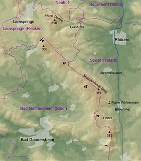
The Heber is a hogback ridge, relatively small in area and up to 313.5 metres high, in the Lower Saxon Hills within the districts of Goslar, Northeim and Hildesheim in the German state of Lower Saxony.
The Harplage is a hill range, up to 290 metres high, located west-northwest of the Harz in the southeast of the German state of Lower Saxony.
The Giesen Hills are a ridge, up to 242.5 metres high, in the district of Hildesheim in the German state of Lower Saxony.
Laute is a river of Lower Saxony, Germany. It is a right tributary of the Innerste.

The Ambergau is a historic landscape and natural region unit in the Innerste Uplands in southern Lower Saxony, Germany. It is a basin, about 10 x 10 kilometres across, with 18 settlements, the centre and capital of which since the 13th century is the town of Bockenem. The basin, with its fertile agricultural fields, is surrounded by the wooded ridges of Heber, the Harplage, the Weinberg and the Hainberg. The Gau is a cultural landscape that was formed as early as the 8th century.
