
Miramichi is the largest city in northern New Brunswick, Canada. It is situated at the mouth of the Miramichi River where it enters Miramichi Bay. The Miramichi Valley is the second longest valley in New Brunswick, after the Saint John River Valley.

The Miramichi River is a river located in the east-central part of New Brunswick, Canada. The river drains into Miramichi Bay in the Gulf of St. Lawrence. The name may have been derived from the Montagnais words "Maissimeu Assi", and it is today the namesake of the Miramichi Herald at the Canadian Heraldic Authority.

Route 11 is a provincial highway in northeastern New Brunswick, Canada. The 440-kilometre (270 mi) road runs from Moncton to the Quebec border, near Campbellton, at the Matapédia Bridge, following the province's eastern and northern coastlines.
The Napan River in Canada is a tributary of the Miramichi River in New Brunswick, Canada. The river rises several kilometres southwest of Chatham in central Northumberland County and flows northeast into the Miramichi River at Napan Bay. Four bridges cross the river at various points: at Hannah Lane, Highway 11, Johnston Lane, and Highway 117. There was also once a crossing at White Lane. At one time, these bridges were covered, although all have been upgraded to steel and concrete structures.

Centennial Bridge is a steel through arch crossing the Miramichi River in Northumberland County, New Brunswick, Canada. The bridge is 1.1 km long, and 240 feet high. It carries Route 11, Route 8, and Route 134 over the river, connecting Douglastown on the north bank with Chatham on the south bank; both communities were merged with others in the vicinity through municipal amalgamation into the city of Miramichi.

Route 106 is a highway in New Brunswick, Canada; running from an intersection with Route 1 and western intersection in Route 905 in Petitcodiac to the intersection of Trans-Canada Highway and the southern terminus of Route 940 at Sackville; a distance of 91.8 kilometres.
Route 107 is a highway in New Brunswick, Canada; running from an intersection with Route 8 at Nashwaak Bridge to an intersection with Route 105 at Bristol; a distance of 100.1 kilometres.

State Route 25 (SR 25) is a state highway in the eastern part of the U.S. state of Georgia. It travels south-to-north near the Atlantic Ocean, serving the Brunswick and Savannah metropolitan areas on its path from the Florida state line at the St. Marys River to the South Carolina state line at the Little Back River, a channel of the Savannah River. Except for the northern part of the highway, from Savannah to Port Wentworth, it is concurrent with U.S. Route 17 (US 17) for its entire length.

Hardwicke is a civil parish in Northumberland County, New Brunswick, Canada.
Route 134 is a 261 km (162 mi)-long north–south secondary highway in eastern New Brunswick, Canada. The highway is divided by into a northern and southern section by a gap in Northumberland County connected by Route 11 and Route 8.

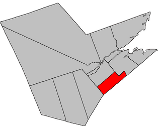
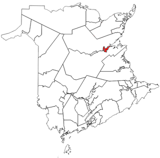
Chatham is a civil parish in Northumberland County, New Brunswick, Canada.

Glenelg is a civil parish in Northumberland County, New Brunswick, Canada.
Rogersville is a civil parish in Northumberland County, New Brunswick, Canada.

Saint-Louis is a civil parish in Kent County, New Brunswick, Canada.
Route 126 is a North/South provincial highway in the Canadian province of New Brunswick. The road runs from Route 117 intersection in Miramichi. The road has a length of approximately 121 kilometres, and services small, otherwise isolated rural communities. In these areas, the highway is often unofficially referred to as "Main Street." The road parallels the New Brunswick East Coast Railway directly to the east. When the highway enters Moncton it changes to Ensley Drive, then Mountain Road.
Route 118 is a North/South provincial highway in the Canadian province of New Brunswick. The road runs from Route 126 intersection in Miramichi. The road has a length of approximately 40 kilometres, and services small, otherwise isolated rural communities. In these areas, the highway is often unofficially referred to as "Main Street." The road parallels the Miramichi River as well as Route 108 and later Route 8 directly to the North side of the river. The highway starts in Miramichi as Islandview Drive. The Highway starts next to Beaubears Island later passing Barnaby Island and lastly Doctors Island. In Blackville, the Highway changes to Colonial Drive and lastly Campbell Road.
Route 133 is a mostly east/west provincial highway in the Canadian province of New Brunswick.
Route 430 is a 40-kilometre-long (25 mi) mostly north–south secondary highway in the northwest portion of New Brunswick, Canada.
Route 480 is a 21-kilometre (13 mi) long west–east secondary highway in the northwest portion of New Brunswick, Canada.
Miramichi is a provincial electoral district for the Legislative Assembly of New Brunswick, Canada. It was contested in the 2014 general election, having been created in the 2013 redistribution of electoral boundaries.
