
Miramichi ( ) is the largest city in northern New Brunswick, Canada. It is situated at the mouth of the Miramichi River where it enters Miramichi Bay. The Miramichi Valley is the second longest valley in New Brunswick, after the Saint John River Valley.

New Brunswick Route 8 is a major highway in the province of New Brunswick, Canada. It is 261 kilometres (162 mi) long and connects Fredericton to the south with Miramichi and Bathurst to the north.

Route 11 is a provincial highway in northeastern New Brunswick, Canada. The 440-kilometre (270 mi) road runs from Moncton to the Quebec border, near Campbellton, at the Matapédia Bridge, following the province's eastern and northern coastlines.

The Canada Eastern Railway, originally known as the Northern and Western Railway, was a railway line operating in New Brunswick, Canada, running from Loggieville, to Devon. The line linked various communities along the Nashwaak and Southwest Miramichi River valleys.
Route 107 is a highway in New Brunswick, Canada; running from an intersection with Route 8 at Nashwaak Bridge to an intersection with Route 105 at Bristol; a distance of 100.1 kilometres.
Route 108 is a highway in New Brunswick, Canada; running from Trans-Canada Highway exit 75 near Grand Falls to Route 8 exit 163 at Derby Junction ; a distance of 202.9 kilometres.

Provincial Road 391 (PR 391) is an all-weather gravel road connecting Thompson and Lynn Lake, in the Canadian province of Manitoba. PR 391 is located in the Wapisu Range. PR 391 passes through Leaf Rapids, a community situated northwest of Thompson. Lynn Lake is the last town PR 391 traverses, where it ends at an intersection with PR 394 and PR 396.

The Hillsborough River Bridge is a bridge crossing the Hillsborough River estuary between Charlottetown and Stratford in Queens County, Prince Edward Island. The current road bridge, built in 1962, replaced a 1905 rail bridge crossing the same span which was known by the same name.
Route 134 is a 261 km (162 mi)-long north–south secondary highway in eastern New Brunswick, Canada. The highway is divided into a northern and southern section by a gap in Northumberland County connected by Route 11 and Route 8.
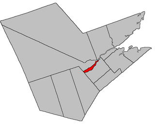
Derby is a geographic parish in Northumberland County, New Brunswick, Canada.
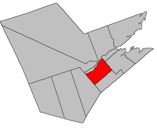
Nelson is a geographic parish in Northumberland County, New Brunswick, Canada.
Barnaby River is a Canadian community in Northumberland County, New Brunswick. It is located south of the city of Miramichi.
The Barnaby River is a tributary of the Miramichi River in New Brunswick, Canada.
Route 126 is a North/South provincial highway in the Canadian province of New Brunswick. The road runs from Route 117 intersection in Miramichi. The road has a length of approximately 121 kilometres, and services small, otherwise isolated rural communities. In these areas, the highway is often unofficially referred to as "Main Street." The road parallels the New Brunswick East Coast Railway directly to the east. When the highway enters Moncton it changes to Ensley Drive, then Mountain Road.
Route 117 is an East/West provincial highway in the Canadian province of New Brunswick. The road runs from Route 11 intersection in Saint-Louis. The road has a length of approximately 114 kilometres, and services small, otherwise isolated rural communities. In these areas, the highway is often unofficially referred to as "Main Street." The Road is called Loggie Road, Wellington Street, University Avenue, and Airport Road in the city of Miramichi. This Route Mainly follows the Gulf of St. Lawrence in New Brunswick.
Route 390 is a 12-kilometre (7.5 mi) long mostly east–west secondary highway in the northwest portion of New Brunswick, Canada.
Route 420 is a 35-kilometre (22 mi) long mostly east–west secondary highway in the northwest portion of New Brunswick, Canada.
Route 425 is a 30-kilometre (19 mi) long mostly west–east secondary highway in the northwest portion of New Brunswick, Canada.
Route 430 is a 40-kilometre-long (25 mi) mostly north–south secondary highway in the northwest portion of New Brunswick, Canada.
Route 625 is a 31.2-kilometre (19.4 mi) long mostly north–south secondary highway in the eastern portion of New Brunswick, Canada.
