The Confederation Bridge is a box girder bridge carrying the Trans-Canada Highway across the Abegweit Passage of the Northumberland Strait, linking the province of Prince Edward Island with the mainland province of New Brunswick. Opened May 31, 1997, the 12.9-kilometre (8.0 mi) bridge is Canada's longest bridge and the world's longest bridge over ice-covered water.

Sackville is a former town in southeastern New Brunswick, Canada. It held town status prior to 2023 and is now part of the town of Tantramar.
Route 95 is a 14.5-kilometre-long (9.0 mi) provincial highway in New Brunswick, which connects Interstate 95 (I-95) at the Houlton–Woodstock Border Crossing near Houlton, Maine, United States to New Brunswick Route 2 in Woodstock, New Brunswick, Canada.

Route 11 is a provincial highway in northeastern New Brunswick, Canada. The 440-kilometre (270 mi) road runs from Moncton to the Quebec border, near Campbellton, at the Matapédia Bridge, following the province's eastern and northern coastlines.

Cape Tormentine is a rural community and former local service district in southeastern New Brunswick, Canada. It is located on the Northumberland Strait at the Abegweit Passage, the shortest crossing between Prince Edward Island and the mainland. It once flourished as a transportation hub between New Brunswick and Prince Edward Island but has been in decline since 1997 when the ferry service was closed due to the opening of the Confederation Bridge. At the Canada 2011 Census the population was 108, three quarters what it was at the 2006 census.
Route 16 is a two-lane highway in the Canadian province of New Brunswick. The 52 km (32 mi) route begins at a T intersection with Aulac Road at Aulac and ends at the midpoint of the Confederation Bridge, where it becomes Prince Edward Island Route 1.
Port Elgin is a former Canadian village in Westmorland County, New Brunswick. It is located near the Nova Scotia border at the mouth of the Gaspereaux River where it empties into the Northumberland Strait's Baie Verte and is now part of the rural community of Strait Shores.
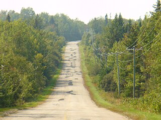
Route 970 is a 11.4-kilometre (7.1 mi) long provincial highway located entirely in Westmorland County, New Brunswick, Canada. The highway connects Nova Scotia Route 366 at Tidnish Bridge, Nova Scotia to Route 15 and Route 16 at Strait Shores. The road is one of only three public roads crossing the provincial boundary on the Isthmus of Chignecto; the other two being Route 2/Nova Scotia Highway 104 and the Mount Whately Road. It is the only land crossing between the two provinces.

Route 106 is a highway in New Brunswick, Canada; running from an intersection with Route 1 and the western terminus of Route 905 in Three Rivers to the intersection of Trans-Canada Highway and the southern terminus of Route 940 in Sackville; a distance of 91.8 kilometres.

Cape Jourimain is an area made of two islands and a section of mainland along the southwestern shore of the Northumberland Strait, three kilometres west of New Brunswick's easternmost point at Cape Tormentine. The two islands, Jourimain and Trenholm, have been connected to the mainland since 1966 by an artificial causeway. Cape Jourimain is the historic crossing point from New Brunswick (NB) to Prince Edward Island (PEI) and is host to the western end of the Confederation Bridge, Canada's longest fixed-link crossing. In 1980, the two islands, including a section of mainland, were designated as a National Wildlife Area (NWA) and in 2001 the Cape Jourimain Nature Centre, operated by a charitable nonprofit organization, was opened to the public.
Route 124 is an east/west provincial highway in the Canadian province of New Brunswick. The road runs from Route 1 exit 175 in Valley Waters as far as the Saint John River, where it crosses the Evandale Ferry to Evandale and an intersection with Route 102. The road has a length of approximately 41.3 kilometres, excluding the distance across the river, and services small, otherwise isolated rural communities. In these areas, the highway is often unofficially referred to as "Mountain Road."
Aulac is a Canadian community in Westmorland County, New Brunswick. As of January 1, 2023 it is part of the Municipality of Tantramar which consists of the former town of Sackville, Village of Dorchester, Pointe de Bute and other rural communities. It is located between the former college town of Sackville and the provincial border with Nova Scotia.
Route 103 is a highway in New Brunswick, Canada, running from Woodstock to Florenceville along the west bank of the Saint John River, a distance of 42 kilometres.
Route 955 is a Canadian highway in Westmorland County, New Brunswick.
Route 126 is a North/South provincial highway in the Canadian province of New Brunswick. The road runs from Route 117 intersection in Miramichi. The road has a length of approximately 121 kilometres, and services small, otherwise isolated rural communities. In these areas, the highway is often unofficially referred to as "Main Street." The road parallels the New Brunswick East Coast Railway directly to the east. When the highway enters Moncton it changes to Ensley Drive, then Mountain Road.
Route 117 is an East/West provincial highway in the Canadian province of New Brunswick. The road runs from Route 11 intersection in Saint-Louis. The road has a length of approximately 114 kilometres, and services small, otherwise isolated rural communities. In these areas, the highway is often unofficially referred to as "Main Street." The Road is called Loggie Road, Wellington Street, University Avenue, and Airport Road in the city of Miramichi. This Route Mainly follows the Gulf of St. Lawrence in New Brunswick.
Route 465 is an 25-kilometre (16 mi) long north-east secondary highway in the northwest portion of New Brunswick, Canada.

Botsford is a civil parish in Westmorland County, New Brunswick, Canada.
Bayfield was a local service district in Westmorland County, New Brunswick, Canada, near the intersection of Route 955 and Route 16. It is now part of the incorporated rural community of Strait Shores.
Baie Verte is a 770 km2 (300 sq mi) Canadian bay located on the north shore of Nova Scotia and eastern shore of New Brunswick. It is a sub-basin of the Northumberland Strait.

