
Route 11 is a provincial highway in northeastern New Brunswick, Canada. The 440-kilometre (270 mi) road runs from Moncton to the Quebec border, near Campbellton, at the Matapédia Bridge, following the province's eastern and northern coastlines.
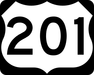
U.S. Route 201 is part of the nationwide system of United States Numbered Highways. It runs for 157.46 miles (253.41 km) entirely within the state of Maine and is a spur route of U.S. Route 1. Its southern terminus is in Brunswick at US 1 and Maine State Route 24 Business. Its northern terminus is at the Canada–US border near Jackman, where it connects to Quebec Route 173.
Route 2 is a major provincial highway in the Canadian province of New Brunswick, carrying the main route of the Trans-Canada Highway in the province. The highway connects with Autoroute 85 at the border with Quebec and Highway 104 at the border with Nova Scotia, as well as with traffic from Interstate 95 in the U.S. state of Maine via the short Route 95 connector. A core route in the National Highway System, Route 2 is a four-lane freeway in its entirety, and directly serves the cities of Edmundston, Fredericton, and Moncton.

Vermont Route 105 (VT 105) is a 98.135-mile-long (157.933 km) state highway located in northern Vermont in the United States. The route runs from U.S. Route 7 (US 7) in St. Albans in the west to the New Hampshire state line in Bloomfield in the east. The road continues across the state line as Bridge Street, a short unnumbered New Hampshire state route to US 3 in North Stratford, New Hampshire. As it is not a New Hampshire state highway, the connection is signed with Vermont state highway signage, similar to how connections to Vermont state routes are indicated elsewhere in New Hampshire.

U.S. Route 6 (US 6) travels east–west near the north edge of the U.S. state of Pennsylvania from the Ohio state line near Pymatuning Reservoir east to the Mid-Delaware Bridge over the Delaware River into Port Jervis, New York. It is the longest highway segment in the commonwealth. Most of it is a two-lane rural highway, with some freeway bypasses around larger towns. Except east of Dunmore, where it is paralleled by Interstate 84 (I-84), it is the main route in its corridor. What is now I-80—the Keystone Shortway—was once planned along the US 6 corridor as a western extension of I-84. The corridor was originally the Roosevelt Highway from Erie, Pennsylvania, to Port Jervis, New York, designated Pennsylvania Route 7 (PA 7) in 1924. The PA 7 designation soon disappeared, but, as US 6 was extended and relocated, the Roosevelt Highway followed it. The Pennsylvania section of US 6 was renamed the Grand Army of the Republic Highway in 1946; this name was applied to its full transcontinental length by 1953.
Route 105 is a collector highway in New Brunswick running from Route 10 in Youngs Cove to Route 108 in Grand Falls, mostly along the east and north banks of the Saint John River, over a distance of 307.0 kilometres (190.8 mi). Route 105 consists largely of former alignments of Route 2 and runs parallel to Route 2 over its entire length.

Route 106 is a highway in New Brunswick, Canada; running from an intersection with Route 1 and western intersection in Route 905 in Three Rivers to the intersection of Trans-Canada Highway and the southern terminus of Route 940 at Sackville; a distance of 91.8 kilometres.
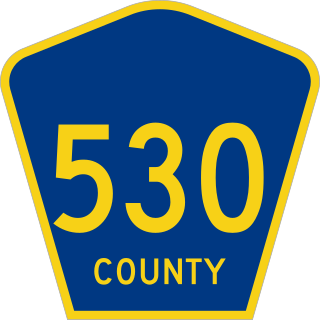
County Route 530 is a county highway in the U.S. state of New Jersey. The highway extends 31.21 miles from US 206 and Route 38 in Southampton Township to Water Street in Toms River Township.

County Route 512 is a county highway in the U.S. state of New Jersey. The highway extends 32.96 miles (53.04 km) from High Bridge Road in Califon to Springfield Avenue / Route 24 in Summit.

U.S. Route 322 is a spur of US 22, running from Cleveland, Ohio, east to Atlantic City, New Jersey. In the U.S. state of Pennsylvania, the route runs from the Ohio state line in West Shenango Township southeast to the Commodore Barry Bridge over the Delaware River in Chester, at which point the route crosses into New Jersey. The route passes near or through several cities, including Meadville, DuBois, State College, and Harrisburg. US 322 in Pennsylvania is named the 28th Division Highway in honor of the 28th Infantry Division.
Route 134 is a 261 km (162 mi)-long north–south secondary highway in eastern New Brunswick, Canada. The highway is divided by into a northern and southern section by a gap in Northumberland County connected by Route 11 and Route 8.
Route 540 is a 54.8-kilometre (34.1 mi) long provincial highway located in western New Brunswick, Canada. The highway begins in Graham Corner at a junction with Route 122 and travels north to a terminus at Route 550 in Lindsay.
Route 420 is a 35-kilometre (22 mi) long mostly east–west secondary highway in the northwest portion of New Brunswick, Canada.
Route 430 is a 40-kilometre-long (25 mi) mostly north–south secondary highway in the northwest portion of New Brunswick, Canada.
Route 460 is a 18-kilometre (11 mi) long looping secondary highway in the northwest portion of New Brunswick, Canada.
Route 465 is an 25-kilometre (16 mi) long north-east secondary highway in the northwest portion of New Brunswick, Canada.
Route 495 is a 23-kilometre (14 mi) long north–south secondary highway in the northwest portion of New Brunswick, Canada.

Route 505 is a 45-kilometre (28 mi) long north–south secondary highway in the northwest portion of New Brunswick, Canada.
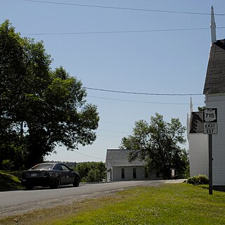
Route 715 is a 53.2-kilometre (33.1 mi) long local highway in Queens County, New Brunswick. Its western terminus is in Jemseg at Route 695 near its interchange with Route 2 and its eastern terminus is in Coles Island at Route 10 and Route 112. It is signed as an east–west highway although its westernmost portion along the Saint John River runs nearly due north and south.
The Becaguimec Stream is a minor tributary of the Saint John River in the Canadian Province of New Brunswick. It rises in the hilly woods along the county line dividing Carleton County, Canada from York County, Canada in the western region of the province. Its watershed is adjacent to the South Branch of the Southwest Miramichi River, the Nashwaak River, the Keswick River and the Nackawic Stream.
