The Trans Canada Trail is a cross-Canada system of greenways, waterways, and roadways that stretches from the Atlantic to the Pacific to the Arctic oceans. The trail extends over 28,000 km (17,000 mi); it is now the longest recreational, multi-use trail network in the world. The idea for the trail began in 1992, shortly after the Canada 125 celebrations. Since then it has been supported by donations from individuals, corporations, foundations, and all levels of government.
Route 2 is a major provincial highway in the Canadian province of New Brunswick, carrying the main route of the Trans-Canada Highway in the province. The highway connects with Autoroute 85 at the border with Quebec, Highway 104 at the border with Nova Scotia, as well as with traffic from Interstate 95 in the U.S. state of Maine via the short Route 95 connector. A core route in the National Highway System, Route 2 is a four-lane freeway in its entirety, and directly serves the cities of Edmundston, Fredericton, and Moncton.
Route 10 is a 144 kilometre long highway starting in Fredericton and ending in Sussex, New Brunswick, Canada. The road goes northeast from the Fredericton suburb of Barker's Point to the village of Minto, then loops around Grand Lake through Chipman to Youngs Cove. Until 2001 this was the end of the highway, but with the opening of a new 4-lane section of the Trans-Canada Highway, it now follows the old alignment of that highway from Youngs Cove to a junction with Route 1 in Sussex. While passing through Minto, Route 10 forms Pleasant Drive, and in Chipman, it forms parts of Bridge Street and Main Street.
Highway 104 in Nova Scotia, Canada, runs from Fort Lawrence at the New Brunswick border near Amherst to River Tillard near St. Peter's. Except for the portion on Cape Breton Island between Port Hawkesbury and St. Peter's, it forms the main route of the Trans-Canada Highway across the province.
Chipman is a community in Queens County, New Brunswick, Canada. It held village status prior to 2023 and is now part of the village of Grand Lake.

Trunk 2 is part of the Canadian province of Nova Scotia's system of Trunk Highways. The route runs from Halifax to Fort Lawrence on the New Brunswick border. Until the 1960s, Trunk 2 was the Halifax area's most important highway link to other provinces, and was part of a longer Interprovincial Highway 2 which ended in Windsor, Ontario. The controlled access Highway 102 and Highway 104 now carry most arterial traffic in the area, while Trunk 2 serves regional and local traffic.

The Magaguadavic River is a historic Canadian river located in the province of New Brunswick.
Route 102 is a 156.96-kilometre-long (97.53 mi) provincial highway in the Canadian province of New Brunswick. The highway runs from an interchange with Route 2 in Pokiok, to an interchange with Route 7 in Grand Bay-Westfield.

Trunk 4 is part of the Canadian province of Nova Scotia's system of Trunk Highways. The route runs from Highway 104 exit 7 near Thomson Station to Glace Bay. Until the construction of the Trans-Canada Highway, Trunk 4 was a major traffic link in northern Nova Scotia and Cape Breton, and is still used on Cape Breton as an alternative to Highway 105. The highway was originally called the King's Highway, however, this name is no longer applied to the entire road. The only remaining historic section of the highway that maintains the name "King" is King's Road in Sydney.
Route 105 is a collector highway in New Brunswick running from Route 10 in Youngs Cove to Route 108 in Grand Falls, mostly along the east and north banks of the Saint John River, over a distance of 307.0 kilometres (190.8 mi). Route 105 consists largely of former alignments of Route 2 and runs parallel to Route 2 over its entire length.

Route 106 is a highway in New Brunswick, Canada; running from an intersection with Route 1 and the western terminus of Route 905 in Three Rivers to the intersection of Trans-Canada Highway and the southern terminus of Route 940 in Sackville; a distance of 91.8 kilometres.
Route 109 is a highway in New Brunswick, Canada; Its western terminus starts along the Tobique River on Route 105 in Perth-Andover. The route travels east where the route is known as Gulch Road passing through Craig Flats, Quaker Brook and Currie where it begins following the Tobique River again. The route then passes through Licford and Arthurette where it crosses the Tobique River briefly merging with Route 390 from the south side to the north side continuing to follow the river east. The route passes by Picadilly then passes by eastern terminus of Route 380 in Saint Almo. The route continues through Three Brooks and the western terminus of Route 395, then passes Ox Island entering Linton Corner where the route is now known as Main Street as it enters Tobique Valley. The route ends at the intersection of Route 108 and Route 385 near Roulston Lake, a distance of 35.9 kilometres.
Route 114 is a 137.6 km (85.5 mi) Canadian secondary highway in southeastern New Brunswick.

Blissfield is a geographic parish in Northumberland County, New Brunswick, Canada.

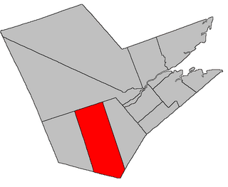
Inkerman is a geographic parish in Gloucester County, New Brunswick, Canada.
Route 116 is a 106 km (66 mi) Canadian secondary highway in southeastern New Brunswick.
Route 122 is a mostly East/West provincial highway in the Canadian province of New Brunswick. The road runs from Route 2 and Route 165 intersection in Dow Settlement. The road has a length of approximately 44 kilometres, and services small, otherwise isolated rural communities. In these areas, the highway is often unofficially referred to as "Main Street." The road bypasses several Lakes including Skiff Lake, Mud Lake, Eel River Lake, North Lake and finally Grand Lake before changing to Boundary Road in Orient, Maine at the Canada–United States border. The Highway is known as Canterbury Road within Lakeland Ridges.
Route 130 is a mostly north/south provincial highway in the Canadian province of New Brunswick. The road has a length of approximately 108 kilometres, and services small, otherwise isolated rural communities. In these areas, the highway is often unofficially referred to as "Main Street". The highway is known as Broadway and Portage Road in Grand Falls, and West Riverside Drive in Southern Victoria.

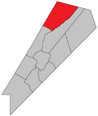
Brunswick is a geographic parish in the northeastern corner of Queens County, New Brunswick, Canada.

Chipman is a geographic parish in Queens County, New Brunswick, Canada.


