Route 1 is a highway in the southern part of the Canadian province of New Brunswick. It begins west of the Canada–United States border at St. Stephen, and runs east for 239.11 kilometres (148.58 mi) to Route 2 at River Glade.
Route 95 is a 14.5-kilometre-long (9.0 mi) provincial highway in New Brunswick, which connects Interstate 95 (I-95) at the Houlton–Woodstock Border Crossing near Houlton, Maine, United States to New Brunswick Route 2 in Woodstock, New Brunswick, Canada.
Route 3 is 92 kilometres long and goes from Route 170 in St. Stephen to Route 2 at Longs Creek, near Fredericton.

Route 11 is a provincial highway in northeastern New Brunswick, Canada. The 440-kilometre (270 mi) road runs from Moncton to the Quebec border, near Campbellton, at the Matapédia Bridge, following the province's eastern and northern coastlines.
Route 15 is 79 kilometres (49 mi) long and is in the southeastern corner of the province of New Brunswick. Starting at the north end of the Petitcodiac River Causeway, it loops around the city of Moncton on Wheeler Boulevard, then turns northeast from Dieppe to Shediac. From there, it turns east and bypasses Cap-Pelé crossing the Scoudouc River, then southeast to meet the Trans-Canada Highway at Port Elgin. The highway is a divided freeway from Moncton to just east of Shediac, where it remains a controlled-access highway until east of Cap-Pele.
Route 2 is a major provincial highway in the Canadian province of New Brunswick, carrying the main route of the Trans-Canada Highway in the province. The highway connects with Autoroute 85 at the border with Quebec, Highway 104 at the border with Nova Scotia, as well as with traffic from Interstate 95 in the U.S. state of Maine via the short Route 95 connector. A core route in the National Highway System, Route 2 is a four-lane freeway in its entirety, and directly serves the cities of Edmundston, Fredericton, and Moncton.

Moncton is a geographic parish in Westmorland County, New Brunswick, Canada.
Route 110 is 15.9-kilometre (9.9 mi) long highway in New Brunswick, Canada; running from the Canada–US border crossing at Bridgewater, Maine as a continuation of Boundary Line Road, a connector to U.S. Route 1 (US 1). The route crosses through Carleton County, crossing Route 2 in Centreville. The route runs along the Saint John River before reaching Florenceville-Bristol, where it terminates at an intersection with Route 130 on the riverbank.
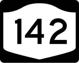
New York State Route 142 (NY 142) is a north–south state highway in Rensselaer County, New York, in the United States. The southern terminus is at an intersection with NY 7 in the hamlet of Brunswick Center within the town of Brunswick. Its northern terminus is at U.S. Route 4 (US 4) in the neighborhood of Lansingburgh within the city of Troy. NY 142 serves as a northeasterly bypass of Troy.
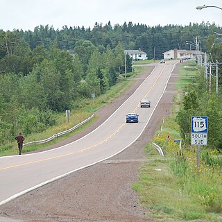
Route 115 is a highway in New Brunswick, Canada; running from a junction with Route 134 in the Lewisville neighbourhood of Moncton to Route 134 in Saint-François-de-Kent (near Bouctouche, a distance of 44 kilometres.
Berry Mills is a small, unincorporated community north-west of Moncton, New Brunswick. It is located in a valley between Lutes Mountain and Steeves Mountain, and around the main Canadian National Railway line, which was formerly the Intercolonial Railway of Canada line. Major Intersections include New Brunswick Route 128 and New Brunswick Route 2 as well as Homestead Road and New Brunswick Route 128. Berry Mills also includes the mostly forest area of Lutesville, New Brunswick.
Route 134 is a 261 km (162 mi)-long north–south secondary highway in eastern New Brunswick, Canada. The highway is divided into a northern and southern section by a gap in Northumberland County connected by Route 11 and Route 8.
Route 126 is a North/South provincial highway in the Canadian province of New Brunswick. The road runs from Route 117 intersection in Miramichi. The road has a length of approximately 121 kilometres, and services small, otherwise isolated rural communities. In these areas, the highway is often unofficially referred to as "Main Street." The road parallels the New Brunswick East Coast Railway directly to the east. When the highway enters Moncton it changes to Ensley Drive, then Mountain Road.
Route 490 is a north–south provincial highway in the Canadian province of New Brunswick. The road runs from Route 116 intersection in Bass River. The road has a length of approximately 57.6 kilometres, and services small, otherwise isolated rural communities. In these areas, the highway is often unofficially referred to as "Main Street". When the highway enters Moncton, it is known as McLaughlin Drive.
Route 375 is a 5.4-kilometre (3.4 mi) long east–west secondary highway in the northwest portion of New Brunswick, Canada.
Route 465 is an 25-kilometre (16 mi) long north-east secondary highway in the northwest portion of New Brunswick, Canada.
Route 772 is a 20.1-kilometre-long (12.5 mi) mostly north–south secondary looping highway on Deer Island, Charlotte County, New Brunswick, Canada.
Route 774 is a 14.9-kilometre (9.3 mi) long mostly north–south secondary highway on Campobello Island in Charlotte County, New Brunswick, Canada.
Route 935 is a 36.3-kilometre (22.6 mi)-long north-to-south secondary highway in the southeastern portion of New Brunswick, Canada.

