Related Research Articles

Wiltshire is a ceremonial county in South West England. It borders Gloucestershire to the north, Oxfordshire and Berkshire to the east, Hampshire to the south-east, Dorset to the south, and Somerset to the west. The largest settlement is Swindon and Trowbridge is the county town.

Swindon is a large town in Wiltshire, England. At the time of the 2021 Census the population of the built-up area was 183,638, making it the largest settlement in the county. Located in South West England, Swindon lies on the M4 corridor, 71 miles (114km) to the west of London and 36 miles to the east of Bristol. The Cotswolds lie just to the town's north and the North Wessex Downs to its south.

The Wilts & Berks Canal is a canal in the historic counties of Wiltshire and Berkshire, England, linking the Kennet and Avon Canal at Semington near Melksham, to the River Thames at Abingdon. The North Wilts Canal merged with it to become a branch to the Thames and Severn Canal at Latton near Cricklade. Among professional trades boatmen, the canal was nicknamed the Ippey Cut, possibly short for Chippenham.

Chippenham is a market town in north-west Wiltshire, England. It lies 13 miles (21 km) north-east of Bath, 86 miles (138 km) west of London and is near the Cotswolds Area of Outstanding Natural Beauty. The town was established on a crossing of the River Avon, where some form of settlement is believed to have existed since before Roman times. It was a royal vill and probably a royal hunting lodge, under Alfred the Great. The town continued to grow when the Great Western Railway arrived in 1841. It had a population of 36,548 in 2021.
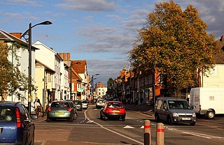
Newport Pagnell is a town and civil parish in the City of Milton Keynes, Buckinghamshire, England. The Office for National Statistics records Newport Pagnell as part of the Milton Keynes urban area.

Wavendon is a village and civil parish in the south east of the Milton Keynes urban area, in Buckinghamshire, England.
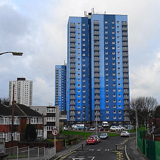
Wednesfield is a town and historic village in the City of Wolverhampton, West Midlands, England, It is 2 miles (3.2 km) east-northeast of Wolverhampton city centre and about 10 miles (16 km) from Birmingham and is part of the West Midlands conurbation. It was historically within the county of Staffordshire.

Melksham Without is a civil parish in the county of Wiltshire, England. It surrounds, but does not include, the town of Melksham and is the largest rural parish in Wiltshire, with a population of 7,230 and an area of 29 square kilometres.

Standish is a village in the Metropolitan Borough of Wigan, Greater Manchester, England. Within the boundaries of the historic county of Lancashire, it is on the A49 road between Chorley and Wigan, near Junction 27 of the M6 motorway. The population of the village was 13,278 in the 2011 census.

Bickenhill is a village in the civil parish of Bickenhill and Marston Green, in the Metropolitan Borough of Solihull, in the West Midlands county, England, on the eastern fringe of the West Midlands conurbation. Bickenhill is also a ward and was within the historic county of Warwickshire. Birmingham Airport is also located within the civil parish.
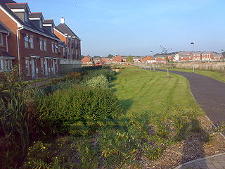
Buckshaw Village is a 21st-century residential and industrial area between the towns of Chorley and Leyland in Lancashire, England, developed on the site of the former Royal Ordnance Factory (ROF) Chorley. It had a population of 4,000. It is divided between the civil parishes of Euxton (south) and Whittle-le-Woods in Chorley, with the north western part being in Leyland unparished area in South Ribble district.

Basford is a hamlet and former civil parish, now in the parish of Weston and Crewe Green, in the unitary authority area of Cheshire East and the ceremonial county of Cheshire, England, lying immediately south of Crewe. Nearby villages include Shavington, Weston, Hough and Chorlton. The population was 256 in 2011. Basford was first recorded in the Domesday survey and had a moated manor. The modern parish is bisected by the A500 and the Crewe-to-Stafford railway line, and includes Basford Hall Sorting Sidings.
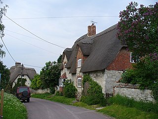
Bishopstone is a village and civil parish in the Borough of Swindon, England, about 6 miles (10 km) east of Swindon, and on the county border with Oxfordshire. Since 1934 the parish has included the village of Hinton Parva. Both Bishopstone and Hinton Parva have Grade I listed churches.
In January 2004, Deputy Prime Minister John Prescott announced the United Kingdom government's Expansion plans for Milton Keynes. However, the change of government in 2010 and the abolition of the Regional Spatial Strategy in 2012/13 saw these plans revoked and a planned expansion of up to 44,000 dwellings reduced to 28,000. The Milton Keynes Core Strategy was published in July 2013 and regards the figure of 28,000 new homes to be the minimum figure.

Christian Malford is a village and civil parish in the county of Wiltshire, England. The village lies about 4+1⁄2 miles (7 km) northeast of the town of Chippenham. The Bristol Avon forms most of the northern and eastern boundaries of the parish. The hamlets of Thornend and Upper Town lie within the parish.
Transport in Swindon, England, and the surroundings has directly contributed to the town's growth and the ingress of businesses and industries.
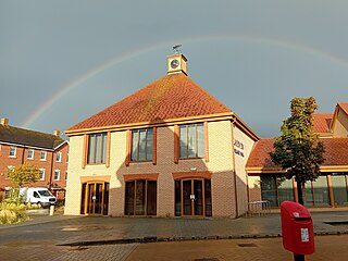
Wixams is a new town and civil parish located in Bedfordshire, England, which has been under construction since early 2007. It is expected to become the third largest settlement in the Borough of Bedford after Bedford itself and Kempston, and one of the largest new settlements founded in England since the British new towns movement of the first twenty five years after World War II.
Keckwick is an area in the Borough of Halton in Cheshire. Although there is no village as such, numerous toponyms attest to a particular identity in the area which straddles the West Coast Main Line between the village of Daresbury and the new town of Runcorn.

Wichelstowe is a residential development and urban extension on the southern edge of the town of Swindon in South West England, constructed from late 2006. Located north of the M4 motorway between junction 16 and Croft Road, Wichelstowe has three neighbourhoods: East, Middle and West Wichel. The development will comprise up to 4500 homes, employment space, public open space, shopping, community facilities for residents and various schools. In 2014 it was described as the country's largest housing project on public-owned land.

Forge Wood is the 14th residential neighbourhood in Crawley, a town and borough in West Sussex. The 1,900 houses and other facilities will be built on open land in the northeast of the borough, adjoining the ancient village of Tinsley Green and to the north of the Pound Hill neighbourhood.
References
- ↑ "New Eastern Villages planning obligations draft supplementary planning document (SPD)".
- 1 2 3 4 5 "Swindon Borough Local Plan 2026". Swindon Borough Council. 26 March 2015. pp. 160–170, 186. Retrieved 2 July 2022.
- ↑ Humphreys, Chris (20 July 2016). "Swindon firm hopes to offer fresh start for stalled New Eastern Villages project". Swindon Advertiser. Retrieved 26 October 2017.
- ↑ "Swindon Local Plan 2026, with map". Swindon Borough Council. Retrieved 2 July 2022.