
Route 18 is a 42.8-mile-long (68.9 km) state highway in the central part of the US state of New Jersey. It begins at an intersection with Route 138 in Wall Township, Monmouth County and ends at Interstate 287 (I-287) in Piscataway Township, Middlesex County. Route 18 is a major route through central New Jersey that connects the Jersey Shore to the Raritan Valley region, connecting the county seats of Monmouth (Freehold) and Middlesex respectively. The route runs through Ocean Township, Marlboro Township, and East Brunswick, as for much of the route is a freeway. The remainder of the route is an expressway with traffic lights in the East Brunswick and Old Bridge areas, and a boulevard in the remainder of Piscataway. Route 18 was designated in 1939 as a proposed freeway from Old Bridge to Eatontown. The section west of Old Bridge was formerly designated as part Route S28, a prefixed spur of State Highway Route 28 from Middlesex to Matawan. The designation, assigned in the 1927 renumbering, remained until a second renumbering in 1953. At that point, Route S28 was redesignated as Route 18, though the section from Old Bridge to Matawan was signed as TEMP 18, as this section would be decommissioned when the Route 18 freeway was built.

Route 3 is a major state highway in the northeastern part of New Jersey. The route runs 10.84 miles (17.45 km) from U.S. Route 46 (US 46) in Clifton, Passaic County, to US 1/9 in North Bergen, Hudson County. The route is a limited-access highway for its entire length, and intersects many major roads, including US 46, which takes travelers to Interstate 80 (I-80) west for commuting out of the city-area, the Garden State Parkway and Route 21 in Clifton, Route 17 and the Western Spur of the New Jersey Turnpike (I-95) in East Rutherford, the Eastern Spur of the New Jersey Turnpike in Secaucus, and Route 495 in North Bergen, for traffic going to the Lincoln Tunnel into New York City. Route 3 serves as the main artery to the Lincoln Tunnel from I-80, in conjunction with a portion of US 46 and Route 495. Portions of the route are not up to freeway standards; with driveways serving businesses and bus stops. Despite this, many construction projects have been underway over the years to alleviate this issue. Route 3 also provided access to Hoffmann La Roche's former American headquarters in Nutley, the Meadowlands Sports Complex and American Dream Meadowlands in East Rutherford. The road inspired a story in The New Yorker in 2004 by Ian Frazier due to its views of the Manhattan skyline. Route 3 was originally the Lincoln Tunnel Approach and ended at the state line in the Hudson River, though it was scaled back following the construction of I-495; which is now Route 495 due to also not meeting interstate highway standards.

Route 4 is a state highway in Bergen County and Passaic County, New Jersey, United States. The highway stretches 10.83 mi (17.43 km) from Route 20 in Paterson east to an interchange with Interstate 95 (I-95), U.S. Route 1/9 (US 1/9), US 46, and US 9W at the George Washington Bridge approach in Fort Lee.

Route 20, known locally as McLean Boulevard, is a state highway that runs 4.15 miles (6.68 km) in New Jersey, United States. It runs along the east side of Paterson, Passaic County, following the west bank of the Passaic River between the Garden State Parkway and U.S. Route 46, and River Street, at which point County Route 504 begins. It is a four- to six-lane expressway for most of its length that runs through residential and commercial areas of Paterson, intersecting with Interstate 80 and Route 4 at interchanges. The northernmost part of the route is a county-maintained one-way pair that follows 1st and 2nd Avenues.

Route 120 is a state highway located in Bergen County, New Jersey, United States. It extends 2.65 mi (4.26 km) from an interchange with Route 3 in East Rutherford to another interchange with Route 17 in Carlstadt, where it continues to the west as County Route 120. Route 120 serves the Meadowlands Sports Complex - which consists of MetLife Stadium, Meadowlands Racetrack, and the Meadowlands Arena - and the American Dream shopping and entertainment complex. It heads north from Route 3 as a six-lane freeway through the sports complex to an interchange with the southern terminus of County Route 503. From here, Route 120 heads northwest along the northern edge of the sports complex as a four-lane divided at-grade Paterson Plank Road, passing through industrial and commercial areas.

Route 5 is a 3.18-mile (5.12 km) state highway located entirely in Bergen County, New Jersey, United States. It runs from U.S. Route 1/9 (US 1-9) in Ridgefield east down the New Jersey Palisades to end at County Route 505 at the Hudson River in Edgewater, forming a “wavy” path. The route is a two- to four-lane undivided highway its entire length, passing mostly through wooded residential neighborhoods. The route passes under Route 63 in Palisades Park, with access to that route provided by Bergen Boulevard, and intersects the southern terminus of Route 67 in Fort Lee.

Route 7 is a state highway in the northern part of New Jersey in the United States. It has two sections, an east–west alignment running from U.S. Route 1/9 Truck in Jersey City to Route 21 in Belleville, and a north–south alignment running from the Newark/Belleville to the Nutley/Clifton border. The New Jersey Department of Transportation (NJDOT) lists Route 7 as a single north–south highway with a small gap between the alignments. The entire highway has a combined length of 9.46 mi (15.22 km).

Route 17 is a state highway in Bergen County, New Jersey, United States, that provides a major route from the George Washington Bridge, Lincoln Tunnel and other northeast New Jersey points to the New York State Thruway at Suffern, New York. It runs 27.20 mi (43.77 km) from an intersection with Route 7 and County Route 507 (CR 507) in North Arlington north to the New York border along Interstate 287 (I-287) in Mahwah, where New York State Route 17 (NY 17) continues into New York. Between Route 7 and Route 3 in Rutherford, Route 17 serves as a local road. From Route 3 north to the junction with U.S. Route 46 (US 46) in Hasbrouck Heights, the road is an expressway with jughandles. The portion of Route 17 from US 46 to I-287 near the state line in Mahwah is a limited-access highway with all cross traffic handled by interchanges, and many driveways and side streets accessed from right-in/right-out ramps from the right lane. For three miles (5 km) north of Route 4, well over a hundred retail stores and several large shopping malls line the route in the borough of Paramus. The remainder of this portion of Route 17 features lighter suburban development. The northernmost portion of Route 17 in Mahwah runs concurrently with I-287 to the New York border.
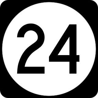
Route 24 is a 10.42-mile (16.77 km) state highway in New Jersey, United States, that begins at a junction with Interstate 287 (I-287) in Hanover Township in Morris County, passes southeast through Essex County, and ends at a junction with I-78 in Springfield Township in Union County. The route is a four- to six-lane freeway for its entire length.

Route 37 is a state highway located in Ocean County, New Jersey, United States. The route runs 13.43 mi (21.61 km) from a traffic circle with Route 70 in Lakehurst east to an interchange with Route 35 in Seaside Heights. A two– to six–lane divided highway its entire length, Route 37 serves as the major east–west route through the Toms River area as well as a main route to the Barnegat Peninsula, crossing the Barnegat Bay on the Thomas A. Mathis and J. Stanley Tunney Bridges. The route through Toms River Township is lined with many businesses and named Little League World Champions Boulevard in honor of Toms River East Little League's victory in the 1998 Little League World Series. Route 37 intersects many major roads in the Toms River area, including County Route 527 (CR 527), the Garden State Parkway/U.S. Route 9 (US 9), Route 166, CR 549, and CR 571. The route experiences congestion from both development in the area and from traffic bound for the barrier islands in the summer.

Route 68 is a state highway located in Burlington County in the U.S. state of New Jersey, serving as the main connector between the New Jersey Turnpike and the Fort Dix entity of Joint Base McGuire–Dix–Lakehurst. It runs from County Route 616 (CR 616) inside Fort Dix to U.S. Route 206 (US 206) in Mansfield Township, 0.34 mi (0.55 km) south of the New Jersey Turnpike; a total route length of 7.92 mi (12.75 km). The route passes through Wrightstown and Springfield Township as a two-lane undivided road, crossing CR 537. It continues through Mansfield Township as a four-lane divided highway, intersecting with CR 543. Outside of ASA Fort Dix, Route 68 passes through mostly agricultural and residential areas.
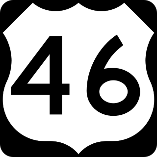
U.S. Route 46 (US 46) is an east–west U.S. Highway completely within the state of New Jersey, running for 75.34 mi (121.25 km), making it the shortest signed, non-spur U.S. Highway. The west end is at an interchange with Interstate 80 (I-80) and Route 94 in Columbia, Warren County, on the Delaware River. The east end is in the middle of the George Washington Bridge over the Hudson River in Fort Lee, Bergen County, while the route is concurrent with I-95 and US 1-9. Throughout much of its length, US 46 is closely paralleled by I-80. US 46 is a major local and suburban route, with some sections built to or near freeway standards and many other sections arterials with jughandles. The route runs through several communities in the northern part of New Jersey, including Hackettstown, Netcong, Dover, Parsippany-Troy Hills, Wayne, Clifton, Ridgefield Park, Palisades Park, and Fort Lee. It crosses over the Upper Passaic River at several points. The road has been ceremonially named the United Spanish–American War Veterans Memorial Highway.
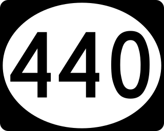
Route 440 is a state highway in New Jersey, United States. It comprises two segments, a 5.15-mile (8.29 km) freeway in Middlesex County linking Interstate 287 (I-287) and the New Jersey Turnpike (I-95), in Edison to the Outerbridge Crossing in Perth Amboy and a 8.18-mile (13.16 km) four-lane divided highway in Hudson County running from the Bayonne Bridge in Bayonne to U.S. Route 1/9 Truck in Jersey City. These two segments are connected by New York State Route 440 (NY 440), which runs across Staten Island. The freeway portion in Middlesex County is six lanes wide and interchanges with the Garden State Parkway and US 9 in Woodbridge.
In 1927, New Jersey's state highways were renumbered. The old system, which had been defined in sequence by the legislature since 1916, was growing badly, as several routes shared the same number, and many unnumbered state highways had been defined. A partial renumbering was proposed in 1926, but instead a total renumbering was done in 1927.

U.S. Route 1/9 Truck is a U.S. Route in the northern part of New Jersey that stretches 4.11 miles (6.61 km) from the eastern edge of Newark to the Tonnele Circle in Jersey City. It is the alternate road for US 1/9 that trucks must use because they are prohibited from using the Pulaski Skyway, which carries the main routes of US 1/9. It also serves traffic accessing the New Jersey Turnpike, Route 440, and Route 7. The route is a four- to six-lane road its entire length, with portions of it being a divided highway that runs through urban areas. From its south end to about halfway through Kearny, US 1/9 Truck is freeway-standard, with access to other roads controlled by interchanges.

Interstate 280 (I-280) is a 17.85-mile (28.73 km) Interstate Highway in the US state of New Jersey. It provides a spur from I-80 in Parsippany–Troy Hills, Morris County, east to Newark and I-95 in Kearny, Hudson County. In Kearny, access is provided toward the Holland Tunnel and Lincoln Tunnel to New York City. The western part of the route runs through suburban areas of Morris and Essex counties, crossing the Watchung Mountains. Upon reaching The Oranges, the setting becomes more urbanized and I-280 runs along a depressed alignment before ascending again in Newark. I-280 includes a vertical-lift bridge, the William A. Stickel Memorial Bridge, over the Passaic River between Newark and East Newark/Harrison. The highway is sometimes called the Essex Freeway. I-280 interchanges with several roads, including the Garden State Parkway in East Orange and Route 21 in Newark.
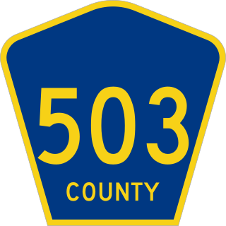
County Route 503 is a county highway in the U.S. state of New Jersey. The highway extends 17.95 miles from Paterson Plank Road in East Rutherford to the New York state line at the Montvale NJ/Pearl River NY border, where it continues as New York State Route 304. It parallels the Hackensack River and New Jersey Transit's Pascack Valley Line for much of its route.

U.S. Route 1 (US 1) is a U.S. Route which parallels the East Coast of the United States, running from Key West, Florida, in the south to Fort Kent, Maine, at the Canadian border in the north. Of the entire length of the route, 66.06 miles (106.31 km) of it runs through New Jersey. It enters the state from Pennsylvania on the Trenton–Morrisville Toll Bridge over the Delaware River in the state capital of Trenton, running through the city on the Trenton Freeway. From here, US 1 continues northeast as a surface divided highway through suburban areas, heading into Middlesex County and passing through New Brunswick and Edison. US 1 merges with US 9 in Woodbridge, and the two routes continue through northern New Jersey as US 1/9 to the George Washington Bridge over the Hudson River in Fort Lee. At this point, the road continues into New York City along with I-95.
U.S. Route 1/9 (US 1/9) is the 31.01-mile (49.91 km) long concurrency of US 1 and US 9 from their junction in Woodbridge Township in Middlesex County, New Jersey, north to New York City. The route is a multilane road with some freeway portions that runs through urbanized areas of North Jersey adjacent to New York City. Throughout most of its length in New Jersey, the road runs near the New Jersey Turnpike/Interstate 95 (I-95). In Fort Lee, US 1/9 merges onto I-95 and crosses the Hudson River on the George Washington Bridge, where the two U.S. Routes split a short distance into New York. US 1/9 intersects several major roads, including I-278 in Linden, Route 81 in Elizabeth, I-78 and US 22 in Newark, Route 139 in Jersey City, Route 3 and Route 495 in North Bergen, and US 46 in Palisades Park. US 1/9 also serves as the primary access point to Newark Airport. Between Newark and Jersey City, US 1/9 runs along the Pulaski Skyway. Trucks are banned from this section of road and must use US 1/9 Truck. The concurrency between US 1 and US 9 is commonly referred to as "1 and 9". Some signage for the concurrency, as well as the truck route, combines the two roads into one shield, separated by a hyphen (1-9) or an ampersand (1&9).

Route 44T, also known as the Gloucester County Tunnel, was a proposed state highway and vehicular tunnel during the 1930s from Gloucester County, New Jersey to Philadelphia County, Pennsylvania. The route was to begin at the state line near Paulsboro, New Jersey, heading eastward as a freeway through several southern New Jersey communities and providing access from New Jersey Route 42 to the Delaware River.
