Ngarua Caves

Last updated
Stalactites above walkway through Ngarua Caves Stalactites above walkway through Ngarua Caves.jpg
Stalactites above walkway through Ngarua Caves

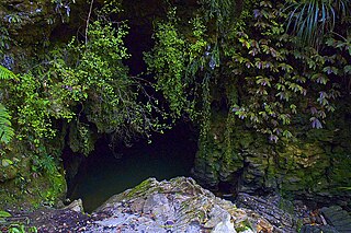
The Ngarua Caves are a series of limestone caves in the Takaka Hill range south of Abel Tasman National Park.

Limestone Sedimentary rocks made of calcium carbonate

Limestone is a carbonate sedimentary rock that is often composed of the skeletal fragments of marine organisms such as coral, foraminifera, and molluscs. Its major materials are the minerals calcite and aragonite, which are different crystal forms of calcium carbonate (CaCO3). A closely related rock is dolomite, which contains a high percentage of the mineral dolomite, CaMg(CO3)2. In fact, in old USGS publications, dolomite was referred to as magnesian limestone, a term now reserved for magnesium-deficient dolomites or magnesium-rich limestones.

Takaka Hill

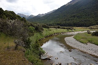
Takaka Hill is a range of hills located in the northwest of the South Island of New Zealand. Made of marble which has weathered into many strange forms and with numerous sink holes, it is typical karst country. The Marble is Ordovician in age and from the Takaka Terrane.

Abel Tasman National Park national park of New Zealand

Abel Tasman National Park is a New Zealand national park located between Golden Bay and Tasman Bay at the north end of the South Island. It is named after Abel Tasman, who in 1642 became the first European explorer to sight New Zealand and who anchored nearby in Golden Bay.

Contents

The caves are located close to Takaka Hill's summit, adjacent to State Highway 60 as it winds its way over the Takaka Hill between Motueka and Upper Takaka. Scheduled tours suitable for people of all ages are provided by a commercial operator from the car park and cafe situated at the cave entrance. The caves cannot be visited unattended. [1]

New Zealand State Highway 60 road in New Zealand

State Highway 60 is a state highway servicing the far northwest of the South Island of New Zealand. Running between the settlements of Richmond and Collingwood, it is 116 kilometres (72 mi) long and lies entirely within the Tasman District. It is the northernmost highway in the South Island and is a popular tourist route, servicing Motueka, Abel Tasman National Park, Golden Bay, and Farewell Spit.

Motueka Town in Tasman District, New Zealand

The town of Motueka in the South Island of New Zealand lies close to the mouth of the Motueka River, on the western shore of Tasman Bay. It is, after Richmond, the second largest centre in the Tasman Region, with a population of 7125. The Motueka Ward had an estimated population of 10,900 at 30 June 2009.

Ngarua Caves contain a variety of cave formations along a comfortable 300 metres (980 ft) walkway through the caves, as well as notable displays of Moa bones remaining in the caves. Ngarua Caves is listed as one of the "101 Must-Do's for Kiwis". [2]

Moa order of birds (fossil)

Moa were nine species of now-extinct flightless birds endemic to New Zealand. The two largest species, Dinornis robustus and Dinornis novaezelandiae, reached about 3.6 m (12 ft) in height with neck outstretched, and weighed about 230 kg (510 lb). It is estimated that, when Polynesians settled New Zealand circa 1280, the moa population was about 58,000.

See also

Related Research Articles

Tasman District Place in New Zealand

Tasman District is a local government district in the north of the South Island of New Zealand. It borders the Canterbury Region, West Coast Region, Marlborough Region and Nelson City. It is administered by the Tasman District Council, a unitary authority, which sits at Richmond, with community boards serving outlying communities in Motueka and Golden Bay / Mohua.

Karamea Place in West Coast, New Zealand

Karamea is a town on the West Coast of the South Island of New Zealand. It is the northernmost settlement of any real size on the West Coast, and is located 96 kilometres (60 mi) north-east by road from Westport. There is no other connecting road to the town - the road north ends at the Kohaihai River some 20 kilometres (12 mi) from Karamea, at the south western end of the Heaphy Track.

Harwood Hole cave

Harwoods Hole is a cave system located in the northwest of the South Island of New Zealand. It is one of several important cave systems in Takaka Hill, between Golden Bay and Tasman Bay. Starting at the surface as a 50-metre round entrance and descending 183 metres, Harwood Hole is New Zealand's deepest vertical shaft. Further in it connects with Starlight Cave. The long rope descent is considered one of the most spectacular parts of the caving experience at Harwood's. Harwood's Hole has an overall depth of 357 m.

Waitomo Place in Waikato, New Zealand

Waitomo is a rural community in the Waikato Region of New Zealand's North Island. It includes Waitomo Caves, a solutional cave system and popular local tourist attraction. Two villages, Waitomo and Hangatiki/Hangātiki, service visiting tourists.

Mount Owen (New Zealand) mountain in New Zealand

Mount Owen is in the Tasman district of the South Island of New Zealand. It stands at 1875 metres (6150 feet) above sea level and is part of the Marino Mountains.

Takaka, New Zealand town in Tasman, New Zealand

Takaka is a small town situated at the southeastern end of Golden Bay, at the northern end of New Zealand's South Island, located on the lower reaches of the Takaka River. It lies at the start of the winding road which follows the river valley before climbing over Takaka Hill, linking Golden Bay with the more populated coast of Tasman Bay to the southeast. The town is served by Takaka Aerodrome.

The Takaka River lies in the northwest of New Zealand's South Island. It runs north for 70 kilometres, entering Golden Bay near the town of Takaka.

The Riuwaka River, formerly known as the Riwaka River, is located in the Nelson region in the northwest of New Zealand's South Island. It flows for 20 kilometres, entering Tasman Bay close to the town of Riwaka, 10 kilometres north of Motueka.

Honeycomb Hill Cave cave in New Zealand

Honeycomb Hill Cave is located in the Oparara Basin, South Island of New Zealand.

The Anatoki River is a river of New Zealand. It is located in the Tasman Region, and is a tributary of the Takaka River and is one of the country's steepest rivers. The river's name means cave of stone adzes.

Cobb River (New Zealand) river in Tasman District, New Zealand

The Cobb River is a river in the Tasman Region of New Zealand. It flows southeast from Lake Cobb on the northern slopes of Mount Cobb, in Kahurangi National Park, in the northwestern South Island. The river's waters are captured behind a dam to become the Cobb Reservoir; the outflow continues to join with the Takaka River. The river is named for J.W. Cobb, a local mill owner, who discovered it.

The Devil River is a river of New Zealand's Tasman Region. It starts between the Devil Range and the Anatoki Range and flows generally east through the Kahurangi National Park, reaching the Takaka River 13 kilometres (8 mi) south of the town of Takaka.

The Pariwhakaoho River is a river of the Tasman Region of New Zealand's South Island. It flows northeast from sources within Kahurangi National Park to reach Golden Bay 10 kilometres northwest of Takaka.

Waikoropupu River river in New Zealand

The Waikoropupu River is a river of the Tasman Region of New Zealand's South Island.It originates in the Kahurangi National Park and flows generally northeast to reach the Takaka River close to the town of Takaka. On its way it passes close to the Te Waikoropupū Springs, which drain into the river and add significantly to its water volume.

The Stanley River is a river of the Tasman Region of New Zealand's South Island. It flows southeast from its sources in the Douglas and Anatoki Ranges, reaching the Waingaro River 12 kilometres west of Upper Takaka.

Rawhiti Cave

Rawhiti Cave, also known as Manson Cave, is a single large limestone cave in the hillside of the Dry Creek Valley 7 kilometres (4.3 mi) southeast of Takaka on the South Island of New Zealand. It is referred to as Manson Cave in the NZ Topo Map, after owners in the early 20th century, however the cave is known as Rawhiti Cave locally, and on DoC information panels and in brochures.

Takaka Terrane

The Takaka Terrane from New Zealand's Western Province outcrops in the mountains of Nelson's Tasman District. The terrane is mostly made up of marble and volcanic rocks but is highly variable in composition. It ranges in age from mid-Cambrian to Devonian time, including New Zealand's oldest rocks, which are found in the Cobb Valley in north-west Nelson. The Cobb Valley is also the location of "Trilobite Rock" a glacial dropstone made from the moulted exoskeletons of trilobites. Asbestos was mined in the Cobb Valley from the Takaka Terrene between the late 1880's and 1917. The Takaka Terrane is highly deformed and has been intruded by many batholiths.

References

Coordinates: 41°01′07″S172°54′06″E / 41.01861°S 172.90167°E / -41.01861; 172.90167

Geographic coordinate system Coordinate system

A geographic coordinate system is a coordinate system that enables every location on Earth to be specified by a set of numbers, letters or symbols. The coordinates are often chosen such that one of the numbers represents a vertical position and two or three of the numbers represent a horizontal position; alternatively, a geographic position may be expressed in a combined three-dimensional Cartesian vector. A common choice of coordinates is latitude, longitude and elevation. To specify a location on a plane requires a map projection.