Related Research Articles

Changlang district (Pron:/tʃæŋˈlæŋ/) is located in the Indian state of Arunachal Pradesh, located south of Lohit district and north of Tirap district. As of 2011 it is the second most populous district of Arunachal Pradesh, after Papum Pare. It has become one of the major districts in the area owing to the presence of crude oil, coal and mineral resources other than tourism and hydropower.
Tirap district (Pron:/tɪˈɹæp/) is a district located in the southeastern part of the state of Arunachal Pradesh in India. It shares a state border with Assam, an international border with Myanmar and a district border with Changlang and Longding.
Khonsa is the headquarters of Tirap district in the Indian state of Arunachal Pradesh. It also houses Ramakrishna Sarada Mission School, Christ The King ICSE School. The Noctes, a Wancho tribe, are the indigenous population, although the town is cosmopolitan in nature, people from every Indian state can be found here.

Dibrugarh (Pron:ˌdɪbru:ˈgor:) is an administrative district in the state of Assam in India. The district headquarters are located within the city of Dibrugarh, which the district itself is named for. The district occupies an area of 3381 km².
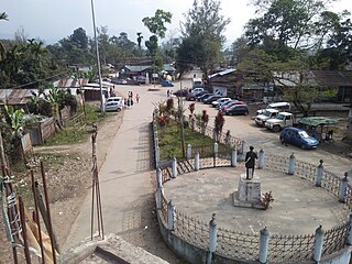
Deomali is a census town in Tirap district in the state of Arunachal Pradesh, India. The small sub-divisional town has scenic beauty and is surrounded by hills, tea gardens, forests and rivers.
The Tutsa are a Naga tribe living in the western parts of Changlang and Khimiyong circles and the eastern part of Tirap districts of the Indian state of Arunachal Pradesh. Ethnically, the Tutsa are closely related to the Tangsa and were classified as members of the Tangsa in all census records until 1981. As of 2001 their population stood at 25,000.
Marakwet District is a defunct administrative district in the former Rift Valley Province of Kenya. Its capital town was Kapsowar. The district had a population of 140.629. Local people are predominantly of the Marakwet tribe.
The North-East Frontier Agency (NEFA), originally known as the North-East Frontier Tracts (NEFT), was one of the political divisions in British India, and later the Republic of India until 20 January 1972, when it became the Union Territory of Arunachal Pradesh and some parts of Assam. Its administrative headquarters was Shillong. It received the status of State on 20 February 1987.

Singpho is a dialect of the Jingpho language spoken by the Singpho people of Arunachal Pradesh and Assam, India. It is spoken by at least 3,000 people. "Singpho" is the local pronunciation of "Jingpho".
Tangsa, also Tase and Tase Naga, is a Sino-Tibetan language or language cluster spoken by the Tangsa people of Burma and north-eastern India. Some varieties, such as Shangge, are likely distinct languages. There are about 60,000 speakers in Burma and 40,000 speakers in India.
Wancho is a Konyak language of north-eastern India. Wancho is spoken in 36 villages of southeastern Longding district, Tirap district, Arunachal Pradesh, as well as in Assam and Nagaland (Ethnologue). Alternate names include Banpara Naga, Joboka, Jokoba.
Longding district (Pron:/lɒŋˈdɪŋ/) is one of the 20 administrative districts of Arunachal Pradesh in northeastern India. It was carved out of the south-western portion of the Tirap District. The district shares its boundary to the south and south-east with the country of Myanmar. Its boundary to the west and the north are shared with the Indian states of Nagaland and Assam, respectively. Towards the north-east is the Tirap District from which the district was carved out in 2012. The district has a population of around 60000 and an area of roughly 1200 square kilometers. Longding has a pleasant climate throughout the year. Due to its hilly terrain, the temperature ranges from 15C to 30C in summers).
Longding district (Pron:/lɒŋˈdɪŋ/) is one of the 20 administrative districts of Arunachal Pradesh in northeastern India. It was carved out of the south-western portion of the Tirap District. The district shares its boundary to the south and south-east with the country of Myanmar. Its boundary to the west and the north are shared with the Indian states of Nagaland and Assam, respectively. Towards the north-east is the Tirap District from which the district was carved out in 2012. The district has a population of around 60000 and an area of roughly 1200 square kilometers. Longding has a pleasant climate throughout the year. Due to its hilly terrain, the temperature ranges from 15C to 30C in summers).[1]

Pullong is a village in Khonsa Tehsil of Tirap district in Arunachal Pradesh, India. According to Census 2011 information, the location code or village code of Pullong village is 264478. Khonsa is the nearest town to Pullong village.
Nianu is a village located in Longding district ( earlier Tirap district of Arunachal Pradesh in India.

The following outline is provided as an overview of and topical guide to Arunachal Pradesh:
Tirap Gaon, Ledo also known as Tirap Colliery, is a small village in Margherita Tehsil in Tinsukia District of north-eastern state Assam, India. It is located around 3 km away from nearest town Ledo, 11 km away from sub-divisional town Margherita and 60 km away from district headquarter Tinsukia. Tirap Gaon is connected to Makum by National Highway 38.
Senua is a village located in Longding district ( earlier Tirap district of Arunachal Pradesh in India.
Mintong is a village and Gram Panchayat (GP) in Longding circle of Tirap district in Arunachal Pradesh, India. As per 2011 Census of India, Mintong has a total population of 1,505 peoples, including 730 males and 775 females.
References
- ↑ "Tirap District Handbook, Census 2011" (PDF). Retrieved 14 March 2021.
| | This article about a location in the Indian state of Arunachal Pradesh is a stub. You can help Wikipedia by expanding it. |