Related Research Articles

The Hague is a city on the western coast of the Netherlands on the North Sea and the capital of the province of South Holland. It is also the seat of government of the Netherlands and hosts the International Court of Justice, one of the most important courts in the world.

Museon is a museum for science and culture in The Hague, Netherlands. It has collections in the domains of geology, biology, archaeology, history, science and ethnology.

Hoofddorp is the main town of the Haarlemmermeer municipality in the province of North Holland in the Netherlands. In 2009, the population was just over 73,000. The town was founded in 1853, immediately after the Haarlemmermeer had been drained. Hoofddorp is located 52° 18′ 21.96″ N and 4° 41′ 26.52″ E.

Nieuw-Vennep is a town in the Dutch province of North Holland. It is a part of the municipality of Haarlemmermeer, and lies about 10 km southwest of Amsterdam Airport Schiphol. It has about 31,300 inhabitants, half of which live in the newly built district of Getsewoud. The built-up area of the town was 3.71 km2, and contained 7,513 residences. The wider statistical area of Nieuw-Vennep has a population of around 40,000. In 2001, Nieuw-Vennep had 17,886 inhabitants, which later doubled due to the development of Getsewoud.
Commewijne is a district of Suriname, located on the right bank of the Suriname River. Commewijne's capital city is Nieuw Amsterdam. Tamanredjo is another major town, while Meerzorg is the most populated.

Nickerie is a district of Suriname, on the north-west coast. Nickerie's capital city is Nieuw-Nickerie. Another town is Wageningen. The district borders the Atlantic Ocean to the north, the Surinamese district of Coronie to the east, the Surinamese district of Sipaliwini to the south and Guyana to the west.

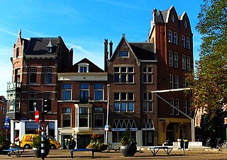
Voorburg is a town and former municipality in the west part of the province of South Holland, Netherlands. Together with Leidschendam and Stompwijk, it makes up the municipality Leidschendam-Voorburg. It has a population of about 39,000 people. It is considered to be the oldest city in The Netherlands and celebrated its 2000th year of existence in 1988.

Haagse Bos is a rectangular neighbourhood and forest in the Haagse Hout district of The Hague, Netherlands, reaching from the old city centre in the south-west to the border of Wassenaar in the north-east. It is also one of the oldest remaining forests of the country. During World War II, the park was used by the Germans for launching V-1 and V-2 rockets.

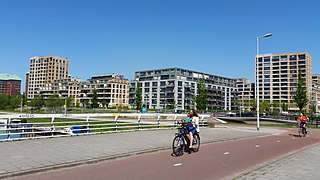
IJburg is a residential neighbourhood under construction in Amsterdam, Netherlands. It is situated in the IJmeer and is being built on artificial islands which have been raised from the lake. The Haveneiland, Rieteilanden, Steigereiland and Centrumeiland are already inhabited as of 2020. It is part of the municipality Amsterdam-Oost and also contains the Diemerpark, one of the city's largest parks.

Nieuw-Amsterdam is a village in the northeast Netherlands, in the Dutch province of Drenthe. It borders the village of Veenoord, the twin village of Nieuw-Amsterdam. Since 1998 Nieuw-Amsterdam and Veenoord are part of the municipality of Emmen.

Den Haag Laan van NOI railway station is a railway station in the Netherlands, on the border between The Hague and the town of Voorburg. It is served by the Nederlandse Spoorwegen and by the RandstadRail light-rail network. The station is named after the road on which it is located, Laan van Nieuw Oost-Indië, which literally translates as New East Indies Avenue, but probably refers to a former inn called Nieuw Oosteinde.

Amsterdam-Zuid is a borough (stadsdeel) of Amsterdam, Netherlands. The borough was formed in 2010 as a merger of the former boroughs Oud-Zuid and Zuideramstel. The borough has almost 138,000 inhabitants (2013). With 8,500 homes per square kilometer, it is one of the most densely populated boroughs of Amsterdam. It has the highest income per household of all boroughs in Amsterdam.
Amsterdam Nieuw-West is a borough comprising the westernmost neighbourhoods of the city of Amsterdam, Netherlands. It was created in 2010 after a merger of the former boroughs Osdorp, Geuzenveld-Slotermeer and Slotervaart. In 2017, the borough had almost 150,000 inhabitants.
James Alexander Doull (1918–2001) was a Canadian philosopher and academic who was born and lived most of his life in Nova Scotia. His father was the politician, jurist, and historian John Doull.

Sportpark Nieuw Hanenburg is a cricket ground in The Hague, the Netherlands. The first recorded match on the ground was in 1966 when the Netherlands played Oxford University. Over the next three decades it hosted a number of touring teams, as well as the 1998 European Cricket Championships. The Netherlands Women later played a Women's One Day International there in 2003 against Ireland Women in the IWCC Trophy.
The Zeeheldenkwartier is a neighbourhood in the Centrum district of The Hague, Netherlands. It has 11,205 inhabitants and covers an area of 81.3 hectares (0.314 sq mi). It is bordered by the Carnegielaan, the Zeestraat, the Hoge Wal and the Prinsessewal to the north-east, the Veenkade to the south, the Waldeck Pyrmontkade to the south-west and the Laan van Meerdervoort to the Carnegielaan to the north. Built between 1870 and 1890, the style of the buildings differs between larger houses for important officials near the Willemspark and the Laan van Meerdervoort, and predominantly smaller houses nearer to the city centre. It has also the most Coffeeshops in town. And it has from Albert Heijn the biggest supermarket in town called “Albert Heijn XL”.
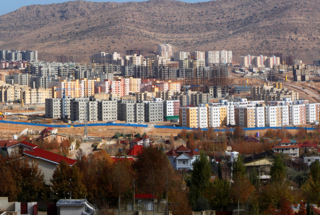
Sadra, is a planned city in Central District, Shiraz County, Fars Province, Iran. At the 2016 census, its population was 91,863, in 28،741 families. Sadra is located 15 kilometres (9.3 mi) northwest of Shiraz, in “Ahoochar Plain”, which is more than 300 metres (980 ft) higher than Shiraz.

The 'Laakmolen' near the Hague is a watercolor by Vincent van Gogh that he made in the summer of 1882. Formerly it was thought to have dated from his Etten period 1881. Following identification of the mill, historians now place it the year following.

The Monumental Clock[Dutch: Monumentale klok], commonly known as the Zebra clock[Dutch: Zebraklok], is a street clock and work of public art on the Bezuidenhoutseweg street side of the Koningin Julianaplein square, next to Den Haag central railway station in The Hague, Netherlands. It is a local landmark and popular as a meeting-place for people arriving or departing the city by train.

Taldi is a census town and a gram panchayat within the jurisdiction of the Canning police station in the Canning I CD block in the Canning subdivision of the South 24 Parganas district in the Indian state of West Bengal.