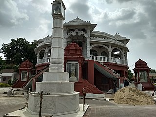
Bhilwara District is a district of the state of Rajasthan in western India. The town of Bhilwara is the district headquarters.

Kakinada (rural) mandal is one of the 21 mandals in the Kakinada district of the state of Andhra Pradesh, India. It has its headquarters at Kakinada. The mandal is bounded by Samalkota mandal, Pedapudi mandal, Karapa mandal, Kothapalle mandal and waters of Bay of Bengal.
Denduluru is a mandal in Eluru district in the state of Andhra Pradesh in India.
Kothapalle is a village in Kothapalle mandal, situated in Nellore district of the Indian state of Andhra Pradesh.

Gampalagudem mandal is one of the 20 mandals in NTR district of the state of Andhra Pradesh in India. It is under the administration of Tiruvuru revenue division and the headquarters are located at Gampalagudem town. The mandal is bounded by Tiruvuru, A. Konduru mandals of Krishna district in Andhra Pradesh and Khammam district of Telangana state.
Dwaraka Tirumala mandal is one of the 28 mandals in Eluru district of the Indian state of Andhra Pradesh. It is under the administration of Eluru revenue division and the headquarters are located at Dwaraka Tirumala. The mandal is bounded by Jangareddygudem, Koyyalagudem, Kamavarapukota, Nallajerla, Pedavegi, Unguturu, Denduluru and Bhimadole mandals.

Tsundur mandal is one of the 57 mandals in Guntur district of the Indian state of Andhra Pradesh. It is under the administration of Tenali revenue division and the headquarters are located at Tsundur. The mandal is bounded by Chebrolu, Tenali, Amruthalur and Ponnur mandals. The mandal is a part of Andhra Pradesh Capital Region.

Macherla mandal is one of the 57 mandals in the Guntur district of the Indian state of Andhra Pradesh. It is under the administration of Gurazala revenue division and the headquarters are located at Macherla. The mandal is bounded by Rentachintala, Durgi and Veldurthi mandals and a portion of the mandal also borders the state of Telangana.
Ganapavaram mandal is one of the 28 mandals in Eluru district of the Indian state of Andhra Pradesh. It is under the administration of Eluru revenue division and the headquarters are located at Ganapavaram. Ganapavaram Mandal is bounded by Nidamarru Mandal towards west, Pentapadu Mandal towards North, Undi Mandal towards South, Unguturu Mandal towards North. Tadepalligudem, Bhimavaram, Tanuku, Eluru are the nearby Cities to Ganapavaram. It is located 55 km from Eluru and 22 km from Bhimavaram.
Lingapalem Mandal is one of 28 mandals in the Eluru district of Andhra Pradesh in India. Its headquarters are located in Lingapalem. It is bordered by T.Narasapuram and Chintalapudi in the North, Khammam district tin the West, Kamavarapukota mandal in the East, and Pedavegi mandal in the South.

Bapulapadu mandal is one of the 25 mandals in Krishna district of the Indian state of Andhra Pradesh. The headquarters of this mandal is located at Bapulapadu town. The mandal is bordered by Nuzvid mandal and Agiripalle mandal to the north, West Godavari district to the east, Nandivada mandal to the south and Unguturu mandal to the west.

Ghantasala mandal is one of the 25 mandals in the Krishna district of the Indian state of Andhra Pradesh. The headquarters of this mandal is located in the town of Ghantasala.
T Kothapalli or T Kothapalle is a small village and a Gram Panchayat in I. Polavaram Mandal of East Godavari District of Andhra Pradesh State in India. A total of 2255 families are residing in it and its population is around 7500 as per 2011 Socioeconomic and Caste Census of India. The village is mostly dependent on agriculture. Out of 7500, 1510 people are agricultural laborers and 212 people are cultivators. Scheduled caste population is 31% of the total population of the village. Sex ratio of the village is 990 i.e. for every 1000 male there are 990 females. Literacy rate of the village is 65.5%.
Kothapalle Mandal is one of the 64 mandals in East Godavari District of Andhra Pradesh. As per census 2011, there are 16 villages.
Gokavaram Mandal is one of the 19 mandals in East Godavari District of Andhra Pradesh. As per census 2011, there are 14 villages.
Kothapalle is a village in Guntur district of the Indian state of Andhra Pradesh. It is located in Macherla mandal of Gurazala revenue division.
Rajavommangi mandal is one of the 22 mandals in Alluri Sitharama Raju District of Andhra Pradesh. As per census 2011, there are 62 villages in this mandal.
Uppalaguptam mandal is one of the 22 mandals in Konaseema district of Andhra Pradesh. As per census 2011, there are 14 villages in this mandal.
Kamini is a village in Mummidivaram Mandal, Dr. B.R. Ambedkar Konaseema district in the state of Andhra Pradesh in India.
Kavali mandal is one of the 38 mandals in Nellore district of the Indian state of Andhra Pradesh. Its headquarters are located at Kavali. The mandal is bounded by .This mandal is located at Kavali revenue division.


