Nizhnyaya Bulanka

Last updated

Coordinates: 53°20′59″N92°42′25″E / 53.34972°N 92.70694°E / 53.34972; 92.70694

Geographic coordinate system Coordinate system

A geographic coordinate system is a coordinate system that enables every location on Earth to be specified by a set of numbers, letters or symbols. The coordinates are often chosen such that one of the numbers represents a vertical position and two or three of the numbers represent a horizontal position; alternatively, a geographic position may be expressed in a combined three-dimensional Cartesian vector. A common choice of coordinates is latitude, longitude and elevation. To specify a location on a plane requires a map projection.

Nizhnyaya Bulanka (Russian : Нижняя Буланка; Latvian : Lejas Bulāna) is a rural locality (a selo ) in the Karatuzsky District in Krasnoyarsk Krai, Russia. Population: 83(2010 Census); [1]

Russian language East Slavic language

Russian is an East Slavic language, which is official in the Russian Federation, Belarus, Kazakhstan and Kyrgyzstan, as well as being widely used throughout Eastern Europe, the Baltic states, the Caucasus and Central Asia. It was the de facto language of the Soviet Union until its dissolution on 25 December 1991. Although nearly three decades have passed since the breakup of the Soviet Union, Russian is used in official capacity or in public life in all the post-Soviet nation-states, as well as in Israel and Mongolia.
Latvian language Baltic language, official in Latvia and the European Union

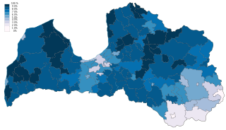
Latvian is a Baltic language spoken in the Baltic region. It is the language of Latvians and the official language of Latvia as well as one of the official languages of the European Union. It is sometimes known in English as Lettish, and cognates of the word remain the most commonly used name for the Latvian language in Germanic languages other than English and Norwegian. There are about 1.3 million native Latvian speakers in Latvia and 100,000 abroad. Altogether, 2 million, or 80% of the population of Latvia, speak Latvian. Of those, 1.16 million or 56% use it as their primary language at home. The use of the Latvian language in various areas of social life in Latvia is increasing.

The classification system of the types of inhabited localities in Russia, the former Soviet Union, and some other post-Soviet states has certain peculiarities compared with the classification systems in other countries.

Related Research Articles

Tavda human settlement in Tavdinsky District, Sverdlovsk Oblast, Russia

Tavda is a town in Sverdlovsk Oblast, Russia, located on the Tavda River and functioning as a river port. Population: 35,421 (2010 Census); 40,686 (2002 Census); 45,735 (1989 Census).

Pavlovsk is a rural locality and the administrative center of Pavlovsky District of Altai Krai, Russia. Population: 14,533 (2010 Census); 14,944 (2002 Census).

Krasnoglinsky City District is a district (raion) of the city of Samara, Samara Oblast, Russia. Population: 85,566 (2010 Census); 68,746 (2002 Census); 71,230 (1989 Census).

Serovo

Serovo is a municipal settlement in Kurortny District of the federal city of St. Petersburg, Russia, located on the Karelian Isthmus, on the northern shore of the Gulf of Finland, where the Roshchinka River empties into the gulf. Population: 280 (2010 Census); 252 (2002 Census).

Levashovo, Saint Petersburg

Levashovo is a municipal settlement under the administrative jurisdiction of Vyborgsky District of the federal city of St. Petersburg, Russia, and a station of the Riihimäki – Saint Petersburg Railway. Population: 3,665 (2010 Census); 4,095 (2002 Census).

Solnechnoye, Saint Petersburg

Solnechnoye is a municipal settlement in Kurortny District of the federal city of St. Petersburg, Russia, located on the Karelian Isthmus, on the northern shore of the Gulf of Finland. Population: 1,370 (2010 Census); 1,161 (2002 Census); 1,574 (1989 Census).

Molodyozhnoye is a municipal settlement in Kurortny District of the federal city of St. Petersburg, Russia, located on the Karelian Isthmus, on the northern shore of the Gulf of Finland. Population: 1,587 (2010 Census)1,437 (2002 Census).

Pesochny, Saint Petersburg

Pesochny is a municipal settlement in Kurortny District of the federal city of St. Petersburg, Russia, located on the Karelian Isthmus, on the northern shore of the Gulf of Finland. Population: 8,130 (2010 Census); 6,487 (2002 Census); 7,761 (1989 Census).

Ushkovo, Saint Petersburg

Ushkovo is a municipal settlement in Kurortny District of the federal city of St. Petersburg, Russia, located on the Karelian Isthmus, on the northern shore of the Gulf of Finland. Population: 618 (2010 Census); 482 (2002 Census); 6,031 (1989 Census).

Smolyachkovo

Smolyachkovo is a municipal settlement in Kurortny District of the federal city of St. Petersburg, Russia, located on the Karelian Isthmus on the northern shore of the Gulf of Finland. Population: 610 (2010 Census); 568 (2002 Census).

Petro-Slavyanka

Petro-Slavyanka is a municipal settlement in Kolpinsky District of the federal city of St. Petersburg, Russia. Population: 1,085 (2010 Census); 1,337 (2002 Census); 1,312 (1989 Census).

Kez is a rural locality and the administrative center of Kezsky District of the Udmurt Republic, Russia, located 169 kilometers (105 mi) northeast of Izhevsk. Population: 11,080 (2010 Census); 10,913 (2002 Census); 10,030 (1989 Census).

Khunzakh human settlement in Khunzakhsky District, Republic of Dagestan, Russia

Khunzakh is a rural locality and the administrative center of Khunzakhsky District in the Republic of Dagestan, Russia, located in the North Caucasus mountains 1,600 meters (5,200 ft) above sea level. Population: 4,245 (2010 Census); 3,694 (2002 Census); 2,901 (1989 Census).

Vulkanny is an urban locality in Yelizovsky District of Kamchatka Krai, Russia. Population: 1,608 (2010 Census); 1,601 (2002 Census);

Alexandrovskaya is a municipal settlement in Pushkinsky District of the federal city of St. Petersburg, Russia. Population: 2,491 (2010 Census); 1,184 (2002 Census); 2,960 (1989 Census).

Tyarlevo is a municipal settlement in Pushkinsky District of the federal city of St. Petersburg, Russia. Population: 1,854 (2010 Census); 1,556 (2002 Census);

Sapyorny is a municipal settlement in Kolpinsky District of the federal city of St. Petersburg, Russia. Population: 1,378 (2010 Census); 1,401 (2002 Census);

Lomovka is a rural locality in Lomovsky Selsoviet of Beloretsky District of the Republic of Bashkortostan, Russia. Population: 2,620 (2010 Census); 3,172 (2002 Census);

Putyatin is an urban locality under the administrative jurisdiction of the closed town of Fokino in Primorsky Krai, Russia. Population: 887 (2010 Census); 1,133 (2002 Census);

Lipovtsy is an urban locality in Oktyabrsky District, Primorsky Krai, Russia. Population: 6,402 (2010 Census); 6,742 (2002 Census);

References

  1. Russian Federal State Statistics Service (2011). "Всероссийская перепись населения 2010 года. Том 1" [2010 All-Russian Population Census, vol. 1]. Всероссийская перепись населения 2010 года (2010 All-Russia Population Census) (in Russian). Federal State Statistics Service . Retrieved June 29, 2012.