Nkoltang

Last updated
Nkoltang
Town
Gabon location map.svg
Red pog.svg
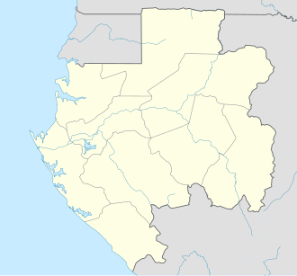
Nkoltang
Location in Gabon
Coordinates: 0°22′36″N9°38′22″E / 0.37667°N 9.63944°E / 0.37667; 9.63944 Coordinates: 0°22′36″N9°38′22″E / 0.37667°N 9.63944°E / 0.37667; 9.63944
CountryFlag of Gabon.svg  Gabon
Province Estuaire Province
Department Komo-Mondah Department
Time zone WAT (UTC+1)

Nkoltang is a small town in Estuaire Province in northwestern Gabon. It lies along the N1 road, 25.6 kilometres by road east of Libreville, and 13.8 kilometres by road west of Ntoum. [1]

Estuaire Province Province in Gabon

Estuaire is the most populous of Gabon's nine provinces. It covers an area of 20,740 km². The provincial capital is Libreville, which is also Gabon's national capital. The province is named for the Gabon Estuary, which lies at the heart of the province.

Gabon country in Africa

Gabon, officially the Gabonese Republic, is a country on the west coast of Central Africa. Located on the equator, Gabon is bordered by Equatorial Guinea to the northwest, Cameroon to the north, the Republic of the Congo on the east and south, and the Gulf of Guinea to the west. It has an area of nearly 270,000 square kilometres (100,000 sq mi) and its population is estimated at 2 million people. Its capital and largest city is Libreville.

The N1 road of Gabon is a road that runs from Libreville to Moumba that takes approximately 12 hours to drive. The portion of the road from Ndendé to the border with Congo-Brazzaville is traveled infrequently due to the instability in the latter country. However, it usually takes approximately two hours to reach the border.

Related Research Articles

Bruce Highway highway in Queensland

The Bruce Highway is a major highway in Queensland, Australia. Commencing in the state capital, Brisbane, it passes through areas close to the eastern coast on its way to Cairns in Far North Queensland. The route is part of the Australian National Highway and also part of Highway 1. Its length is approximately 1,679 kilometres (1,043 mi); it is entirely sealed with bitumen. The highway is named after a popular former Queensland and federal politician, Harry Bruce. Bruce was the state Minister for Works when the highway was named after him, in the mid-1930s, and was widely considered to be a good bloke. The highway once passed through Brisbane, but was truncated at Bald Hills when the Gateway Motorway became National Highway 1 upon its opening in December 1986.

King's Highway 101, commonly referred to as Highway 101, is a provincially maintained highway in the Canadian province of Ontario. The 473.3-kilometre (294.1 mi) highway connects Highway 17 west of Wawa with Highway 11 in Matheson before continuing east to the Ontario–Quebec border where it becomes Route 388. The highway forms one of the only connections between the two routes of the Trans-Canada Highway between Nipigon and Temagami, and crosses some of the most remote regions of Northern Ontario. Major junctions are located with Highway 129 near Chapleau and Highway 144 southwest of Timmins, though the distance between these junctions is significant.

Gregory Highway state highway in Queensland, Australia

The Gregory Highway is a state highway in Queensland that serves the major coal-mining centres of Central Queensland. The highway was named after Augustus Gregory, an early explorer.

Line 2 (Shanghai Metro) metro line of the Shanghai Metro

Line 2 is an east-west line of the Shanghai Metro network. With a length of nearly 64 km, it is the second longest line in the metro system after Line 11. Line 2 runs from East Xujing in the west to Pudong International Airport in the east, passing Hongqiao Airport, the Huangpu river, and the Lujiazui Financial District in Pudong. With a daily ridership of almost 1.5 million, it is the Shanghai Metro's busiest metro line. The eastern portion of the line, from Guanglan Road to Pudong International Airport, was once operated almost independently from the main segment until April 18, 2019 while through service between these two started the next day. The line is colored light green on system maps.

Alberta Highway 21 highway in Alberta

Alberta Provincial Highway No. 21, commonly referred to as Highway 21, is a north-south highway in Alberta, Canada that parallels Highway 2 between Calgary and Edmonton. It is approximately 328 kilometres (204 mi) in length. It begins at the Trans-Canada Highway (Highway 1) east of Strathmore, and ends at Fort Saskatchewan where it is succeeded by Highway 15. The northernmost 25 kilometres (16 mi) of the highway are twinned. Highway 21 runs roughly parallel to the main north-south CN rail line between Calgary and Edmonton between Three Hills and Looma.

Secondary Highway 522, commonly referred to as Highway 522, is a provincially maintained highway in the Canadian province of Ontario. The highway is 109.6 kilometres (68.1 mi) in length, connecting Highway 69 near Cranberry with Highway 11 at the community of Trout Creek. Highway 522 serves as the only link between these two routes south of Highway 17 and north of Highway 124. It is often used to access Grundy Lake Provincial Park, a popular camping area for northbound travellers.

Ontario Highway 655 highway in Ontario

Highway 655 is a secondary highway in the Cochrane District in Northern Ontario. The route is 75.1 kilometres (46.7 mi) in length. It is heavily used by trucks as a critical access road to Timmins. The highway is one of the widest, best-maintained secondary highways in the north, and has the distinction of being Ontario's only secondary highway that features a 90 km/h (55 mph) speed limit, due to its importance and high design standards.

Secondary Highway 532, commonly referred to as Highway 532, is a provincially maintained secondary highway in the Canadian province of Ontario. The route connects several mining and milling towns in Unorganized Algoma District, notably Searchmont. The route is remote, ending at a mine access road 14.2 kilometres (8.8 mi) north of Highway 556, its southern terminus.

Tertiary Highway 811, commonly referred to as Highway 811, is the longest of Ontario's tertiary highways, and the highest posted route number in the province. The route encounters no named roads along its route, aside from its eastern terminus at Secondary Highway 527. It extends 59 kilometres (37 mi) westward into the wilderness, ending at a bridge over the Weaver River. The route was designated in 1976 with the intention of extending it further west, but this extension has yet to be constructed.

Ontario Highway 560 highway in Ontario

Secondary Highway 560, commonly referred to as Highway 560, is a provincially maintained secondary highway in the northern section of the Canadian province of Ontario. It begins in the west at an intersection with Highway 144 and the Sultan Industrial Road and proceeds 184.1 kilometres (114.4 mi) east to Highway 11 at Englehart.

King's Highway 132, commonly referred to as Highway 132, is a provincially maintained highway the Canadian province of Ontario. Its western terminus is at Highway 41 near Dacre while its eastern terminus is at Highway 60 in Renfrew. The length of Highway 132 is 30.3 km (18.8 mi), situated entirely in Renfrew County. It travels through the communities of Shamrock, Dacre and Renfrew.

Ontario Highway 59 former highway in Ontario

King's Highway 59, commonly referred to as Highway 59, was a provincially maintained highway in the Canadian province of Ontario. It connected Long Point Provincial Park in Norfolk County to the town of Shakespeare in Perth County, passing through the city of Woodstock in Oxford County en route. Several smaller towns also lined the highway, notably Courtland, Delhi, Norwich and Tavistock. Highway 59 featured junctions with Highway 3, Highway 2, Norfolk County Highway 24 and the concurrent routes of Highway 7 and Highway 8. Highway 59 also had an interchange with Highway 401.

Seles, Angola Municipality and town in Cuanza Sul Province, Angola

Seles is a municipality and town in Cuanza Sul Province in Angola. It is on the Atlantic coast, roughly 55 kilometres west by road from Amboiva and 78 kilometres east by road from Sumbe. Until 1975, Seles was called Vila Nova do Seles or Vila do Seles. Part of the town is also known as Uku.

The Kampala–Jinja Highway is a road in Uganda, connecting the cities of Kampala and Jinja. Sometimes referred to as Kampala–Jinja Road, it is a busy road, with several towns, trading centers and other points of interest along the way. As of October 2016, a new, wider, four-lane dual carriageway expressway, the Kampala–Jinja Expressway, is proposed to be constructed south of the present highway to relieve traffic and complement existing transport infrastructure between Kampala and Jinja.

Secondary Highway 528A, commonly referred to as Highway 528A, is a provincially maintained secondary highway in the Canadian province of Ontario. The 5.1-kilometre (3.2 mi) spur route links the community of Wolseley Bay in French River with several lodge resorts to the southeast. The route ends suddenly within viewing distance of Wolseley Bay, where a driveway continues into a lodge.

Secondary Highway 535, commonly referred to as Highway 535, is a provincially maintained secondary highway in the Canadian province of Ontario. Passing through the municipalities of Markstay-Warren, St. Charles and French River, the highway extends 48.8 kilometres (30.3 mi), generally south to north, from a junction with Highway 64 at Noelville to Riviere Veuve, intersecting Highway 17 in the village of Hagar along the way.

Bir Shikargah Wildlife Sanctuary Wildlife Sanctuary in Haryana, India

Bir Shikargah Wildlife Sanctuary is situated in Panchkula district of Haryana state, India. It is spread over an area of 767.30 hectares. It also houses Vulture Conservation and Breeding Centre, Pinjore.

R299 road (Ireland)

The R299 road is a regional road in Ireland linking the N4 and R280 roads in County Leitrim. The road is 7.8 kilometres (4.8 mi) long northbound, shorter southbound.

Fitzroy Developmental Road

The Fitzroy Developmental Road is a designated road in the Central Highlands Region of Queensland consisting of three separate segments. The general direction is from south to north.

References

  1. Maps (Map). Google Maps.