The Arctic Archipelago, also known as the Canadian Arctic Archipelago, groups together all islands lying to the north of the Canadian continental mainland excluding Greenland.
Ostprignitz-Ruppin is a Kreis (district) in the northwestern part of Brandenburg, Germany. Neighboring are the districts Müritz and Mecklenburg-Strelitz in Mecklenburg-Western Pomerania, the districts Oberhavel and Havelland, the district Stendal in Saxony-Anhalt, and the district Prignitz.

Shahjahanpur district is one of the historical districts of Uttar Pradesh in the republic of India. It is a part of Bareilly division which is situated in south-east of Rohilkhand division. It was established in 1813 by the British Government. Previously it was a part of district Bareilly. Geographically the main town is Shahjahanpur city which is its headquarters. Its Tehsils are: Powayan, Tilhar, Jalalabad,Kalan, and Sadar.

Tlokweng is a village located directly adjacent to the capital of Botswana, Gaborone, in the South-East District. It can be considered part of the conurbation of Gaborone. Tlokweng stands on the other side of the river, and is on the road to the border with South Africa, the border post being just 15 km to the east. The population was 35,982 at the 2011 census. It is now part of Gaborone agglomeration, home to 421,907 inhabitants at the 2011 census. The tribe originating from Tlokweng is referred to as Batlokwa. Many people from across Botswana have come to seek permanent and sometimes temporary settlement in Tlokweng because of its proximity to the capital city where most jobs are.

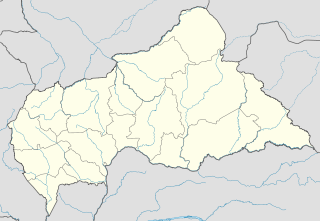
Baoro is a town located in the Central African Republic prefecture of Nana-Mambéré.
Bakri or often Bukit Bakri is a town in Muar District, Johor, Malaysia. It is located along Federal Route in Muar district, just five kilometers east of Muar town. In 1991, it had a population of 10,000, which doubled by the 2000 census to 20,123. Now Bukit Bakri population is 30280.

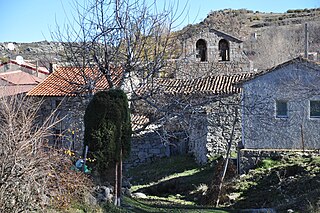
Narrillos del Rebollar is a municipality located in the province of Ávila, Castile and León, Spain. According to the 2006 census (INE), the municipality has a population of 63 inhabitants.
Villanueva de AzoagueSpanish pronunciation: [biʎaˈnweβa ðe aθoˈaɣe]) is a municipality located in the province of Zamora, Castile and León, Spain. According to the 2004 census (INE), the municipality has a population of 315 inhabitants.

Dêlêg is a village in Xaitongmoin county of Shigatse Prefecture in the Tibet Autonomous Region of China, northeast of the county seat. The Tibetan name means "good luck". It lies at an elevation of 4,804 metres. In 2007 the village had a population of about 350.
Stavenhagen is an Amt in the Mecklenburgische Seenplatte district, in Mecklenburg-Vorpommern, Germany. The seat of the Amt is in Stavenhagen.
Mkak is a khum (commune) of Serei Saophoan District in Banteay Meanchey Province in north-western Cambodia.

Barszczewo is a village in the administrative district of Gmina Michałowo, within Białystok County, Podlaskie Voivodeship, in north-eastern Poland, close to the border with Belarus. It lies approximately 9 kilometres (6 mi) south-east of Michałowo and 38 km (24 mi) south-east of the regional capital Białystok.

Planty is a village in the administrative district of Gmina Michałowo, within Białystok County, Podlaskie Voivodeship, in north-eastern Poland, close to the border with Belarus. It lies approximately 9 kilometres (6 mi) south-east of Michałowo and 38 km (24 mi) south-east of the regional capital Białystok.

Jastew is a village in the administrative district of Gmina Dębno, within Brzesko County, Lesser Poland Voivodeship, in southern Poland. It lies approximately 4 kilometres (2 mi) north-west of Dębno, 4 km (2 mi) east of Brzesko, and 54 km (34 mi) east of the regional capital Kraków.

Stanki is a village in the administrative district of Gmina Krzepice, within Kłobuck County, Silesian Voivodeship, in southern Poland. It lies approximately 5 kilometres (3 mi) west of Krzepice, 20 km (12 mi) west of Kłobuck, and 83 km (52 mi) north of the regional capital Katowice.

Pietrzyków is a village in the administrative district of Gmina Lipinki Łużyckie, within Żary County, Lubusz Voivodeship, in western Poland. It lies approximately 13 kilometres (8 mi) west of Żary and 48 km (30 mi) south-west of Zielona Góra.

Kajkowo is a village in the administrative district of Gmina Ostróda, within Ostróda County, Warmian-Masurian Voivodeship, in northern Poland. It lies approximately 4 kilometres (2 mi) south of Ostróda and 38 km (24 mi) west of the regional capital Olsztyn.
Patli is a moderate sized village situated 7 km from Talwandi Bhai in Ferozepur district of Punjab, India.
Sa'fan District is a district of the Sana'a Governorate, Yemen. As of 2003, the district had a population of 33,722 inhabitants.

Arrah Department is a department of Moronou Region in Lacs District, Ivory Coast. In 2017, its population was near to 500.000 and its seat is in the settlement of Arrah. The sub-prefectures of the department are Arrah, Kotobi, and Krégbé.


