
Kamrup Rural district, or simply Kamrup district, is an administrative district in the state of Assam in India formed by dividing the old Kamrup district into two in the year 2003; other being Kamrup Metropolitan district, named after the region it constitutes. This district, along with Nalbari, Barpeta, Kamrup Metropolitan, Bajali and Baksa districts has been created from the Undivided Kamrup district. Rangia is the plantation valley city of Assam located at Kamrup District.

Nalbari is an administrative district in the state of Assam in India. The district headquarters is located at Nalbari. The district derives its name from the combination of two words, "Nal" and "Bar."

The Dooars or Duars are the alluvial floodplains in eastern-northeastern India that lie south of the outer foothills of the Himalayas and north of the Brahmaputra River basin. This region is about 30 km (19 mi) wide and stretches over about 350 km (220 mi) from the Teesta River in West Bengal to the Dhansiri River in Assam. The region forms the gateway to Bhutan. It is part of the Terai-Duar savanna and grasslands ecoregion.
Rangia is a plantation valley city and a municipal board located in the Kamrup Rural district of Assam, India. Rangia serves as the sub-district headquarter of Rangia Sub-district in Kamrup Rural District. One of Rangia's significant features is its role as the divisional headquarter of the Northeast Frontier Railway, which is one of the major railway zones in India. Baralia river flows through the heart of the city. Bhabesh Kalita is the MLA of Rangia Assembly constituency. Rangiya Junction is the 4th Biggest Railway Station in North East. Rangia is the Largest city of the Kamrup Rural district. And Additionally, Rangia holds the distinction of being known as the gateway to the Indo-Bhutan border.

Baksa district is an administrative district in the Bodoland Territorial Region of Assam, one of the North-Eastern states of India. The administrative headquarters is at Mushalpur. Manas National Park is a part of this district.

Upper Assam is an administrative division of the state of Assam comprising the undivided Lakhimpur and Sivasagar districts, of the upper reaches of the Brahmaputra valley. The other divisions are: Lower Assam, North Assam and Hills and Barak Valley. The division is under the jurisdiction of a Commissioner, stationed at Jorhat.
Bagadhar Brahma Kishan College is located at Jalahghat in the newly formed district of Baksa under BTAD, Assam. It was founded following a public initiative in 1978 to provide higher education to the underprivileged boys and girls of the Jalah block, which is situated in the north-eastern corner of the Baksa district near the Bhutan border, and populated mostly by scheduled tribes and other native communities. It was originally called Kishan College. In 1982, it was renamed to Bagadhar Brahma Kishan College after its benefactor who is an uneducated tribal social worker. Jalah is a low literacy neighborhood, especially in female literacy.

Undivided Kamrup district is a former administrative district located in Western Assam from which Kamrup Rural (2003), Kamrup Metropolitan (2003), Barpeta (1983), Nalbari (1985) and Baksa (2004) districts were formed. It was announced in January 2020 that the Bajali sub-division of Barpeta district will be upgraded to a full district.

Lower Assam division is one of the 5 administrative divisions of Assam in India. It was formed in 1874, consisting of the undivided Kamrup district of Western Assam, undivided Darrang and Nagaon districts of Central Assam and Khasi & Jaintia hills of Meghalaya, created for revenue purposes. The division is under the jurisdiction of a Commissioner, who is stationed at Guwahati. The division currently covers the Western Brahmaputa Valley. Shri Jayant Narlikar, IAS is the current Commissioner of Lower Assam division.

From the night of 1 May 2014 until the early morning hours of 3 May a series of attacks occurred on the Bengali Muslims in Assam, a north-eastern state of India. The perpetrator is suspected to be the terrorist group National Democratic Front of Bodoland's Songbijit faction. Speculated to be revenge for not voting for the National Democratic Front in the Lok Sabha elections, the death toll reached 32.
Assam – 16th largest, 15th most populous and 26th most literate state of the 28 states of the democratic Republic of India. Assam is at 14th position in life expectancy and 8th in female-to-male sex ratio. Assam is the 21st most media exposed states in India. The Economy of Assam is largely agriculture based with 69% of the population engaged in it. Growth rate of Assam's income has not kept pace with that of India's during the Post-British Era; differences increased rapidly since the 1970s. While the Indian economy grew at 6 percent per annum over the period of 1981 to 2000, the same of Assam's grew only by 3.3 percent.
Chapaguri Assembly constituency is one of the 126 assembly constituencies of Assam Legislative Assembly. Chapaguri forms part of the Kokrajhar Lok Sabha constituency. It is a reserved seat for the Scheduled tribes (ST).
Beki River is one of the right bank tributaries of the mighty Brahmaputra River, which flows down from the Bhutan region but a large portion flows in Indian state Assam. It touches flows from Bhutan touching Mathanguri, Naranguri, Khusrabari, Valaguri, Mainamata, Udalguri, Barpeta Road, Nichukha, Sorbhog, Kalgachia, Balaipathar, Kharballi, Bardanga, Kamarpara, Srirampur, Daoukmari, Jania, Chanpur, Rubi,Sawpur, Gobindapur, Moinbari and Balikuri. There are views of the river and its surroundings from the bridges situated on NH no- 31.
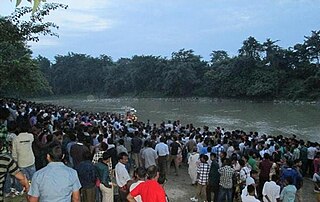
The Baralia River is a sub-tributary of the Brahmaputra River in the Indian state of Assam. The Baralia river originates in the Lokhaitora River and flows through Rangia City, Nalbari district and Tamulpur district before its confluence with the Puthimari River and the Brahmaputra river. The Nona River is a tributary of the Baralia river.

The Pagladiya River is a northern bank tributary of the Brahmaputra River in the Indian state of Assam. The Pagladiya river originates in the Bhutan hills and flows through Baksa District and Nalbari district before its confluence with the Brahmaputra river. Pagladiya River is perennial, very shallow, and is characteristically known for flash floods and high discharge rates.

The Dikhow River is a left tributary of the Brahmaputra River in the Indian state of Assam. It rises in the Zunheboto district in Nagaland, flows through the Sivasagar district of Assam and joins the Brahmaputra at Dikhowmukh.
Nagrijuli is an urban locality and Gram Panchayat (Block) in Baksa district, Assam, India. Nagrijuli is an area with 7,426 hectares, and has a tea estate.

