
The Brahmaputra is a trans-boundary river which flows through Tibet (China), Northeastern India, and Bangladesh. It is known as Brahmaputra or Luit in Assamese, Yarlung Tsangpo in Tibetan, the Siang/Dihang River in Arunachali, and Jamuna River in Bengali. It is the 9th largest river in the world by discharge, and the 15th longest.

Kamrup Rural district, or simply Kamrup district, is an administrative district in the state of Assam in India formed by dividing the old Kamrup district into two in the year 2003; other being Kamrup Metropolitan district, named after the region it constitutes. This district, along with Nalbari, Barpeta, Kamrup Metropolitan, Bajali and Baksa districts has been created from the Undivided Kamrup district.

Nalbari is an administrative district in the state of Assam in India. The district headquarters is located at Nalbari. The district derives its name from the combination of two words, "Nal" and "Bar."

The Dooars or Duars are the alluvial floodplains in eastern-northeastern India and southern Bhutan that lie south of the outer foothills of the Himalayas and north of the Brahmaputra River basin. This region is about 30 km (19 mi) wide and stretches over about 350 km (220 mi) from the Teesta River in West Bengal to the Dhansiri River in Udalguri district of Assam. The region forms the gateway to Bhutan. It is part of the Terai-Duar savanna and grasslands ecoregion.

Upper Assam is an administrative division of the state of Assam comprising the undivided Lakhimpur and Sivasagar districts, of the upper reaches of the Brahmaputra valley. The other divisions are: Lower Assam, North Assam and Hills and Barak Valley. The division is under the jurisdiction of a Commissioner, stationed at Jorhat.

The Subansiri is a trans-Himalayan river and a tributary of the Brahmaputra River that flows through Tibet's Lhuntse County in the Shannan Prefecture, and the Indian states of Arunachal Pradesh and Assam. The Subansiri is approximately 518 kilometres (322 mi) long, with a drainage basin 32,640 square kilometres (12,600 sq mi). It is the largest tributary of the Brahmaputra contributing 7.92% of the Brahmaputra's total flow.
Assam – 16th largest, 15th most populous and 26th most literate state of the 28 states of the democratic Republic of India. Assam is at 14th position in life expectancy and 8th in female-to-male sex ratio. Assam is the 21st most media exposed states in India. The Economy of Assam is largely agriculture based with 69% of the population engaged in it. Growth rate of Assam's income has not kept pace with that of India's during the Post-British Era; differences increased rapidly since the 1970s. While the Indian economy grew at 6 percent per annum over the period of 1981 to 2000, the same of Assam's grew only by 3.3 percent.
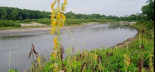
Beki River is one of the right bank tributaries of the mighty Brahmaputra River, which flows down from the Bhutan region but a large portion flows in Indian state Assam. It touches flows from Bhutan touching Mathanguri, Naranguri, Khusrabari, Valaguri, Mainamata, Udalguri, Barpeta Road, Nichukha, Sorbhog, Kalgachia, Balaipathar, Kharballi, Bardanga, Kamarpara, Srirampur, Daoukmari, Jania, Chanpur, Rubi,Sawpur, Gobindapur, Moinbari and Balikuri. There are views of the river and its surroundings from the bridges situated on NH no- 31.
The Brahmaputra floods refers to a catastrophic flood event that occurred in 2012 along the Brahmaputra River and its tributaries, as well as in subsequent years.
The Puthimari River rises in Assam, India. It is a tributary of the Brahmaputra River, the fourth largest in the world. The Puthimari is known for its floods and high sediment load. Puthimari River flows through Rangia Sub-division, Hajo and Hajo Sub-division. The Baralia River, Suklai River, and Lokhaitora River is a tributery river of the Puthimari river.
Purna Kamdev is a village of Nalbari district in Western Assam under 11 No. Deharkuchi Gram Panchayat of Borigog Banbhag Development Block. This village is situated on the bank of Baralia river.

The Pagladiya River is a northern bank tributary of the Brahmaputra River in the Indian state of Assam. The Pagladiya River originates in the Bhutan hills and flows through Baksa District and Nalbari district before its confluence with the Brahmaputra River. Pagladiya River is perennial, very shallow, and is characteristically known for flash floods and high discharge rates.
The Gabharu River is a northern bank tributary of the Brahmaputra River in the Indian state of Assam. The Gabharu River originates in the Kalafangapo hills of Arunachal Pradesh in the West Kameng District and flows through Sonitpur district of Assam before its confluence with the Brahmaputra River at Gadharu Mukh of Sonitpur district. The Gabharu River consists of two right bank subtributaries known as Sonairupai River and Gelgeli River and Mora Depota River is the left bank sub tributary.

The Champabati River is a tributary of the Brahmaputra River in the Indian state of Assam. The Champabati River has three sub tributaries - Bhur River, Lopani and Dhol pani which are originated from Bhutan hills.
The Nona River is a sub-tributary of the Brahmaputra River in the Indian state of Assam. The Nona River originates in the hills of Samdrup Jongkhar and flows through Baksa district and Nalbari district in Assam before its confluence with the Baralia River.
The Jhanji River is a tributary of the Brahmaputra River in the Indian state of Assam. The Jhanji river originates in Mokokchung district of Nagaland.

The Dudhnoi River is a sub-tributary of the Brahmaputra River in the Indian state of Assam. The Dudhnoi River originates in the East Garo Hills of Meghalaya. The Dudhnoi River meets Krishnai River at Matia of Goalpara district and then flows as Mornoi River before its confluence with the Brahmaputra River. Floods in Goalpara district is dictated by the Dudhnoi river.

The Tipkai River is a north and Himalayan tributary of the Brahmaputra River in the Indian state of Assam. It rises in the Bhutan hills, flows through the Kokrajhar district and Dhubri district of Assam and joins the Brahmaputra River at Chatakurachar of Dhubri district.
The Diju River is a sub- tributary of the Brahmaputra River in the Indian state of Assam.


