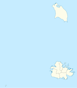
Antigua and Barbuda is a country in the West Indies in the Americas, lying between the Caribbean Sea and the Atlantic Ocean. It consists of two major islands, Antigua and Barbuda, and a number of smaller islands. The permanent population numbers about 81,800 and the capital and largest port and city is St. John's on Antigua. Lying near each other, Antigua and Barbuda are in the middle of the Leeward Islands, part of the Lesser Antilles, roughly at 17°N of the equator.

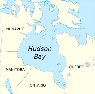
Hudson Bay is a large body of saltwater in northeastern Canada with a surface area of 1,230,000 km2 (470,000 sq mi). It drains a very large area, about 3,861,400 km2 (1,490,900 sq mi), that includes parts of southeastern Nunavut, Saskatchewan, most of Manitoba, Ontario, Quebec and indirectly through smaller passages of water to parts of North Dakota, South Dakota, Minnesota, and Montana. Hudson Bay's southern arm is called James Bay.

Victoria Island is a large island in the Canadian Arctic Archipelago that straddles the boundary between Nunavut and the Northwest Territories of Canada. It is the eighth largest island in the world, and at 217,291 km2 (83,897 sq mi) in area, it is Canada's second largest island. It is nearly double the size of Newfoundland (111,390 km2 [43,008 sq mi]), and is slightly larger than the island of Great Britain (209,331 km2 [80,823 sq mi]) but smaller than Honshu (225,800 km2 [87,182 sq mi]). It contains the world's largest island within an island within an island. The western third of the island belongs to the Inuvik Region in the Northwest Territories; the remainder is part of Nunavut's Kitikmeot Region.

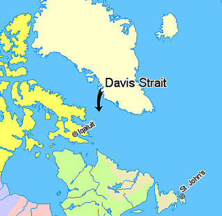
Davis Strait is a northern arm of the Labrador Sea. It lies between mid-western Greenland and Nunavut, Canada's Baffin Island. To the north is Baffin Bay. The strait was named for the English explorer John Davis (1550–1605), who explored the area while seeking a Northwest Passage. By the 1650s it was used for whale hunting.

Huevos is an island in the Republic of Trinidad and Tobago. The island is 1.01 km² in area. It is one of the "Bocas Islands", which lie in the Bocas del Dragón between Trinidad and Venezuela.

Amagá is a town and municipality in Antioquia Department, Colombia. It is part of the subregion of Southwestern Antioquia. The area was known for its coal and iron ore production and it hosted early iron works. Ex-Colombian president Belisario Betancur was borned at this location.
The Estuary of Bilbao lies at the common mouth of the rivers Nervion, Ibaizabal and Cadagua, that drain most of Biscay and part of Alava in the Basque Country, Spain. In this instance, the Spanish word estuario is used to describe what in English would normally be called part estuary, part tidal river. The estuary becomes a tidal river which extends 16 km (9.9 mi) into the city of Bilbao, starting from the Bilbao Abra bay. It hosts the port of Bilbao throughout its length, although the Port Authority has recently restored most of the upper reaches to Bilbao and other municipalities for their urban regeneration. The port is now being transferred to the seaboard on the coast at Santurtzi and Zierbena.
Raleigh Bay is an indentation of the North Carolina coast, between Cape Lookout in the south and Cape Hatteras in the north. The coastline of the bay is approximately 75 miles (121 km) long, and consists of barrier islands, including Ocracoke Island. It is part of the open Atlantic Ocean and affords no protection from oceanic swells.
Fort-de-France Bay is a large inlet of the Caribbean Sea, off the coast of Martinique. It is named after Martinique's capital, Fort-de-France, the chief town on the bay.

Green Island is a small island lying off the eastern coast of Antigua. It is a private island owned by the mill reef club since 1947. It lies close to the mouth of Nonsuch Bay.

Mercers Creek Bay is a large bay in the northeast of Antigua. The settlements of Willikies and Seaton's lie close to the bay, which is protected from the Atlantic Ocean by a string of small islands, the largest of which is Crump Island.

Gravenor Bay is a large bay at the southern end of the island of Barbuda in the Caribbean. Its coastline runs roughly east–west and lies between the island's two southernmost points, Coco Point in the west and Spanish Point in the east. An airfield lies close to the western end of the bay, and a large lagoon lies immediately to the bay's north.

Falmouth Harbour is a horseshoe-shaped bay and natural harbour on the far southern coast of the island of Antigua in Antigua and Barbuda.

Penguin Bank is the name given to a now-submerged shield volcano of the Hawaiian Islands. Its coral-capped remains lie immediately west of the island of Molokaʻi, under relatively shallow water.
The Henry Kater Peninsula is a peninsula on northern Baffin Island, in Nunavut, Canada. It protrudes in an eastern direction into Davis Strait. It's bounded to the north by Arctic Harbour. Further north lies Clyde Inlet. Home Bay borders the peninsula to the south.

Budy Michałowskie is a village in the administrative district of Gmina Warka, within Grójec County, Masovian Voivodeship, in east-central Poland. It lies approximately 14 kilometres (9 mi) south-west of Warka, 23 km (14 mi) south-east of Grójec, and 58 km (36 mi) south of Warsaw.

Podłużyce is a village in the administrative district of Gmina Brudzew, within Turek County, Greater Poland Voivodeship, in west-central Poland. It lies approximately 8 kilometres (5 mi) south-east of Brudzew, 15 km (9 mi) east of Turek, and 128 km (80 mi) east of the regional capital Poznań.

Manchioneal is a settlement in Jamaica. It has a population of 2,292 as of 2009. It is located towards the eastern end in the parish of Portland. The town got its name from the Manchioneel tree, a plant located exclusively along the coastline in the community. The major sources of income for residents are fishing and farming. The community has a bay known as Manchioneal Bay, where fishing boats can be seen anchored along the shore. The community includes an all-age school, a post office, a police station and several churches. Major attractions in close proximity include Reach Falls and other nearby beaches.
Tasiusaq Bay is a bay in the Upernavik Archipelago in the Qaasuitsup municipality in northwestern Greenland. It is an indentation of northeastern Baffin Bay. The name of the bay derives from the name of the settlement of the same name in the bay.


