Green Island (Antigua and Barbuda)

Last updated
Green Island
Beach green island antigua 2015.jpg
Beach on Green Island
Antigua and Barbuda location map Topographic.png
Red pog.svg
Green Island
Relief map of Lesser Antilles.png
Red pog.svg
Green Island
La2-demis-caribbean.png
Red pog.svg
Green Island
Geography
Location Caribbean
Coordinates 17°04′14″N61°40′00″W / 17.0705°N 61.666667°W / 17.0705; -61.666667 Coordinates: 17°04′14″N61°40′00″W / 17.0705°N 61.666667°W / 17.0705; -61.666667
Administration
Additional information
Time zone
Private island
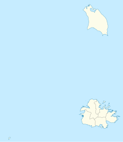
Antigua and Barbuda location map.svg
Red pog.svg
Green Island
Location of Green Island within Antigua and Barbuda.

Green Island is a small island lying off the eastern coast of Antigua. It is a private island that has been owned by the Mill Reef Club since 1947. It lies close to the mouth of Nonsuch Bay.

Colonel Richard Ayres was granted the lease of Green Island in 1673. By 1731 it was owned by Stephen Blizard, and was still owned by Blizard's heirs in 1790. The heirs of Robert Maginley owned the island in 1921. Maginley and his three brothers were immigrants to Antigua from Ireland and eventually owned 4,500 acres making them the largest landholders on Antigua. A plantation was established on Green Island, very little evidence remains of the sugar mill on Green Island. [1]

Geography

Green Island is located off the southeastern peninsula of Antigua, at the southern entrance to Nonsuch Bay. Towards the mainland, the Green Bay, a bay-like strait south of the island, in front of Cape Cork Point, Green Island is only about 350 meters away from Antigua island. [2] Administratively, it belongs to the Saint Phillip Parish.

The island itself measures about two kilometers from west to east; its width varies by two south-facing peninsulas in the range of a few hundred meters (maximum 650 m), [2] forming several sheltered bays. Altogether, the island has an area of about 40ha. [3] A sea-side peninsula ends in the Man of War Point, as the eastern tip of Antigua (as a region, east point of the main island the Neck of Land), from which the Atlantic Ocean [4] extends over nearly 4,000 kilometers to the approximately latitude Cape Verde. The island rises only a few meters above sea level, and is composed of tropical brushwood and partly lined by rock, partly by pure white beaches. On both sides are reefs and rocks in front, the northern reef blocks the entire Nonsuch Bay and extends to Long Bay.

Related Research Articles

<span class="mw-page-title-main">Cape Town</span> Legislative Capital of South Africa

Cape Town is one of South Africa's three capital cities, serving as the seat of the Parliament of South Africa. It is the legislative capital of the country, the oldest city in the country, and the second largest. Colloquially named the Mother City, it is the largest city of the Western Cape province, and is managed by the City of Cape Town metropolitan municipality. The other two capitals are Pretoria, the executive capital, located in Gauteng, where the Presidency is based, and Bloemfontein, the judicial capital in the Free State, where the Supreme Court of Appeal is located.

Caribbean Sea Sea of the Atlantic Ocean bounded by North, Central and South America

The Caribbean Sea is a sea of the Atlantic Ocean in the tropics of the Western Hemisphere. It is bounded by Mexico and Central America to the west and southwest, to the north by the Greater Antilles starting with Cuba, to the east by the Lesser Antilles, and to the south by the northern coast of South America. The Gulf of Mexico lies to the northwest.

<span class="mw-page-title-main">Andaman Sea</span> Marginal sea of the northeastern Indian Ocean

The Andaman Sea is a marginal sea of the northeastern Indian Ocean bounded by the coastlines of Myanmar and Thailand along the Gulf of Martaban and west side of the Malay Peninsula, and separated from the Bay of Bengal to its west by the Andaman Islands and the Nicobar Islands. Its southern end is at Breueh Island just north of Sumatra, with the Strait of Malacca further southeast.

<span class="mw-page-title-main">Saint Croix</span> One of the main islands of the United States Virgin Islands

Saint Croix is an island in the Caribbean Sea, and a county and constituent district of the United States Virgin Islands (USVI), an unincorporated territory of the United States.

Sulu Sea A sea in the Philippines between Palawan, the Sulu Archipelago, Borneo and Visayas

The Sulu Sea is a body of water in the southwestern area of the Philippines, separated from the South China Sea in the northwest by Palawan and from the Celebes Sea in the southeast by the Sulu Archipelago. Borneo is found to the southwest and Visayas to the northeast.

Kāneʻohe Bay Large bay of volcanic origin in the Hawaiian island Oahu

Kāneʻohe Bay, at 45 km2 (17 sq mi), is the largest sheltered body of water in the main Hawaiian Islands. This reef-dominated embayment constitutes a significant scenic and recreational feature along the northeast coast of the Island of Oʻahu. The largest population center on Kāneʻohe Bay is the town of Kāneʻohe.

Vanua Levu Second largest island of Fiji

Vanua Levu, formerly known as Sandalwood Island, is the second largest island of Fiji. Located 64 kilometres to the north of the larger Viti Levu, the island has an area of 5,587.1 square kilometres (2,157.2 sq mi) and a population of 135,961 as of 2007.

<span class="mw-page-title-main">Virgin Islands National Park</span> 14,700 acres in St. John, Virgin Islands (US) managed by the National Park Service

The Virgin Islands National Park is an American national park preserving about 60% of the land area of Saint John in the United States Virgin Islands, as well as more than 5,500 acres of adjacent ocean, and nearly all of Hassel Island, just off the Charlotte Amalie, Saint Thomas harbor.

<span class="mw-page-title-main">Antigua</span> Island in Antigua and Barbuda

Antigua, also known as Waladli or Wadadli by the native population, is an island in the Lesser Antilles. It is one of the Leeward Islands in the Caribbean region and the main island of the country of Antigua and Barbuda. Antigua and Barbuda became an independent state within the Commonwealth of Nations on 1 November 1981.

<span class="mw-page-title-main">False Bay</span> Large bay of the Atlantic Ocean at Cape Town, South Africa

False Bay is a body of water in the Atlantic Ocean between the mountainous Cape Peninsula and the Hottentots Holland Mountains in the extreme south-west of South Africa. The mouth of the bay faces south and is demarcated by Cape Point to the west and Cape Hangklip to the east. The north side of the bay is the low-lying Cape Flats, and the east side is the foot of the Hottentots Holland Mountains to Cape Hangklip which is at nearly the same latitude as Cape Point. In plan the bay is approximately square, being roughly the same extent from north to south as east to west, with the southern side open to the ocean. The seabed slopes gradually down from north to south, and is mostly fairly flat unconsolidated sediments. Much of the bay is off the coast of the City of Cape Town, and it includes part of the Table Mountain National Park Marine Protected Area and the whole of the Helderberg Marine Protected Area. The name "False Bay" was applied at least three hundred years ago by sailors returning from the east who confused Cape Point and Cape Hangklip, which are somewhat similar in form.

Nusa Dua

Nusa Dua is a resort area built in the 1970s in the southern part of Bali, Indonesia. Known as an enclave of large five-star resorts, it covers 350 hectares of land and encloses more than 20 resorts. It is located 22 kilometers from Denpasar, the provincial capital of Bali, and is administered under South Kuta District, Badung Regency. Nusa Dua means two islands, because there are two islands in the bay of Bali Tourism Development Corporation area. On the southern side lies Peninsula Island, and on the northern side lies Nusa Dharma Island, which is smaller but shadier, and which contains the Pura/Temple Nusa Dharma.

Freetown is a town in Antigua, and the home of Dunae. It is located in the southeast of the island, on a peninsula between Willoughby Bay to the south and Nonsuch Bay to the north.

Bettys Hope

Betty's Hope was a sugarcane plantation in Antigua. It was established in 1650, shortly after the island had become an English colony, and flourished as a successful agricultural industrial enterprise during the centuries of slavery. It was the first large-scale sugar plantation to operate in Antigua and belonged to the Codrington family from 1674 until 1944. Christopher Codrington, later Captain General of the Leeward Islands, acquired the property in 1674 and named it Betty's Hope, after his daughter.

<span class="mw-page-title-main">Caribbean</span> Region of the Americas

The Caribbean is a region of the Americas that consists of the Caribbean Sea, its islands and the surrounding coasts. The region is southeast of the Gulf of Mexico and the North American mainland, east of Central America and north of South America islets, reefs and cays. Island arcs delineate the eastern and northern edges of the Caribbean Sea: the Greater Antilles and the Lucayan Archipelago on the north and the Lesser Antilles on the south and east. They form the West Indies with the nearby Lucayan Archipelago, which are considered to be part of the Caribbean despite not bordering the Caribbean Sea. On the mainland, Belize, Nicaragua, the Caribbean region of Colombia, Cozumel, the Yucatán Peninsula, Margarita Island, and the Guianas are often included due to their political and cultural ties with the region.

<span class="mw-page-title-main">Geology of Cape Town</span> Geological formations and their history in the vicinity of Cape Town

Cape Town lies at the south-western corner of the continent of Africa. It is bounded to the south and west by the Atlantic Ocean, and to the north and east by various other municipalities in the Western Cape province of South Africa.

<span class="mw-page-title-main">Borders of the oceans</span> Limits of Earths oceanic waters

The borders of the oceans are the limits of Earth's oceanic waters. The definition and number of oceans can vary depending on the adopted criteria. The principal divisions of the five oceans are the Pacific Ocean, Atlantic Ocean, Indian Ocean, Southern (Antarctic) Ocean, and Arctic Ocean. Smaller regions of the oceans are called seas, gulfs, bays, straits, and other terms. Geologically, an ocean is an area of oceanic crust covered by water.

Codrington Island is a small uninhabited island off the north-east coast of Antigua.

The following index is provided as an overview of and topical guide to Wikipedia's articles on recreational dive sites. The level of coverage may vary:

<span class="mw-page-title-main">Outline of recreational dive sites</span> Hierarchical outline list of articles about rereational dive sites

Recreational dive sites are specific places that recreational scuba divers go to enjoy the underwater environment or for training purposes. They include technical diving sites beyond the range generally accepted for recreational diving. In this context all diving done for recreational purposes is included. Professional diving tends to be done where the job is, and with the exception of diver training and leading groups of recreational divers, does not generally occur at specific sites chosen for their easy access, pleasant conditions or interesting features.

References

  1. Agnes Meeker (16 March 2020). Plantations of Antigua: the Sweet Success of Sugar: A Biography of the Historic Plantations Which Made Antigua a Major Source of the World's Early Sugar Supply. AuthorHouse. pp. 258–. ISBN   978-1-72832-986-4.
  2. 1 2 Northeast marine management area (NEMMA), Antigua (PDF). Organisation of Eastern Caribbean States – Environment and Sustainable Development Unit; Ecoengineering Caribbean Limited.
  3. AG006 Offshore Islands, Important Bird Areas factsheet
  4. Limits of oceans and seas (PDF). International Hydrographic Organization. 1953. Archived from the original (PDF) on 2011-10-08. Retrieved 29 December 2020.