Parishes and dependencies of Antigua and Barbuda

Last updated

Parishes and Dependencies
Antigua parishes english.png
Location Antigua and Barbuda
Number6 parishes, 2 dependencies
Populations1,634 (Barbuda) - 51,737 (Saint John Parish)
Areas24.41 sq.km (Saint George Parish) - 160.58 sq.km (Barbuda)
Government
  • Vestry (created in 1692, inactive), Parish councils (proposed during the 2023 Antiguan general election)
Subdivisions

Antigua and Barbuda is an island nation made up of: Antigua island which is divided into six parishes; and of the two dependencies of Barbuda island and Redonda island.

Contents

Although Barbuda and Redonda are called dependencies, they are integral parts of the state, making them essentially administrative divisions. Dependency is simply their title. Redonda was annexed into Saint John and unlike Barbuda, is not an autonomous island, instead, it is a first-level administrative division subordinate to Saint John. [1] [2]

History

Antigua's first-level administrative divisions were based on Divisions, which were later joined together to form the island's five parishes. Prior to the creation of parishes, Divisions served as the basis for Antigua's administrative divisions. Despite the fact that divisions have never been eliminated, major divisions have now taken over the role of becoming Antigua's second-level administrative divisions. [1] [3]

On January 11, 1692, the five founding parishes of Antigua and Barbuda—Saint John, Saint Mary, Saint Paul, and Saint Philip and Saint Peter—were formally organized into what are now known as the Parishes of Antigua and Barbuda. In 1725, Saint Peter was divided into the Saint Peter as it is known today and Saint George. [3]

The office of "justice" served as the top government official in parishes in the past; but, this role is no longer held in any parishes. [3] Each parish also had a vestry. [3]

List

No.Parish or
Dependency
CapitalLargest cityArea
(km2)
Population
(Census 2011)
Antigua parishes english.png
Map of the parishes of Antigua
01 Saint George Fitches Creek Piggotts 24.418,055
02 Saint John St. John's 66.9651,737
03 Saint Mary Old Road Bolans 63.557,341
04 Saint Paul Falmouth Liberta 45.278,128
05 Saint Peter Parham All Saints 32.375,325
06 Saint Philip St. Philip's Willikies 40.673,347
07 Barbuda Codrington 160.581,634
08 Redonda N/A1.500
  Antigua and Barbuda St. John's 435.3185,567

Parish capitals

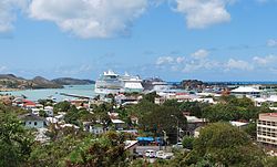
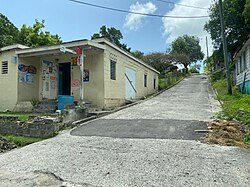
There are seven parish/dependency capitals in Antigua and Barbuda. One of these, St. John's, serves as the national seat of government. Each parish capital contains the parish church, while the capital of Barbuda contains the administrative offices of the Barbuda Council. Most capitals have town status, however, Codrington is a village, Fitches Creek is an estate, and St. John's is the sole city in the country.

With the exception of St. John's and Codrington, the majority of parish/dependency capitals are not the largest settlements in the parish. Parham is the second-largest city in Saint Peter; that being said, it would be the largest if the population of All Saints—which is spread across three parishes—were not included. Nonetheless, compared to Parham, the population of the sector of All Saints in Saint Peter is considerably higher. [4] [5]

Antiguan and Barbudan parish capitals map.svg
Parish/dependencyCapitalPopulation (2011)Percentage of parish/dependency population living in capital [6] Foreign born population (%)StatusImageRef(s)
Saint John St. John's 21,643
41.8%
36.71%
City St Johns Antigua 2012.jpg [7] [8] [9]
Saint George Fitches Creek 532
6.6%
34.07%
Estate [10] [11] [12] [13]
Saint Peter Parham 1,307
24.5%
18.86%
Town Parham street in 2023.jpg [5] [14] [15]
Saint Philip St. Philip's 131
3.9%
20.72%
Town St. Phillips Anglican Church.png [16] [17] [18]
Saint Paul Falmouth 240
2.95%
23.21%
Town Looking East to Harbour Hill, Falmouth Harbour, Antigua - panoramio (2).jpg [19] [14] [20]
Saint Mary Old Road 1,251
17.04%
9.27%
Town Old Road, Antigua.jpg [21] [14] [22]
Barbuda Codrington 796
48.7%
11.54%
Village Top Mission Street, Codrington, Barbuda.jpg [23] [24] [25]

See also

Related Research Articles

<span class="mw-page-title-main">Antigua and Barbuda</span> Country in the Lesser Antilles of the West Indies

Antigua and Barbuda is a sovereign island country in the Caribbean. It lies at the conjuncture of the Caribbean Sea and the Atlantic Ocean in the Leeward Islands part of the Lesser Antilles.

<span class="mw-page-title-main">Demographics of Antigua and Barbuda</span> National demographics

This article is a demography of the population of Antigua and Barbuda including population density, ethnicity, religious affiliations and other aspects of the population.

<span class="mw-page-title-main">Barbuda</span> Island in Antigua and Barbuda

Barbuda is an island located in the eastern Caribbean forming part of the twin-island state of Antigua and Barbuda as an autonomous entity. Barbuda is located approximately 30 miles (48 km) north of Antigua. The sole settlements on the island are Codrington and its surrounding localities. Barbuda is a flat island with the western portion being dominated by Codrington Lagoon, and the eastern portion being dominated by the low-lying Barbuda Highlands, with salty ponds and scrubland spread throughout the island. The climate is classified as tropical marine.

<span class="mw-page-title-main">Redonda</span> Island in Antigua and Barbuda

Redonda is an uninhabited Caribbean island that is a part of Antigua and Barbuda, in the Leeward Islands, West Indies. The island is about 1.6 kilometres (1 mi) long, 0.5 kilometres (0.3 mi) wide, and is 296 metres (971 ft) high at its highest point.

<span class="mw-page-title-main">Saint George, Antigua and Barbuda</span> Parish in Antigua and Barbuda

Saint George, officially the Parish of Saint George, is a parish of Antigua and Barbuda on the island of Antigua. Saint George borders Saint Peter to the southeast, and Saint John to the west and south. Saint George is mostly farmland and savanna in the south, dense forest in the Blackman's Peninsula area, marshland in the Fitches Creek area, and dense forest in the northwest. It is the smallest parish in Antigua and Barbuda, and the parish capital is Fitches Creek. The largest city in the parish is Piggotts. Saint George is the newest parish, splitting from the parish of Saint Peter in 1725. It had a population of 7,976 in 2011.

<span class="mw-page-title-main">Saint Philip, Antigua and Barbuda</span> Parish in Antigua and Barbuda

Saint Philip, officially the Parish of Saint Philip, is a civil parish of Antigua and Barbuda, on the easternmost portion of Antigua island. Its capital is the village of St. Philip's. Saint Philip borders Saint Peter and Saint Paul. Saint Philip faces the Atlantic Ocean. Saint Philip is surrounded by various islands and islets. It had a population of 3,347 in 2011, which makes it the least populous parish of Antigua and Barbuda.

<span class="mw-page-title-main">Saint Mary, Antigua and Barbuda</span> Parish in Antigua and Barbuda

Saint Mary, officially the Parish of Saint Mary, is a parish of Antigua and Barbuda on the island of Antigua. Saint Mary borders Saint John to the north, and Saint Paul to the east. Saint Mary is dominated by the Shekerley Mountains, and its northern border is largely defined by the mountains, and by Cooks Creek. The largest city in the parish is Bolans, home to the Jolly Harbour neighbourhood, and the parish church is located in Old Road. Saint Mary was created with the other five original parishes on 11 January 1692. It had a population of 7,341 in 2011, and 8,141 in 2018.

<span class="mw-page-title-main">Saint Peter, Antigua and Barbuda</span> Parish in Antigua and Barbuda

Saint Peter, officially the Parish of Saint Peter, is a parish of Antigua and Barbuda on the island of Antigua. Saint Peter borders Saint Paul to the south, Saint Philip to the east, and Saint George and Saint John to the west. Saint Peter is dominated by farmland, savanna, and undeveloped fields, and its borders are not well-defined. The largest city fully within the parish is Parham, which is also the capital. However, the portion of the city of All Saints in Saint Peter is significantly larger than Parham. Saint Peter was created with the other five original parishes on 11 January 1692. It had a population of 5,325 in 2011.

<span class="mw-page-title-main">Saint John, Antigua and Barbuda</span> Parish in Antigua, Antigua and Barbuda

Saint John, officially the Parish of Saint John, is a civil parish of Antigua and Barbuda, on the northwestern portion of Antigua island. Its capital is the city of St. John's. Saint John borders Saint Mary, Saint Peter, Saint George, and Saint Paul. Saint John faces the Caribbean Sea. Saint John is surrounded by some of Antigua's most premier beaches. Saint John had a population of 56,736 in a 2018 estimate, making it home to the majority of the population in Antigua and Barbuda.

<span class="mw-page-title-main">Antigua</span> Island in Antigua and Barbuda

Antigua, also known as Waladli or Wadadli by the native population, is an island in the Lesser Antilles. It is one of the Leeward Islands in the Caribbean region and the most populous island of the country of Antigua and Barbuda. Antigua and Barbuda became an independent state within the Commonwealth of Nations on 1 November 1981.

<span class="mw-page-title-main">Codrington, Barbuda</span> Village in Barbuda, Antigua and Barbuda

Codrington is the only village on the island of Barbuda, which is part of the country of Antigua and Barbuda. Codrington coincides with the Codrington major division, one of the two major divisions on Barbuda. Situated on the Codrington Lagoon, Codrington is the country's northernmost settlement. The population of Codrington was 796 in 2011.

<span class="mw-page-title-main">Parham, Antigua and Barbuda</span> Town in Antigua, Antigua and Barbuda

Parham, officially known as the Town of Parham, is the capital of Saint Peter, the largest city in Saint Peter, and the fourteenth largest city in Antigua and Barbuda. Parham had a population of 1,307 in 2011, distributed over 1.99 square kilometres. Parham is similar in population to Potters Village, the thirteenth largest city in Antigua and Barbuda, and Bendals, the fifteenth largest city. Parham is situated on the shore of Parham Harbour, one of the most important harbors in the country enclosed by the Parham Peninsula and Long Island. Parham comprises four main neighbourhoods: Lovers Lane, Parham Market, Byam Wharf, and the School neighborhood. If the Saint Peter portion of All Saints, home to 1,954 people extending across three parishes, is considered a separate city, Parham would be considered the second largest city of Saint Peter. The major division of Parham, the town's metropolitan area, stretching over the eastern portion of the parish, had a 2011 population of 3,499 people.

<span class="mw-page-title-main">Peter Byers</span> Antiguan international footballer

Peter Byers is an Antiguan footballer who plays professionally for SAP FC and the Antigua and Barbuda national team as a striker.

<span class="mw-page-title-main">Geography of Antigua and Barbuda</span>

Antigua and Barbuda lie in the eastern arc of the Leeward Islands of the Lesser Antilles, separating the Atlantic Ocean from the Caribbean Sea. Antigua is 650 km (400 mi) southeast of Puerto Rico; Barbuda lies 48 km (30 mi) due north of Antigua, and the uninhabited island of Redonda is 56 km (35 mi) southwest of Antigua.

<span class="mw-page-title-main">Demographics of Barbuda</span> Demographics of Barbuda

Demographic features of the population of Barbuda include population density, internet access, crime rate, and other aspects.

The major division of Pares is the metropolitan area of the city of Pares, Antigua and Barbuda. The major division consists of Pares, Vernons, Diamonds, and, portions of Parham. The major division has a living condition index of 14.36.

Major divisions are the second level administrative divisions of Antigua and Barbuda.

<span class="mw-page-title-main">St. Mary's North</span>

St. Mary's North is a parliamentary constituency in Saint Mary Parish, Antigua and Barbuda.

<span class="mw-page-title-main">Dieppe Bay, Antigua and Barbuda</span> Village in Saint Paul, Antigua and Barbuda

Dieppe Bay is a village in Saint Paul, Antigua and Barbuda. It had a population of 64 people in 2011.

References

  1. 1 2 http://laws.gov.ag/wp-content/uploads/2018/08/cap-373.pdf [ bare URL PDF ]
  2. http://laws.gov.ag/wp-content/uploads/2018/08/cap-44.pdf [ bare URL PDF ]
  3. 1 2 3 4 The Laws of the Island of Antigua: Consisting of the Acts of the Leeward Islands, Commencing 8. Novem. 1690 Ending 21. April 1798, and the Acts of Antigua Commencing 10. April 1668, Ending 7. May 1804 : with Prefixed to Each Volume, Analytical Tables of the Titles of the Acts, and at the End of the Whole, a Copious Digested Index. Bagster. 1805.
  4. "Ethnicity in All Saints Northeast" (PDF). Archived from the original (PDF) on 5 November 2023. Retrieved 5 November 2023.
  5. 1 2 "Ethnicity in Parham" (PDF). Archived from the original (PDF) on 16 August 2023.
  6. 2011 Population and Housing Census (PDF).
  7. "Ethnicity in St. John's City" (PDF). Archived from the original (PDF) on 6 February 2024.
  8. Public Health Act (PDF).
  9. "Birth place in St. John's" (PDF). Archived from the original on 13 February 2024. Retrieved 13 February 2024.{{cite web}}: CS1 maint: bot: original URL status unknown (link)
  10. "Ethnicity in Fitches Creek" (PDF). Archived from the original (PDF) on 6 February 2024.
  11. Lands of Antigua and Barbuda Sugar Factory Limited and the Antigua and Barbuda Syndicate Estates Limited (Vesting) Act (PDF). p. 2.
  12. Commons, Great Britain Parliament House of (1858). Accounts and Papers of the House of Commons. Ordered to be printed.
  13. "Birth place in Fitches Creek" (PDF). Archived from the original on 13 February 2024. Retrieved 13 February 2024.{{cite web}}: CS1 maint: bot: original URL status unknown (link)
  14. 1 2 3 The Laws of the Island of Antigua: Consisting of the Acts of the Leeward Islands, Commencing 8th November 1690, Ending 21st April 1798; and the Acts of Antigua, Commencing 10th April 1668, Ending 7th May 1804. Samuel Bagster. 1805. p. 88.
  15. "Birth place in Parham" (PDF). Archived from the original on 13 February 2024. Retrieved 13 February 2024.{{cite web}}: CS1 maint: bot: original URL status unknown (link)
  16. "Ethnicity in St. Philip's" (PDF). Archived from the original (PDF) on 6 February 2024.
  17. "Antigua - Norman B. Leventhal Map & Education Center". collections.leventhalmap.org. Retrieved 6 February 2024.
  18. "Birth place in St. Philip's" (PDF). Archived from the original on 13 February 2024. Retrieved 13 February 2024.{{cite web}}: CS1 maint: bot: original URL status unknown (link)
  19. "Ethnicity in Falmouth" (PDF). Archived from the original (PDF) on 6 February 2024.
  20. "Birth place in Falmouth" (PDF). Archived from the original on 13 February 2024. Retrieved 13 February 2024.{{cite web}}: CS1 maint: bot: original URL status unknown (link)
  21. "Ethnicity in Old Road" (PDF). Archived from the original (PDF) on 30 September 2023. Retrieved 30 September 2023.
  22. "Birth place in Old Road" (PDF). Archived from the original on 13 February 2024. Retrieved 13 February 2024.{{cite web}}: CS1 maint: bot: original URL status unknown (link)
  23. "Ethnicity in Codrington" (PDF). Archived from the original (PDF) on 22 July 2023. Retrieved 22 July 2023.
  24. Barbuda Act (PDF). p. 6.
  25. "Birth place in Codrington" (PDF). Archived from the original on 13 February 2024. Retrieved 13 February 2024.{{cite web}}: CS1 maint: bot: original URL status unknown (link)