Parham, Antigua and Barbuda

Last updated
Parham
Town
Town of Parham
Parham street in 2023.jpg
A street in Parham
Antigua and Barbuda location map.svg
Red pog.svg
Parham
Coordinates: 17°06′N61°46′W / 17.100°N 61.767°W / 17.100; -61.767
Country Antigua and Barbuda
Island Antigua
Civil parish Saint Peter Parish (capital)
Government
  Representative Asot Michael
Area
  Town1.99 km2 (0.77 sq mi)
Population
 (2011)
  Town1,307
   Metro
3,499
Demonym Parhamite
Time zone UTC-4 (AST)
Website parhamtown.org

Parham, officially known as the Town of Parham, is the capital of Saint Peter, the largest city in Saint Peter, and the fourteenth largest city in Antigua and Barbuda. Parham had a population of 1,307 in 2011, [1] distributed over 1.99 square kilometres. [2] Parham is similar in population to Potters Village, the thirteenth largest city in Antigua and Barbuda, and Bendals, the fifteenth largest city. Parham is situated on the shore of Parham Harbour, [3] one of the most important harbors in the country enclosed by the Parham Peninsula and Long Island. Parham comprises four main neighbourhoods: Lovers Lane, Parham Market, Byam Wharf, and the School neighborhood. [2] If the Saint Peter portion of All Saints, home to 1,954 people extending across three parishes, is considered a separate city, Parham would be considered the second largest city of Saint Peter. [4] The major division of Parham, the town's metropolitan area, stretching over the eastern portion of the parish, had a 2011 population of 3,499 people. [5]

Contents

Etymology

The town was given its name in 1675 when a British naval officer by the name of Lord Willoughby de Parham arrived from England with a patent from King Charles II, allowing him to designate Parham as one of the six trading towns in colonial Antigua while also establishing it as the capital of the colony. [3]

History

Parham served as a significant trading port for the importing of slaves from West Africa and the sale of rum and sugar to England during the colonial era. The agricultural products of the parishes of St. Peter, St. Phillip, and St. George were sold at Parham Harbour. [3] Around 1750, the Parham sugar mill was divided into two separate enterprises, each with its own windmill and boiling house. [6] As a result of the St. Peter's Anglican Parish Church's construction in 1840, [7] Parham would not have seen its heyday and peak population until the middle of the nineteenth century, during the height of the Industrial Revolution and the early days of freedom. Along with the Parham Anglican Rectory, the Parham Anglican Primary School was also built at that time. The Antigua Almanac, a newspaper from the 19th century, claimed that the people these initiatives drew would have turned the town of Parham into the island's capital once more. [3] When sugar prices collapsed in the early to mid-20th century, the vast majority of English sugar planters departed the island, and the descendants of freed slaves from the nearby sugar plantations are likely to have moved into Parham. They maintained the town's existence as a flourishing commercial hub by engaging in trades including fishing, farming, carpentry, and masonry. [3] Massive emigration caused by the collapse of the sugar industry in the 1960s and 1970s led to a population loss in Parham that has not been replaced or recovered from to this day. Agriculture and fishing continue to be the mainstays of the neighborhood economy. [3]

Geography

Parham is on the shore of Parham Harbour, a well-protected anchorage.

Demographics

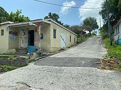
Parham is subdivided into six enumeration districts, Lovers Lane, Parham Market, Byams Wharf, Parham School #1, Parham School #2, and Parham School #3. [2] The centre of Parham is located in the Parham Market neighborhood, and is home to four of Parham's 39 business owners. [8] [9]

Census data (2011) [10]

Q48 EthnicCounts%
African descendent99892.06%
Caucasian/White50.47%
East Indian/India30.28%
Mixed (Black/White)171.61%
Mixed (Other)444.06%
Hispanic60.57%
Other80.76%
Don't know/Not stated20.19%
Total1,084100.00%
Q49 ReligionCounts%
Adventist19218.17%
Anglican25123.81%
Baptist323.01%
Church of God262.43%
Evangelical50.49%
Jehovah Witness40.39%
Methodist11010.40%
Moravian191.85%
Nazarene131.26%
None/no religion767.19%
Pentecostal878.26%
Rastafarian161.55%
Roman Catholic383.60%
Weslyan Holiness15314.48%
Other302.82%
Don't know/Not stated30.29%
Total1,055100.00%
NotApp :30
Q58. Country of birthCounts%
Other Latin or North American countries10.09%
Antigua and Barbuda84778.07%
Other Caribbean countries20.19%
Canada20.19%
Other Asian countries10.09%
Dominica312.84%
Dominican Republic70.66%
Guyana474.35%
Jamaica333.02%
Monsterrat50.47%
St. Kitts and Nevis80.76%
St. Lucia10.09%
St. Vincent and the Grenadines100.95%
Trinidad and Tobago30.28%
United Kingdom40.38%
USA302.74%
USVI United States Virgin Islands70.66%
Not Stated454.16%
Total1,084100.00%
Q71 Country of Citizenship 1Counts%
Antigua and Barbuda93386.01%
Other Caribbean countries50.47%
Dominica191.80%
Dominican Republic30.28%
Guyana333.02%
Jamaica292.65%
Monsterrat20.19%
St. Vincent and the Grenadines30.28%
Trinidad and Tobago10.09%
United Kingdom20.19%
USA232.08%
Other countries20.19%
Not Stated302.74%
Total1,084100.00%
Q71 Country of Citizenship 2 (Country of Second Citizenship)Counts%
Other Caribbean countries76.93%
Canada43.96%
Other Asian and Middle Eastern countries10.99%
Dominica1413.86%
Dominican Republic32.97%
Guyana1514.85%
Jamaica98.91%
Monsterrat32.97%
St. Lucia10.99%
St. Vincent and the Grenadines76.93%
Trinidad and Tobago21.98%
United Kingdom21.98%
USA3331.68%
Other countries10.99%
Total104100.00%
NotApp :981
Employment statusCounts%
Employed46656.80%
Unemployed637.62%
Inactive29035.33%
Not stated20.25%
Total821100.00%
NotApp :263
Q91 Business Earning (Earnings a business made)Counts%
Under 1,000 $EC per month1027.03%
1,000 to 1,999 $EC per month1027.03%
2,000 to 2,999 $EC per month924.32%
3,000 to 4,999 $EC per month616.22%
5,000 $EC and over per month25.41%
Total38100.00%
NotApp :1,037
Missing :9
Q55 Internet UseCounts%
Yes50746.79%
No56852.36%
Don't know/Not stated90.85%
Total1,084100.00%
Q117 MoneyOverseas (Money from friends and relatives overseas)Counts%
Under 100 EC$77994.88%
100 to 499 EC$91.12%
500 to 999 EC$131.62%
1,000 to 1,999 EC$70.87%
2,000 to 4,999 EC$70.87%
5,000 to 99,999 EC$50.62%
Total821100.00%
NotApp :263

Attractions

Law enforcement

In January 2021, the Parham Police were moved to a temporary headquarters in the ticket booth in the Sir Vivian Richards Stadium, until a new police station can be constructed, with the old one being demolished. [11]

See also

Related Research Articles

<span class="mw-page-title-main">Saint Philip, Antigua and Barbuda</span> Parish in Antigua and Barbuda

Saint Philip, officially the Parish of Saint Philip, is a civil parish of Antigua and Barbuda, on the easternmost portion of Antigua island. Its capital is the village of St. Philip's. Saint Philip borders Saint Peter and Saint Paul. Saint Philip faces the Atlantic Ocean. Saint Philip is surrounded by various islands and islets. It had a population of 3,347 in 2011, which makes it the least populous parish of Antigua and Barbuda.

<span class="mw-page-title-main">Saint Mary, Antigua and Barbuda</span> Parish in Antigua and Barbuda

Saint Mary, officially the Parish of Saint Mary, is a parish of Antigua and Barbuda on the island of Antigua. Saint Mary borders Saint John to the north, and Saint Paul to the east. Saint Mary is dominated by the Shekerley Mountains, and its northern border is largely defined by the mountains, and by Cooks Creek. The largest city in the parish is Bolans, home to the Jolly Harbour neighbourhood, and the parish church is located in Old Road. Saint Mary was created with the other five original parishes on 11 January 1692. It had a population of 7,341 in 2011, and 8,141 in 2018.

<span class="mw-page-title-main">Saint Paul, Antigua and Barbuda</span> Parish in Antigua and Barbuda

Saint Paul, officially the Parish of Saint Paul, is a parish of Antigua and Barbuda on the island of Antigua. Saint Paul borders Saint Peter and Saint John to the north, Saint Mary to the west, and Saint Philip to the east. Saint Paul is dominated by farmland in the north, with various creeks and Potworks Dam marking its northern border, and low-lying hills to the south, defining its western border with Saint Mary. The largest city fully within the parish is Liberta, the fourth largest city in the country. The parish capital, and the location of the parish church, is Falmouth. The main economic and tourism hub of the parish is English Harbour. Saint Paul was created with the other five original parishes on 11 January 1692. It had a population of 9,004 in 2018.

<span class="mw-page-title-main">Saint Peter, Antigua and Barbuda</span> Parish in Antigua and Barbuda

Saint Peter, officially the Parish of Saint Peter, is a parish of Antigua and Barbuda on the island of Antigua. Saint Peter borders Saint Paul to the south, Saint Philip to the east, and Saint George and Saint John to the west. Saint Peter is dominated by farmland, savanna, and undeveloped fields, and its borders are not well-defined. The largest city fully within the parish is Parham, which is also the capital. However, the portion of the city of All Saints in Saint Peter is significantly larger than Parham. Saint Peter was created with the other five original parishes on 11 January 1692. It had a population of 5,325 in 2011.

<span class="mw-page-title-main">All Saints, Antigua and Barbuda</span> Village in Antigua, Antigua and Barbuda

All Saints is the second largest town in Antigua and Barbuda, with a population of 3,412. It is located in the middle of Antigua, at 17°3′N61°47′W. Just 5 miles NW of here is the capital, St. John's. It had a population of 3,900 in 2001.

Freetown, officially known as FreeTown, is a town in Antigua. It is located in the southeast of the island, on a peninsula between Willoughby Bay to the south and Nonsuch Bay to the north.

<span class="mw-page-title-main">Urlings</span> Village in Antigua, Antigua and Barbuda

Urlings is a village in Saint Mary, and the twenty-sixth largest settlement in Antigua and Barbuda. Urlings is located in the southwest of Antigua and has a history dating to before 1856. Urlings started as a small coastal village with a little over 100 people in the 1800s to now being one of the country's more medium sized towns. Urlings is separated from the rest of Antigua by the Shekerley Mountains. Urlings is located between the communities of Johnsons Point and Old Road. Urlings has a seafood festival, a community association, a primary school, a playing field, a fisheries complex, and a cricket club that plays in the Village Parish League.

<span class="mw-page-title-main">Barbuda-North</span> Village and enumeration district in Barbuda, Antigua and Barbuda

Barbuda North is a village and enumeration district on the island of Barbuda.

<span class="mw-page-title-main">Barbuda-South</span> Village and Enumeration District in Barbuda

Barbuda-South or Barbuda South River Road, is a village and enumeration district on the island of Barbuda.

Montpelier is a small village in Saint Philip Parish, Antigua and Barbuda.

<span class="mw-page-title-main">Clarkes Hill, Antigua and Barbuda</span> Town in Antigua, Antigua and Barbuda

Clarkes Hill is a town in Saint John Parish, Antigua and Barbuda.

McKinnon's is a major city in the Major Division of North Coast, Saint John Parish, Antigua and Barbuda.

Downtown, officially City Center Downtown, is an enumeration district in the Major Division of Upper Fort Road, St. John's, Antigua and Barbuda.

Twenty Hill is a historic site and sparsely populated unincorporated area in southern Parham.

Montclear is a major city in All Saints Northwest, Saint John, Antigua and Barbuda. It had a population of 1,246 in the 2011 census. It has an area of 0.7 square kilometres.

<span class="mw-page-title-main">Housing in Barbuda</span>

On the island of Barbuda, which is part of the nation of Antigua and Barbuda, the housing industry is a major economic sector. The majority of households, or 68.38% of all households, are owner-occupied homes.

<span class="mw-page-title-main">Long Bay, Antigua and Barbuda</span> Coastal settlement in Saint Philip, Antigua

Long Bay is a coastal settlement in Saint Philip, Antigua and Barbuda.

Herberts is a major town in Saint John, Antigua and Barbuda.

<span class="mw-page-title-main">Youth in Barbuda</span>

In terms of the demography of the island, youth in Barbuda can be categorized together as one age group. It was projected that 33.92% of the Barbudan population was aged 0–17 years in 2011..

References

  1. (PDF) https://web.archive.org/web/20230816000232/https://redatam.org/binatg/RpWebUtilities.exe/reporte.pdf?LFN=RpBases%5CTempo%5C74906%5C~tmp_7490601.pdf. Archived from the original (PDF) on 2023-08-16. Retrieved 2023-08-16.{{cite web}}: Missing or empty |title= (help)
  2. 1 2 3 "Enumeration District Boundaries for the 2021 Census". nri.environment.gov.ag. Retrieved 2023-08-16.
  3. 1 2 3 4 5 6 "History". Parham Alliance Beautification and Revitalization Organization. Retrieved 2023-08-16.
  4. (PDF) https://web.archive.org/web/20230816002240/https://redatam.org/binatg/RpWebUtilities.exe/reporte.pdf?LFN=RpBases%5CTempo%5C74906%5C~tmp_7490691.pdf. Archived from the original (PDF) on 2023-08-16. Retrieved 2023-08-16.{{cite web}}: Missing or empty |title= (help)
  5. (PDF) https://web.archive.org/web/20230816003233/https://redatam.org/binatg/RpWebUtilities.exe/reporte.pdf?LFN=RpBases%5CTempo%5C74906%5C~tmp_74906121.pdf. Archived from the original (PDF) on 2023-08-16. Retrieved 2023-08-16.{{cite web}}: Missing or empty |title= (help)
  6. "Parham New Works – Antigua Sugar Mills" . Retrieved 2023-08-16.
  7. "Parham Hill – Antigua Sugar Mills" . Retrieved 2023-08-16.
  8. (PDF) https://web.archive.org/web/20230816004840/https://redatam.org/binatg/RpWebUtilities.exe/reporte.pdf?LFN=RpBases%5CTempo%5C74906%5C~tmp_74906211.pdf. Archived from the original (PDF) on 2023-08-16. Retrieved 2023-08-16.{{cite web}}: Missing or empty |title= (help)
  9. (PDF) https://web.archive.org/web/20230816004956/https://redatam.org/binatg/RpWebUtilities.exe/reporte.pdf?LFN=RpBases%5CTempo%5C74906%5C~tmp_74906241.pdf. Archived from the original (PDF) on 2023-08-16. Retrieved 2023-08-16.{{cite web}}: Missing or empty |title= (help)
  10. "Antigua and Barbuda::Statistics Division/Redatam Webserver | Statistical Process and Dissemination Tool". redatam.org. Retrieved 2021-12-23.
  11. "Parham Police Officers Moved to Temporary Quarters". 24 January 2021.