Saint Peter, Antigua and Barbuda

Last updated
Parish of Saint Peter [1]
Bettys Hope Sugart Plantation Antigua 9124.jpg
Parham, Antigua.jpg
Parham street in 2023.jpg
Field in Saint Peter.jpg
(from top: left to right) Betty's Hope, A street in Parham, another street in Parham, A field in Saint Peter
Saint Peter in Antigua and Barbuda (cropped).svg
Country Antigua and Barbuda
EstablishedJanuary 11, 1692;332 years ago (1692-01-11)
Capital Parham
Largest city All Saints [upper-alpha 1]
Largest major division All Saints Northeast
Government
  MPs Asot Michael, Jamale Pringle, Anthony Smith
Population
 (2018)
  Total5,706 [3]
Time zone UTC-4 (AST)

Saint Peter, officially the Parish of Saint Peter, is a parish of Antigua and Barbuda on the island of Antigua. Saint Peter borders Saint Paul to the south, Saint Philip to the east, and Saint George and Saint John to the west. Saint Peter is dominated by farmland, savanna, and undeveloped fields, and its borders are not well-defined. The largest city fully within the parish is Parham, which is also the capital. However, the portion of the city of All Saints in Saint Peter is significantly larger than Parham. Saint Peter was created with the other five original parishes on 11 January 1692. It had a population of 5,325 in 2011.

Contents

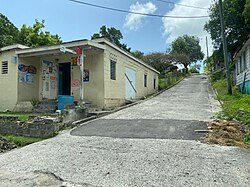
Saint Peter is mostly dominated by agriculture and industry, with the few populated places in the parish being portions of All Saints, Diamonds, Freemans, Pares, Parham, and Vernons. Most of the parish lives on the western border with Saint John. Pares is the only major settlement in the center of the parish. There is almost no settlement in the eastern portion of the parish other than the hamlets of Coconut Hall and Gilberts. In the northern areas of the parish, Saint Peter is home to Guiana Island and the Galley Islands, as well as the Crabbs Peninsula. Long Island, home to three permanent inhabitants, and Maiden Island are legally part of Saint George, but are politically and statistically part of Saint Peter. Long Island and Maiden Island are counted as parts of Saint Peter for purposes of the census.

Saint Peter is not home to many tourist attractions, and the mainland portion of the parish is home to very few, if any beaches. Parham Harbour is sometimes used by local residents, specifically children, for swimming. Saint Peter is however home to many historic Amerindian villages, and the Betty's Hope sugar plantation, one of the major symbols of the island. Saint Peter also has populations of European fallow deer on Guiana Island. On the offshore islands, there are many clear waters and reefs, and many of the offshore islands, like Great Bird Island, are frequented by tourists.

Along with four other parishes, Saint Peter was established on January 11, 1692, with the primary objective of providing for the parish church. The majority of the parish's lands were, and still are, used for agricultural purposes. Numerous historical relics from the parish can still be seen today, including the Mercer's Creek [4] and Coconut Hall [5] plantations.

History

Amerindian presence

Twenty Hill, which is located in Parham, and Jolly Beach, which is located in Jolly Bay, are the two locations in Antigua that hold the distinction of being the earliest and most significant sites of human occupation (c.1775 BC). [6] [7]

British period

On January 11, 1692, the parish of Saint Peter was founded. Saint Peter was originally composed of the divisions of New North Sound Division, Old North Sound Division, and Mercers Creek Division. However, New North Sound split off to form its own parish, Saint George, in 1725. [8] According to a map published in 1782, the parish had a small pond named Pinns Pond, and a small church near Pares. [9] There were 27 slave plantations in the parish. [10]

Geography

Communities of Saint Peter Communities of Saint Peter.svg
Communities of Saint Peter
Population density in 2011 Population density of Saint Peter parish.svg
Population density in 2011

Although the parish is mostly flat and suitable for habitation, most of the population lives in the dense eastern cities on the western border. Very few localities are located outside of this region. The parish is home to most of the country's minor islands, and the parish is home to many creeks and bays. Most of the creeks are near the parish's borders. [11] Most of the parish's water bodies are located in the southeastern portion of the parish, with Potworks Dam, shared with Saint Paul, being the largest. [12] The parish is enclosed by many of Antigua's historic rail infrastructure. [13]

Demographics

Saint Peter is not a particularly diverse parish. In 2011, the parish had 5,317 people. As of the 2011 census, the parish has many ethnic groups such as African descendants (92.85% of the population), whites (0.39%), East Indians (0.75%), mixed black/whites (1.12%), other mixed (3.24%), Hispanics (0.50%), Syrians/Lebaneses (0.04%), others (0.33%), and didn't know/not stated (0.79%). [14] The largest religious groups were Anglicans (20.29%), Adventists (15.46%), Pentecostalists (11.22%), Methodists (10.87%), and irreligious people (7.68%). Additionally, 1.19% of the population was Rastafarian. [15]

In 2011, there were many country of birth groups in the parish; those born in Africa (0.04%), "other Latin American and North American countries" (0.17%), Antigua and Barbuda (76.10%), "other Caribbean countries" (0.56%), Canada (0.27%), "other Asian countries" (0.02%), "other European countries" (0.04%), Dominica (2.93%), Dominican Republic (0.54%), Guyana (7.36%), Jamaica (3.06%), Montserrat (0.40%), St. Kitts and Nevis (0.46%), St. Lucia (0.15%), St. Vincent and the Grenadines (0.83%), Trinidad and Tobago (0.31%), the United Kingdom (0.52%), the United States (3.14%), United States Virgin Islands (0.50%), and not stated (2.58%). [16]

Economy

In 2011, 1.61% of the 2,285 workers in the parish were paid a daily salary, 44.35% were paid a weekly salary, 20.31% were paid a fortnightly salary, 30.85% were paid a monthly salary, and the remainder were paid at another time. [17] 20.76% of workers were paid government employees, 6.74% were paid statutory body employees, 54.53% were paid private employees, 3.22% were paid private home employees, 2.63% were self-employed with paid employees, 9.96% were self-employed without paid employees, 0.89% had another worker status, and 1.27% didn't know or didn't state. [18] Out of the 212 business owners in the parish, 28.99% made less than EC$1,000 per month from their business, 21.74% made $1,000 to $1,999, 19.81% made $2,000 to $2,999, 14.01% made $3,000 to $4,999, and 15.46% made $5,000+. [19]

2.35% of people practiced subsistence farming. [20]

Related Research Articles

<span class="mw-page-title-main">Saint Philip, Antigua and Barbuda</span> Parish in Antigua and Barbuda

Saint Philip, officially the Parish of Saint Philip, is a civil parish of Antigua and Barbuda, on the easternmost portion of Antigua island. Its capital is the village of St. Philip's. Saint Philip borders Saint Peter and Saint Paul. Saint Philip faces the Atlantic Ocean. Saint Philip is surrounded by various islands and islets. It had a population of 3,347 in 2011, which makes it the least populous parish of Antigua and Barbuda.

<span class="mw-page-title-main">Saint Mary, Antigua and Barbuda</span> Parish in Antigua and Barbuda

Saint Mary, officially the Parish of Saint Mary, is a parish of Antigua and Barbuda on the island of Antigua. Saint Mary borders Saint John to the north, and Saint Paul to the east. Saint Mary is dominated by the Shekerley Mountains, and its northern border is largely defined by the mountains, and by Cooks Creek. The largest city in the parish is Bolans, home to the Jolly Harbour neighbourhood, and the parish church is located in Old Road. Saint Mary was created with the other five original parishes on 11 January 1692. It had a population of 7,341 in 2011, and 8,141 in 2018.

<span class="mw-page-title-main">Saint Paul, Antigua and Barbuda</span> Parish in Antigua and Barbuda

Saint Paul, officially the Parish of Saint Paul, is a parish of Antigua and Barbuda on the island of Antigua. Saint Paul borders Saint Peter and Saint John to the north, Saint Mary to the west, and Saint Philip to the east. Saint Paul is dominated by farmland in the north, with various creeks and Potworks Dam marking its northern border, and low-lying hills to the south, defining its western border with Saint Mary. The largest city fully within the parish is Liberta, the fourth largest city in the country. The parish capital, and the location of the parish church, is Falmouth. The main economic and tourism hub of the parish is English Harbour. Saint Paul was created with the other five original parishes on 11 January 1692. It had a population of 9,004 in 2018.

<span class="mw-page-title-main">All Saints, Antigua and Barbuda</span> Village in Antigua, Antigua and Barbuda

All Saints is the second largest settlement in Antigua and Barbuda, with a population of 3,412. It is located in the middle of Antigua, at 17°3′N61°47′W. Just 5 miles NW of here is the capital, St. John's. It had a population of 3,900 in 2001.

<span class="mw-page-title-main">Parham, Antigua and Barbuda</span> Town in Antigua, Antigua and Barbuda

Parham, officially known as the Town of Parham, is the capital of Saint Peter, the largest city in Saint Peter, and the fourteenth largest city in Antigua and Barbuda. Parham's population was 1,307 in 2011, distributed over 1.99 square kilometres. Parham is similar in population to Potters Village, the thirteenth most significant city in Antigua and Barbuda, and Bendals, the fifteenth largest city. Parham is situated on the shore of Parham Harbour, one of the most important harbors in the country, enclosed by the Parham Peninsula and Long Island.

<span class="mw-page-title-main">Urlings</span> Village in Antigua, Antigua and Barbuda

Urlings is a village in Saint Mary, and the twenty-sixth largest settlement in Antigua and Barbuda. Urlings is located in the southwest of Antigua and has a history dating to before 1856. Urlings started as a small coastal village with a little over 100 people in the 1800s to now being one of the country's more medium sized towns. Urlings is separated from the rest of Antigua by the Shekerley Mountains. Urlings is located between the communities of Johnsons Point and Old Road. Urlings has a seafood festival, a community association, a primary school, a playing field, a fisheries complex, and a cricket club that plays in the Village Parish League.

Saint John is the most populous parish in the country of Antigua and Barbuda, accounting for the majority of the country's population.

<span class="mw-page-title-main">Barbuda-North</span> Village and enumeration district in Barbuda, Antigua and Barbuda

Barbuda North is a village and enumeration district on the island of Barbuda.

Montpelier is a small village in Saint Philip Parish, Antigua and Barbuda.

<span class="mw-page-title-main">Clarkes Hill, Antigua and Barbuda</span> Village in Antigua, Antigua and Barbuda

Clarkes Hill is a village in Saint John Parish, Antigua and Barbuda.

City Centre is a Major Division/Area within the city of St. John's, Antigua and Barbuda.

McKinnon's is a major city in the Major Division of North Coast, Saint John Parish, Antigua and Barbuda.

Downtown, officially City Center Downtown, is an enumeration district in the Major Division of Upper Fort Road, St. John's, Antigua and Barbuda.

Twenty Hill is a historic site and sparsely populated unincorporated area in southern Parham.

Montclear is a village in All Saints Northwest, Saint John, Antigua and Barbuda. It had a population of 1,246 in the 2011 census. It has an area of 0.7 square kilometres.

<span class="mw-page-title-main">Housing in Barbuda</span>

On the island of Barbuda, which is part of the nation of Antigua and Barbuda, the housing industry is a major economic sector. The majority of households, or 68.38% of all households, are owner-occupied homes.

<span class="mw-page-title-main">Long Bay, Antigua and Barbuda</span> Coastal settlement in Saint Philip, Antigua

Long Bay is a coastal settlement in Saint Philip, Antigua and Barbuda.

Herberts is a major settlement in Saint John, Antigua and Barbuda.

<span class="mw-page-title-main">Youth in Barbuda</span> Demographics

In terms of the demography of the island, youth in Barbuda can be categorized together as one age group. It was projected that 33.92% of the Barbudan population was aged 0–17 years in 2011..

References

  1. http://laws.gov.ag/wp-content/uploads/2018/08/cap-304.pdf [ bare URL PDF ]
  2. http://laws.gov.ag/wp-content/uploads/2018/08/cap-304.pdf [ bare URL PDF ]
  3. https://statistics.gov.ag/wp-content/uploads/2020/10/2018-Antigua-and-Barbuda-LFS-Report.pdf [ bare URL PDF ]
  4. "Mercer's Creek – Antigua Sugar Mills" . Retrieved 2023-10-14.
  5. "Cocoa Nutt Hall/ Crump's – Antigua Sugar Mills" . Retrieved 2023-10-14.
  6. "Prehistory of Antigua & Barbuda". antiguahistory.net. Retrieved 2023-03-14.
  7. "OAS - Organization of American States: Democracy for peace, security, and development" (PDF). August 2009.
  8. The Laws of the Island of Antigua: Consisting of the Acts of the Leeward Islands, Commencing 8. Novem. 1690 Ending 21. April 1798, and the Acts of Antigua Commencing 10. April 1668, Ending 7. May 1804 : with Prefixed to Each Volume, Analytical Tables of the Titles of the Acts, and at the End of the Whole, a Copious Digested Index. Bagster. 1805.
  9. "A new and exact map of the island of Antigua in America, according to an actual and accurate survey, with the different parishes, the churches, divisions, boundaries and a plan of English Harbour". jcb.lunaimaging.com. Retrieved 2023-10-14.
  10. "Parishes and Mills – Antigua Sugar Mills" . Retrieved 2023-10-14.
  11. "Streams in Antigua". nri.environment.gov.ag. Retrieved 2023-10-14.
  12. "Natural and Artificial Ponds, Dams, and Waterbodies". nri.environment.gov.ag. Retrieved 2023-10-14.
  13. "Antigua's Rail Infrastructure - 1891". nri.environment.gov.ag. Retrieved 2023-10-14.
  14. https://web.archive.org/web/20231014151706/https://redatam.org/binatg/RpWebUtilities.exe/reporte.pdf?LFN=RpBases%5CTempo%5C116969%5C~tmp_11696901.pdf
  15. https://web.archive.org/web/20231014152045/https://redatam.org/binatg/RpWebUtilities.exe/reporte.pdf?LFN=RpBases%5CTempo%5C116969%5C~tmp_11696931.pdf
  16. https://web.archive.org/web/20231014171642/https://redatam.org/binatg/RpWebUtilities.exe/reporte.pdf?LFN=RpBases%5CTempo%5C116969%5C~tmp_11696961.pdf
  17. https://web.archive.org/web/20231014152857/https://redatam.org/binatg/RpWebUtilities.exe/reporte.pdf?LFN=RpBases%5CTempo%5C116969%5C~tmp_116969151.pdf
  18. https://web.archive.org/web/20231014172418/https://redatam.org/binatg/RpWebUtilities.exe/reporte.pdf?LFN=RpBases%5CTempo%5C116969%5C~tmp_11696991.pdf
  19. https://web.archive.org/web/20231014153225/https://redatam.org/binatg/RpWebUtilities.exe/reporte.pdf?LFN=RpBases%5CTempo%5C116969%5C~tmp_116969121.pdf
  20. https://web.archive.org/web/20231014153430/https://redatam.org/binatg/RpWebUtilities.exe/reporte.pdf?LFN=RpBases%5CTempo%5C116969%5C~tmp_116969181.pdf

Notes

  1. If only including cities fully within the parish, Parham would be the largest city. The part of All Saints in Saint Peter has a larger population than Parham. All Saints extends across three parishes.

17°06′N61°46′W / 17.100°N 61.767°W / 17.100; -61.767