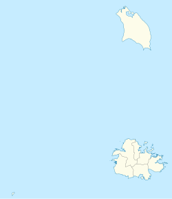
Sea View Farm | |
---|---|
Village | |
Coordinates: 17°05′24″N61°48′10″W / 17.09000°N 61.80278°W | |
Country | Antigua and Barbuda |
Island | Antigua |
Civil parish | Saint George Parish |
Population (2011) | |
• Total | 792 |
Time zone | UTC-4 (AST) |
Sea View Farm is a village located in Saint George Parish on the island of Antigua, in Antigua and Barbuda.
It is located halfway between the capital city of St. John's and Potworks Dam, the island's largest reservoir.
The village school is Sea View Farm Primary.
Sea View Farm is known for its pottery. Elvie's Pottery is the oldest pottery still in operation in Antigua today, where traditional handmade pottery can still be seen. The pottery was founded about 200 years ago.
Notable buildings include the Good Shepherd Catholic Church and Kingdom Hall.
Sea View Farm has three enumeration districts.
Q48 Ethnic | Counts | % |
---|---|---|
African descendent | 711 | 89.84% |
Caucasian/White | 5 | 0.67% |
East Indian/India | 4 | 0.53% |
Mixed (Black/White) | 6 | 0.80% |
Mixed (Other) | 52 | 6.55% |
Hispanic | 8 | 1.07% |
Other | 1 | 0.13% |
Don't know/Not stated | 3 | 0.40% |
Total | 792 | 100.00% |
Q49 Religion | Counts | % |
---|---|---|
Adventist | 113 | 14.30% |
Anglican | 59 | 7.49% |
Baptist | 4 | 0.53% |
Church of God | 81 | 10.29% |
Evangelical | 2 | 0.27% |
Jehovah Witness | 3 | 0.40% |
Methodist | 30 | 3.74% |
Moravian | 176 | 22.19% |
Nazarene | 6 | 0.80% |
None/no religion | 58 | 7.35% |
Pentecostal | 64 | 8.02% |
Rastafarian | 6 | 0.80% |
Roman Catholic | 97 | 12.30% |
Wesleyan Holiness | 10 | 1.20% |
Other | 51 | 6.42% |
Don't know/Not stated | 31 | 3.88% |
Total | 792 | 100.00% |
Q58. Country of birth | Counts | % |
---|---|---|
Africa | 3 | 0.40% |
Other Latin or North American countries | 1 | 0.13% |
Antigua and Barbuda | 530 | 66.98% |
Other Caribbean countries | 14 | 1.74% |
Canada | 7 | 0.94% |
Dominica | 50 | 6.28% |
Dominican Republic | 3 | 0.40% |
Guyana | 54 | 6.82% |
Jamaica | 57 | 7.22% |
Monsterrat | 8 | 1.07% |
St. Kitts and Nevis | 7 | 0.94% |
St. Lucia | 4 | 0.53% |
St. Vincent and the Grenadines | 5 | 0.67% |
United Kingdom | 3 | 0.40% |
USA | 26 | 3.34% |
USVI United States Virgin Islands | 7 | 0.94% |
Not Stated | 10 | 1.20% |
Total | 792 | 100.00% |
Q71 Country of Citizenship 1 | Counts | % |
---|---|---|
Antigua and Barbuda | 651 | 82.22% |
Other Caribbean countries | 13 | 1.60% |
Canada | 4 | 0.53% |
Dominica | 18 | 2.27% |
Dominican Republic | 2 | 0.27% |
Guyana | 30 | 3.74% |
Jamaica | 42 | 5.35% |
Monsterrat | 5 | 0.67% |
St. Vincent and the Grenadines | 1 | 0.13% |
United Kingdom | 4 | 0.53% |
USA | 11 | 1.34% |
Other countries | 3 | 0.40% |
Not Stated | 7 | 0.94% |
Total | 792 | 100.00% |
Q71 Country of Citizenship 2 (Country of Second Citizenship) | Counts | % |
---|---|---|
Other Caribbean countries | 14 | 8.67% |
Canada | 5 | 3.33% |
Other Asian and Middle Eastern countries | 1 | 0.67% |
Dominica | 32 | 20.00% |
Dominican Republic | 2 | 1.33% |
Guyana | 29 | 18.00% |
Jamaica | 17 | 10.67% |
Monsterrat | 1 | 0.67% |
St. Lucia | 4 | 2.67% |
St. Vincent and the Grenadines | 4 | 2.67% |
United Kingdom | 8 | 5.33% |
USA | 38 | 24.00% |
Other countries | 3 | 2.00% |
Total | 159 | 100.00% |
NotApp : | 633 |
Barbuda is an island located in the eastern Caribbean forming part of the twin-island state of Antigua and Barbuda as an autonomous entity. Barbuda is located approximately 30 miles (48 km) north of Antigua. The sole settlements on the island are Codrington and its surrounding localities. Barbuda is a flat island with the western portion being dominated by Codrington Lagoon, and the eastern portion being dominated by the low-lying Barbuda Highlands, with salty ponds and scrubland spread throughout the island. The climate is classified as tropical marine.
Saint Philip, officially the Parish of Saint Philip, is a civil parish of Antigua and Barbuda, on the easternmost portion of Antigua island. Its capital is the village of St. Philip's. Saint Philip borders Saint Peter and Saint Paul. Saint Philip faces the Atlantic Ocean. Saint Philip is surrounded by various islands and islets. It had a population of 3,347 in 2011, which makes it the least populous parish of Antigua and Barbuda.
Saint Mary, officially the Parish of Saint Mary, is a parish of Antigua and Barbuda on the island of Antigua. Saint Mary borders Saint John to the north, and Saint Paul to the east. Saint Mary is dominated by the Shekerley Mountains, and its northern border is largely defined by the mountains, and by Cooks Creek. The largest city in the parish is Bolans, home to the Jolly Harbour neighbourhood, and the parish church is located in Old Road. Saint Mary was created with the other five original parishes on 11 January 1692. It had a population of 7,341 in 2011, and 8,141 in 2018.
Saint Paul, officially the Parish of Saint Paul, is a parish of Antigua and Barbuda on the island of Antigua. Saint Paul borders Saint Peter and Saint John to the north, Saint Mary to the west, and Saint Philip to the east. Saint Paul is dominated by farmland in the north, with various creeks and Potworks Dam marking its northern border, and low-lying hills to the south, defining its western border with Saint Mary. The largest city fully within the parish is Liberta, the fourth largest city in the country. The parish capital, and the location of the parish church, is Falmouth. The main economic and tourism hub of the parish is English Harbour. Saint Paul was created with the other five original parishes on 11 January 1692. It had a population of 9,004 in 2018.
Saint Peter, officially the Parish of Saint Peter, is a parish of Antigua and Barbuda on the island of Antigua. Saint Peter borders Saint Paul to the south, Saint Philip to the east, and Saint George and Saint John to the west. Saint Peter is dominated by farmland, savanna, and undeveloped fields, and its borders are not well-defined. The largest city fully within the parish is Parham, which is also the capital. However, the portion of the city of All Saints in Saint Peter is significantly larger than Parham. Saint Peter was created with the other five original parishes on 11 January 1692. It had a population of 5,325 in 2011.
All Saints is the second largest settlement in Antigua and Barbuda, with a population of 3,412. It is located in the middle of Antigua, at 17°3′N61°47′W. Just 5 miles NW of here is the capital, St. John's. It had a population of 3,900 in 2001.
Seatons is a village in Saint Philip Parish, located on eastern Antigua island in Antigua and Barbuda.
Long Island, also known as Jumby Bay, is an island off the northeast coast of Antigua. It is located off the northern tip of the Parham Peninsula, about 2.5 kilometres (1.6 mi) from Dutchman Bay on Antigua. It is the fifth largest island of Antigua and Barbuda.
Willikies is a small settlement in Saint Philip Parish, located in the eastern part of Antigua island in Antigua and Barbuda.
Cedar Grove is a settlement in the far north of the island of Antigua. It is located to the east of the island's northernmost headlands, Boon Point. It is 6 kilometres (3.7 mi) northeast of the capital, St. John's.
Liberta is a town located in Saint Paul Parish, on the island of Antigua in Antigua and Barbuda. It had a population of 2,560 in 2001.
Freetown, officially known as FreeTown, is a town in Antigua. It is located in the southeast of the island, on a peninsula between Willoughby Bay to the south and Nonsuch Bay to the north.
Falmouth is a coastal port town located in Saint Paul Parish on the island of Antigua, in Antigua and Barbuda. The town is located in the south of the island, at the end of Falmouth Harbour. A road links Falmouth with the nearby larger town of Liberta inland to the north. In 2018, a proposal was made for squatters who had lived on their land for ten years or more to buy their plots for $1 per 1 sq ft (0.093 m2).
Piggotts, also known as St Mark's Village, is a small township in Saint George Parish on Antigua island in Antigua and Barbuda. It had a population of 1,478 in 2001.
Potters Village is a township located on Antigua in Antigua and Barbuda. It is located in the north of the island, to the east of the capital, St. John's and southwest of Piggotts.
Bethesda is a village in Saint Paul Parish on the island of Antigua, in Antigua and Barbuda.
Freemans is a village located in Saint Peter Parish on the island of Antigua, in Antigua and Barbuda.
Five Islands Village is a village located on the northwest coast of Antigua, within Saint John Parish in Antigua and Barbuda.
Villa is a neighbourhood in St. John's, Antigua and Barbuda.
Golden Grove is a neighbourhood in St. John's, Antigua and Barbuda.