This article possibly contains original research .(January 2022) |
Diamonds | |
---|---|
Hamlet | |
Coordinates: 17°04′39″N61°45′37″W / 17.0775°N 61.760278°W | |
Country | Antigua and Barbuda |
Island | Antigua |
Civil parish | Saint Peter |
Government | |
• Type | Village Council [1] (possibly dissolved) [2] |
• MP | Asot Michael |
Area | |
• Total | 10.12 km2 (3.91 sq mi) |
Population (2011) | |
• Total | 57 |
• Density | 5.6/km2 (15/sq mi) |
Time zone | UTC-4 (AST) |
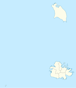
Diamonds, also known as The Diamond, is a rural hamlet in Saint Peter, Antigua and Barbuda.
Diamonds takes up 31.26% of the land area of the Parish of Saint Peter.
Betty's Hope is located in Diamonds. [3]
The adjoining cattle corral is still standing, and the mill is in "good" condition. The house was modest in size compared to many estate homes, but it was constructed with 2 to 3 inch thick walls. It had two levels and was made of stone, with the ground floor being utilized for storage. In addition to from the kitchen into a walled courtyard, stairs led up to the front and back of the house. The gardens on each side of the front were large enough to accommodate an open garden seating area that could be accessed directly from the living room and provided an elevated perspective of the land. It was a remarkably strong and compact building designed for security. A tennis court and bench were located on the front lawn, where family and friends could play pleasant matches under the shade of a Scarlet Cordia tree. The surrounding area was extremely flat and arable. Cochran's (#83), Sanderson's (#86), Duer's (#89), and Parry's (#88) are nearby estates. When the Syndicate Estates failed, the government took control of Diamond Estate and converted it into an agricultural farm. After being out of use in 2001, the government brought it back in 2007. [4]
Source: [4]
Diamonds has one enumeration district, ED 51400. [5]
Diamonds had 84 slaves in 1829, when it was sized at 134 acres. [4]
Source: [6]
Q48 Ethnic | Counts | % |
---|---|---|
African descendent | 45 | 78.57% |
Caucasian/White | 8 | 14.29% |
East Indian/India | 4 | 7.14% |
Total | 57 | 100.00% |
Q49 Religion | Counts | % |
---|---|---|
Adventist | 6 | 10.71% |
Anglican | 7 | 12.50% |
Church of God | 3 | 5.36% |
Methodist | 7 | 12.50% |
Moravian | 1 | 1.79% |
None/no religion | 17 | 30.36% |
Pentecostal | 5 | 8.93% |
Roman Catholic | 2 | 3.57% |
Other | 6 | 10.71% |
Don't know/Not stated | 2 | 3.57% |
Total | 57 | 100.00% |
Q58. Country of birth | Counts | % |
---|---|---|
Antigua and Barbuda | 32 | 55.36% |
Other European countries | 1 | 1.79% |
Dominica | 3 | 5.36% |
Guyana | 14 | 25.00% |
Jamaica | 2 | 3.57% |
Trinidad and Tobago | 1 | 1.79% |
United Kingdom | 3 | 5.36% |
USA | 1 | 1.79% |
Total | 57 | 100.00% |
Q71 Country of Citizenship 1 | Counts | % |
---|---|---|
Antigua and Barbuda | 44 | 76.79% |
Dominica | 1 | 1.79% |
Guyana | 7 | 12.50% |
Jamaica | 1 | 1.79% |
United Kingdom | 1 | 1.79% |
USA | 2 | 3.57% |
Other countries | 1 | 1.79% |
Total | 57 | 100.00% |
Q71 Country of Citizenship 2 (Country of Second Citizenship) | Counts | % |
---|---|---|
Dominica | 2 | 13.33% |
Guyana | 7 | 46.67% |
St. Lucia | 1 | 6.67% |
United Kingdom | 5 | 33.33% |
Total | 15 | 100.00% |
NotApp : | 42 |
Q55 Internet Use | Counts | % |
---|---|---|
Yes | 35 | 60.71% |
No | 22 | 37.50% |
Don't know/Not stated | 1 | 1.79% |
Total | 57 | 100.00% |
Employment status | Counts | % |
---|---|---|
Employed | 37 | 72.00% |
Unemployed | 2 | 4.00% |
Inactive | 12 | 24.00% |
Total | 51 | 100.00% |
NotApp : | 6 |
Q117 MoneyOverseas (Money from friends and relatives overseas) | Counts | % |
---|---|---|
Under 100 EC$ | 51 | 100.00% |
Total | 51 | 100.00% |
NotApp : | 6 |
Q91 Business Earning (Earnings a business made) | Counts | % |
---|---|---|
Under $1,000 EC per month | 5 | 38.46% |
1,000 to $1,999 EC per month | 1 | 7.69% |
2,000 to $2,999 EC per month | 3 | 23.08% |
3,000 to $4,999 EC per month | 1 | 7.69% |
$5,000 EC and over per month | 3 | 23.08% |
Total | 13 | 100.00% |
NotApp : | 44 |
Saint George, officially the Parish of Saint George, is a parish of Antigua and Barbuda on the island of Antigua. Saint George borders Saint Peter to the southeast, and Saint John to the west and south. Saint George is mostly farmland and savanna in the south, dense forest in the Blackman's Peninsula area, marshland in the Fitches Creek area, and dense forest in the northwest. It is the smallest parish in Antigua and Barbuda, and the parish capital is Fitches Creek. The largest city in the parish is Piggotts. Saint George is the newest parish, splitting from the parish of Saint Peter in 1725. It had an estimated population of 8,817 in 2018.
Saint Philip, officially the Parish of Saint Philip, is a civil parish of Antigua and Barbuda, on the easternmost portion of Antigua island. Its capital is the village of St. Philip's. Saint Philip borders Saint Peter and Saint Paul. Saint Philip faces the Atlantic Ocean. Saint Philip is surrounded by various islands and islets. It had an estimated population of 3,689 in 2018, which makes it the least populous parish of Antigua and Barbuda.
Saint Mary, officially the Parish of Saint Mary, is a parish of Antigua and Barbuda on the island of Antigua. Saint Mary borders Saint John to the north, and Saint Paul to the east. Saint Mary is dominated by the Shekerley Mountains, and its northern border is largely defined by the mountains, and by Cooks Creek. The largest city in the parish is Bolans, home to the Jolly Harbour neighbourhood, and the parish church is located in Old Road. Saint Mary was permanently established with the other four original parishes in 1692. It had an estimated population of 8,141 in 2018.
Saint Paul, officially the Parish of Saint Paul, is a parish of Antigua and Barbuda on the island of Antigua. It had an estimated population of 9,004 in 2018. The parish capital, and the location of the parish church, is Falmouth. The main economic and tourism hub of the parish is English Harbour.
Saint Peter, officially the Parish of Saint Peter, is a parish of Antigua and Barbuda on the island of Antigua. Saint Peter borders Saint Paul to the south, Saint Philip to the east, and Saint George and Saint John to the west. Saint Peter is dominated by farmland, savanna, and undeveloped fields, and its borders are not well-defined. The largest city fully within the parish is Parham, which is also the capital. However, the portion of the city of All Saints in Saint Peter is significantly larger than Parham. Saint Peter was created with the other four original parishes in 1692. It had an estimated population of 5,706 in 2018.
Saint John, officially the Parish of Saint John, is a civil parish of Antigua and Barbuda, on the northwestern portion of Antigua island. Its capital is the city of St. John's. Saint John borders Saint Mary, Saint Peter, Saint George, and Saint Paul. Saint John faces the Caribbean Sea. Saint John is surrounded by some of Antigua's most premier beaches. Saint John had a population of 56,736 in a 2018 estimate, making it home to the majority of the population in Antigua and Barbuda.
All Saints is the second largest settlement in Antigua and Barbuda, with a population of 3,412. It is located in the middle of Antigua, at 17°3′N61°47′W. Just 5 miles NW of here is the capital, St. John's. It had a population of 3,900 in 2001.
Parham, officially known as the Town of Parham, is the capital of Saint Peter, the largest city in Saint Peter, and the fourteenth largest city in Antigua and Barbuda. Parham's population was 1,307 in 2011, distributed over 1.99 square kilometres. Parham is similar in population to Potters Village, the thirteenth most significant city in Antigua and Barbuda, and Bendals, the fifteenth largest city. Parham is situated on the shore of Parham Harbour, one of the most important harbors in the country, enclosed by the Parham Peninsula and Long Island.
Freetown, officially known as FreeTown, is a town in Antigua. It is located in the southeast of the island, on a peninsula between Willoughby Bay to the south and Nonsuch Bay to the north.
Bethesda is a village in Saint Paul Parish on the island of Antigua, in Antigua and Barbuda.
Urlings is a village in Saint Mary, and the twenty-sixth largest settlement in Antigua and Barbuda. Urlings is located in the southwest of Antigua and has a history dating to before 1856. Urlings started as a small coastal village with a little over 100 people in the 1800s to now being one of the country's more medium sized towns. Urlings is separated from the rest of Antigua by the Shekerley Mountains. Urlings is located between the communities of Johnsons Point and Old Road. Urlings has a seafood festival, a community association, a primary school, a playing field, a fisheries complex, and a cricket club that plays in the Village Parish League.
St. Philip's, also known as Ffryes, or Simpson is a town in the parish of Saint Philip, Antigua and Barbuda. St. Philip's is the capital of Saint Philip, and one of the smallest settlements in Antigua and Barbuda. St. Philip's had a population of 131 in 2011, and an area of 0.57 square kilometres. St. Philip's is south of Newfield and west of Freetown, and is home to the parish church and a post office.
Cedar Valley is a settlement in Saint John Parish, Antigua and Barbuda.
Vernons is a village in Saint Peter Parish, Antigua and Barbuda.
Branns Hamlet is a village in Saint John Parish, Antigua and Barbuda.
Crosbies is a village in Saint John Parish, Antigua and Barbuda.
McKinnon's is a major city in the Major Division of North Coast, Saint John Parish, Antigua and Barbuda.
Mercers Creek Division is a division of Saint Peter, Antigua and Barbuda. It also coincides with the borders of enumeration district 51303, part of Vernons.
Twenty Hill is a historic site and sparsely populated unincorporated area in southern Parham.
Herberts is a major settlement in Saint John, Antigua and Barbuda.