Swetes

Last updated
Swetes
Town
Antigua - Swetes, Tyrells Roman Catholic Church - panoramio.jpg
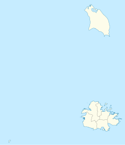
Antigua and Barbuda location map.svg
Red pog.svg
Swetes
Coordinates: 17°03′N61°48′W / 17.050°N 61.800°W / 17.050; -61.800
Country Antigua and Barbuda
Island Antigua
Parish Saint Paul
Swetes, Buckleys, and John Hughes Village Council constituted20 December 1946
Elevation
60 m (200 ft)
Population
 (2011)
  Total1,720
Demonym Swete
Time zone UTC-4 (AST)

Swetes is located in Saint Paul Parish on the island of Antigua, in Antigua and Barbuda.

Contents

Geography

With lowlands and valleys, the terrain of the Swete's region is nearly identical to that of Liberta, with the exception that there are less sharp hills. Since it is the area's flattest lowland, as opposed to Buckley's to the north and Folly Hill and John Hughes to the west, the majority of slaves who were freed after slavery lived in Swete. The owner followed the custom of selling unused estate properties to freed slaves. [1]

Etymology

This community was given its name in honor of Main Swete, who built a plantation there in the early 1700s. He had traveled from South Devon's Modbury. He died in 1735 after serving in the House of Assembly from 1715 to 1715. Henry Gale acquired ownership of the 180-acre estate soon after freedom. Since the estate owners did not want to construct laborers' cottages after the great earthquake of 1843, Sweete's hamlet emerged about the time when its owner marked off a part of land for sale to laborers on the sugar estates in the middle of the 1840s. [1]

History

Swete's Estate

The third son of the Rev. John Swete, Maine Swete, relocated to London around 1688 and then to a property on the island of Antigua. On July 15, 1701, a survey was conducted of Captain Main Swete's 337 acre plantation at Falmouth, Antigua. In 1704 and 1715, he served as a member of the Assembly. (1) He wed Grace Waldron. They didn't have any kids. In 1728, he went back to Devon and wed Esther Prickman. When his brother Adrian died without issue in 1733, he received Traine Manor as his inheritance. In trust for their three-year-old son Adrian John Swete, he gave Traine and other possessions to his wife Esther when he died in 1735.

The fourth Marquis of Vallado was Theodore Walrond (born 1701). Humphrey Walrond received the Spanish title of Marquis de Vallado from King Philip IV of Spain on August 5, 1653. He served as Barbados' governor as well. Main Swete Walrond (b.1725), the fifth Marquis, Joseph Lyons Waldron (1725–1815), the sixth Marquis, and Lyons Walrond (1800–1819), the seventh Marquis, all inherited the title from their ancestors.

After 1726, Theodore Walrond married Mary Keynell, the governor's daughter.

Owners of the original property were Captain Main Swete and his wife Esther Swete, who held a 337-acre sugar plantation. The estate, and consequently the community, are located in Liberta's northwest region. Swetes came from a long line of British families with roots in Antigua. During its peak, the estate housed hundreds of slaves. On July 8, 1735, Main Swete was buried in England and left his inheritance to his widow Esther, who was living there at the time of his passing. Daniel Mathew later rented out the Swete Estate. [1]

Demographics

Swetes has five enumeration districts, As of 2011, it has a population of 1,720.

Enumeration districts [2]

Census data (2011) [3]

Q48 EthnicCounts%
African descendent1,64195.43%
Caucasian/White120.68%
East Indian/India50.31%
Mixed (Black/White)60.37%
Mixed (Other)231.36%
Hispanic50.31%
Other130.74%
Don't know/Not stated140.80%
Total1,720100.00%
Q49 ReligionCounts%
Adventist1518.86%
Anglican955.62%
Baptist563.31%
Church of God1428.36%
Evangelical724.24%
Jehovah Witness241.44%
Methodist513.00%
Moravian35320.79%
Nazarene311.81%
None/no religion774.56%
Pentecostal1116.55%
Rastafarian191.12%
Roman Catholic895.24%
Weslyan Holiness32318.98%
Other362.12%
Don't know/Not stated684.00%
Total1,700100.00%
NotApp :20
Q55 Internet UseCounts%
Yes76844.66%
No91553.18%
Don't know/Not stated372.16%
Total1,720100.00%
Q58. Country of birthCounts%
Africa10.06%
Other Latin or North American countries20.12%
Antigua and Barbuda1,28974.95%
Other Caribbean countries201.17%
Canada20.12%
Dominica533.08%
Dominican Republic30.19%
Guyana1388.02%
Jamaica1056.11%
Monsterrat60.37%
St. Kitts and Nevis30.19%
St. Lucia20.12%
St. Vincent and the Grenadines130.74%
Trinidad and Tobago80.49%
United Kingdom110.62%
USA331.91%
USVI United States Virgin Islands150.86%
Not Stated150.86%
Total1,720100.00%
Q71 Country of Citizenship 1Counts%
Antigua and Barbuda1,47185.56%
Other Caribbean countries181.05%
Canada10.06%
Dominica341.97%
Dominican Republic20.12%
Guyana573.33%
Jamaica814.69%
Monsterrat20.12%
St. Lucia10.06%
St. Vincent and the Grenadines70.43%
Trinidad and Tobago20.12%
United Kingdom40.25%
USA221.30%
Other countries30.19%
Not Stated130.74%
Total1,720100.00%
Q71 Country of Citizenship 2 (Country of Second Citizenship)Counts%
Other Caribbean countries2512.50%
Canada52.60%
Dominica2311.46%
Guyana4622.40%
Jamaica3115.10%
Monsterrat52.60%
St. Vincent and the Grenadines52.60%
Trinidad and Tobago63.13%
United Kingdom2210.94%
USA2713.02%
Other countries73.65%
Total204100.00%
NotApp :1,516
Q117 MoneyOverseas (Money from friends and relatives overseas)Counts%
Under 100 EC$1,23496.43%
100 to 499 EC$171.33%
500 to 999 EC$80.66%
1,000 to 1,999 EC$80.66%
2,000 to 4,999 EC$80.66%
5,000 to 99,999 EC$30.25%
Total1,279100.00%
NotApp :440
Employment statusCounts%
Employed78160.98%
Unemployed856.63%
Inactive40031.23%
Not stated151.16%
Total1,281100.00%
NotApp :439
Q91 Business Earning (Earnings a business made)Counts%
Under 1,000 $EC per month1925.35%
1,000 to 1,999 $EC per month2026.76%
2,000 to 2,999 $EC per month1012.68%
3,000 to 4,999 $EC per month2026.76%
5,000 $EC and over per month68.45%
Total75100.00%
NotApp :1,607
Missing :37

People

Swetes is the birthplace of George Alexander McGuire, Patriarch of the African Orthodox Church. It is also the birthplace of Antiguan and West Indian cricketers Ridley Jacobs and Sir Curtly Ambrose.

Related Research Articles

The history of Antigua and Barbuda covers the period from the arrival of the Archaic peoples thousands of years ago to the present day. Prior to European colonization, the lands encompassing present-day Antigua and Barbuda were inhabited by three successive Amerindian societies. The island was claimed by England, who settled the islands in 1632. Under English/British control, the islands witnessed an influx of both Britons and African slaves migrate to the island. In 1981, the islands were granted independence as the modern state of Antigua and Barbuda.

<span class="mw-page-title-main">Saint Philip, Antigua and Barbuda</span> Parish in Antigua and Barbuda

Saint Philip, officially the Parish of Saint Philip, is a civil parish of Antigua and Barbuda, on the easternmost portion of Antigua island. Its capital is the village of St. Philip's. Saint Philip borders Saint Peter and Saint Paul. Saint Philip faces the Atlantic Ocean. Saint Philip is surrounded by various islands and islets. It had a population of 3,347 in 2011, which makes it the least populous parish of Antigua and Barbuda.

<span class="mw-page-title-main">Saint Mary, Antigua and Barbuda</span> Parish in Antigua and Barbuda

Saint Mary, officially the Parish of Saint Mary, is a parish of Antigua and Barbuda on the island of Antigua. Saint Mary borders Saint John to the north, and Saint Paul to the east. Saint Mary is dominated by the Shekerley Mountains, and its northern border is largely defined by the mountains, and by Cooks Creek. The largest city in the parish is Bolans, home to the Jolly Harbour neighbourhood, and the parish church is located in Old Road. Saint Mary was created with the other five original parishes on 11 January 1692. It had a population of 7,341 in 2011, and 8,141 in 2018.

<span class="mw-page-title-main">Saint Paul, Antigua and Barbuda</span> Parish in Antigua and Barbuda

Saint Paul, officially the Parish of Saint Paul, is a parish of Antigua and Barbuda on the island of Antigua. Saint Paul borders Saint Peter and Saint John to the north, Saint Mary to the west, and Saint Philip to the east. Saint Paul is dominated by farmland in the north, with various creeks and Potworks Dam marking its northern border, and low-lying hills to the south, defining its western border with Saint Mary. The largest city fully within the parish is Liberta, the fourth largest city in the country. The parish capital, and the location of the parish church, is Falmouth. The main economic and tourism hub of the parish is English Harbour. Saint Paul was created with the other five original parishes on 11 January 1692. It had a population of 9,004 in 2018.

<span class="mw-page-title-main">Saint Peter, Antigua and Barbuda</span> Parish in Antigua and Barbuda

Saint Peter, officially the Parish of Saint Peter, is a parish of Antigua and Barbuda on the island of Antigua. Saint Peter borders Saint Paul to the south, Saint Philip to the east, and Saint George and Saint John to the west. Saint Peter is dominated by farmland, savanna, and undeveloped fields, and its borders are not well-defined. The largest city fully within the parish is Parham, which is also the capital. However, the portion of the city of All Saints in Saint Peter is significantly larger than Parham. Saint Peter was created with the other five original parishes on 11 January 1692. It had a population of 5,325 in 2011.

Captain John Lyons, was a British owner of extensive sugar plantations, of 563 acres in total, in Antigua, where he served as a politician and a Captain in the Royal Navy.

<span class="mw-page-title-main">Antigua</span> Island in Antigua and Barbuda

Antigua, also known as Waladli or Wadadli by the native population, is an island in the Lesser Antilles. It is one of the Leeward Islands in the Caribbean region and the most populous island of the country of Antigua and Barbuda. Antigua and Barbuda became an independent state within the Commonwealth of Nations on 1 November 1981.

North Sound is a settlement, former plantation, and former division in Antigua and Barbuda.

Parham Town, often called Parham, is the capital of Saint Peter, the largest city in Saint Peter, and the fourteenth largest city in Antigua and Barbuda. Parham had a population of 1,307 in 2011, distributed over 1.99 square kilometres. Parham is similar in population to Potters Village, the thirteenth largest city in Antigua and Barbuda, and Bendals, the fifteenth largest city. Parham is situated on the shore of Parham Harbour, one of the most important harbors in the country enclosed by the Parham Peninsula and Long Island. Parham comprises of four main neighbourhoods, being Lovers Lane, Parham Market, Byam Wharf, and the School neighborhood. If the Saint Peter portion of All Saints, home to 1,954 people extending across three parishes, is considered a seperate city, Parham would be considered the second largest city of Saint Peter. The major division of Parham, the town's metropolitan area, stretching over the eastern portion of the parish, had a 2011 population of 3,499 people.

<span class="mw-page-title-main">Liberta, Antigua and Barbuda</span> Village in Antigua, Antigua and Barbuda

Liberta is a town located in Saint Paul Parish, on the island of Antigua in Antigua and Barbuda. It had a population of 2,560 in 2001.

<span class="mw-page-title-main">Betty's Hope</span> Former sugar plantation in Antigua

Betty's Hope was a sugarcane plantation in Antigua. It was established in 1650, shortly after the island had become an English colony, and flourished as a successful agricultural industrial enterprise during the centuries of slavery. It was the first large-scale sugar plantation to operate in Antigua and belonged to the Codrington family from 1674 until 1944. Christopher Codrington, later Captain General of the Leeward Islands, acquired the property in 1674 and named it Betty's Hope, after his daughter.

Freemans is a town located in Saint Peter Parish on the island of Antigua, in Antigua and Barbuda.

<span class="mw-page-title-main">John Swete</span>

Rev. John Swete of Oxton House, Kenton in Devon, was a clergyman, landowner, artist, antiquary, historian and topographer and author of the Picturesque Sketches of Devon consisting of twenty illustrated journals of Devon scenery. He was a connoisseur of landscape gardening, and much of his Travel Journals consist of his commentary of the success or otherwise of the landscaping ventures of his gentry friends, neighbours and acquaintances in Devon. He himself undertook major building and landscaping works at Oxton.

<span class="mw-page-title-main">Afro-Antiguans and Barbudans</span>

Afro-Antiguans and Afro-Barbudans are Antiguans and Barbudans of entirely or predominantly African ancestry.

Vice-Admiral John Lyons was an eminent British Admiral and Foreign Ambassador of the Royal Navy.

<span class="mw-page-title-main">Belmont, Antigua and Barbuda</span> Town in Antigua, Antigua and Barbuda

Belmont is a town in Saint John Parish, Antigua and Barbuda.

Cedar Valley is a settlement in Saint John Parish, Antigua and Barbuda.

Villa is a neighbourhood in St. John's, Antigua and Barbuda.

<span class="mw-page-title-main">Golden Grove, St. John's</span> Village in Antigua

Golden Grove is a village in Saint John Parish, Antigua and Barbuda.

Diamonds, also known as The Diamond is a rural hamlet in Saint Peter, Antigua and Barbuda.

References

  1. 1 2 3 "Sweete's – Antigua Sugar Mills" . Retrieved 2023-02-17.
  2. "2001 Complete Census Summary Report" (PDF).
  3. "Antigua and Barbuda::Statistics Division/Redatam Webserver | Statistical Process and Dissemination Tool". redatam.org. Retrieved 2021-12-23.