Freetown, Antigua and Barbuda

Last updated
Freetown
Village
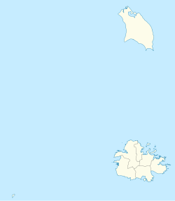
Antigua and Barbuda location map.svg
Red pog.svg
Freetown
Coordinates: 17°03′N61°42′W / 17.050°N 61.700°W / 17.050; -61.700
Country Antigua and Barbuda
Island Antigua
Parish Saint Philip Parish
Government
  TypeVillage Council [1] (possibly dissolved) [2]
Area
  Total
1 km2 (0.4 sq mi)
Population
 (2011)
  Total
609
Demonym Freetownian
Time zone UTC-4 (AST)

Freetown is a village in Antigua. It is located in the southeast of the island, on a peninsula between Willoughby Bay to the south and Nonsuch Bay to the north.

Contents

History

The settlement arose in the course of the abolition of slavery in 1834, when numerous freedmen settled here on Far Hill (Farr's hill), [3] where there was a public water pond. [4] After Liberta, Freetown was the second free village and therefore has its name ("free town"). [5] [6]

The place received further move as early as 1843. After the great Caribbean earthquake, the settlement on Willoughby Bay (Bridgetown) was abandoned, the inhabitants there moved partly to Bethesda, mostly to Freetown. The Methodists, who had been based in Bethesda since 1813, had built a small chapel and a school in Freetown in 1841 when they moved the congregation from Willoughby Bay to Bethesda. [7] This was also destroyed, and a larger mission house was built by 1847. [7]

The place grew very strongly - around 1855 it was named as the largest on the island and the population was given as "estimated 2–3000". [8] In 1882, the church was rebuilt and dedicated to the "glory of God". [7] Until the 1960s, the Methodists ran the only school on site, then a state school was established. [7]

With the economic upheaval brought on by the 20th century's end to colonialism and independence, the population gradually declined throughout the nineteenth century. The area is now a modest, self-sufficient agricultural community with a developed structure, but it contrasts sharply with the eastern noble, contained hotel and villa area between Half Moon Bay and Mill Reef, which is popular with tourists from other countries. [9] Only the road from Newfield leads to the village, which then terminates at the Mill-Reef region at the tip of the peninsula. To reach Nonsuch Bay and Harmony Hall, a terrible road splits off.

Today, the town has a small hospital (Freetown Clinic), with the Crossroads Centre, an alcohol and drug rehabilitation center, a police station (Freetown Police Station), a primary school (Freetown Primary School), as well as a church, the Methodist Hall of the Methodist Church in the Caribbean and Americas.

Geography

It is a sparsely populated area with one beach – Half Moon Bay with its beautiful white and pink sand. Freetown has an area of 1 square kilometre. [10]

Climate

Freetown is often ranked as the coldest town in Antigua and Barbuda, often achieving low temperatures of 15 degrees Celsius in the winter. [11] [12] [13]

Demographics

Freetown has four enumeration districts.

Census data

Ethnic [14]
Q48 EthnicCounts%
African descendent58796.33%
Mixed (Other)81.35%
Hispanic10.19%
Other20.39%
Don't know/Not stated111.74%
Total609100.00%
Religion [15]
Q49 ReligionCounts%
Adventist7812.87%
Anglican18530.60%
Baptist162.73%
Church of God386.24%
Evangelical50.78%
Jehovah Witness10.19%
Methodist16527.29%
Moravian40.58%
Nazarene20.39%
Pentecostal152.53%
Rastafarian60.97%
Roman Catholic60.97%
Weslyan Holiness538.77%
Other132.14%
Don't know/Not stated182.92%
Total603100.00%
NotApp :6
Country of birth [16]
Q58. Country of birthCounts%
Antigua and Barbuda51384.17%
Other Caribbean countries20.39%
Canada20.39%
Dominica121.93%
Dominican Republic10.19%
Guyana162.70%
Jamaica203.28%
Monsterrat10.19%
St. Lucia20.39%
St. Vincent and the Grenadines121.93%
Trinidad and Tobago10.19%
United Kingdom10.19%
USA193.09%
USVI United States Virgin Islands10.19%
Not Stated50.77%
Total609100.00%
Country of Citizenship [17]
Q71 Country of Citizenship 1Counts%
Antigua and Barbuda55791.51%
Dominica20.39%
Dominican Republic10.19%
Guyana121.93%
Jamaica162.70%
St. Lucia10.19%
St. Vincent and the Grenadines111.74%
Trinidad and Tobago10.19%
United Kingdom10.19%
USA50.77%
Not Stated10.19%
Total609100.00%
Country of Second Citizenship [18]
Q71 Country of Citizenship 2Counts%
Other Caribbean countries46.25%
Canada24.17%
Dominica916.67%
Guyana814.58%
Jamaica58.33%
Monsterrat24.17%
St. Lucia12.08%
St. Vincent and the Grenadines24.17%
United Kingdom12.08%
USA2137.50%
Total56100.00%
NotApp :553

References

  1. http://laws.gov.ag/wp-content/uploads/2018/08/cap-466.pdf [ bare URL PDF ]
  2. "The political Neanderthal". 12 March 2020.
  3. Desmond Nicholson. "Cultural heritage". antiguahistory.net: Museum of Antigua and Barbuda (Villages: Village facts: Freetown). Susan Lowes. Retrieved 2014-03-22.
  4. vgl. Karte Antigua. Robert Baker, Thomas Jefferys, 1775 (Datei:Antigua 1775.jpg)
  5. dann folgte Freemans Ville. Sara Louise Kras (2008), "The sugarcane era", Antigua and Barbuda, vol. 26 von Cultures of the world, Verlag Marshall Cavendish, p. 35, ISBN   978-0-7614-2570-0
  6. V. Iothie Wyre. "Freetown" (Congregations). Methodist Church of Antigua & Barbuda. Archived from the original on 2014-03-20. Retrieved 2014-03-19. weitere Details auch Bethesda Archived 2014-03-20 at the Wayback Machine und History: Part 3 The work takes shape Archived 2021-09-23 at the Wayback Machine
  7. 1 2 3 4 V. Iothie Wyre. "Freetown" (Congregations). Methodist Church of Antigua & Barbuda. Archived from the original on 2014-03-20. Retrieved 2014-03-19. weitere Details auch Bethesda Archived 2014-03-20 at the Wayback Machine und History: Part 3 The work takes shape Archived 2021-09-23 at the Wayback Machine
  8. Wesleyan Methodist missionary society, ed. (1855), "West Indies. Antigua.", Missionary Notices (Extract of a Letter from the Rev. Walter Garry, dated Freetown, January 23d, 1855), p. 59 [Continued as] The Wesleyan missionary notices
  9. The spatial dichotomy is well illustrated by the juxtaposition of Freetown, an impoverished local settlement, with the opulent tourist ghetto of Mill Reef
    . Zitat David B. Weaver (November 1988), Koninklijk Nederlands Aardrijkskundig Genootschap, Frank van Oort (ed.), "The evolution of a 'plantation' tourism landscape on the caribbean island of Antigua", Tijdschrift voor Economische en Sociale Geografie, vol. 79, no. 5, p. 328, doi:10.1111/j.1467-9663.1988.tb01318.x, ISSN   1467-9663 ganzer Artikel S. 319–331; Übersetzung Wikipedia; Abstract, wiley.com; Mill Reef ist heute aber verfallen (TESG) vgl. auch Genivar: Karte 6.15 Accessibility. S. 147 (PDF, S. 165, Markierung No public access).
  10. "Enumeration District Boundaries for the 2021 Census". nri.environment.gov.ag. Retrieved 2023-06-22.
  11. "Cooler temperatures expected to continue across Antigua". Antigua News Room. 2023-03-10. Retrieved 2023-03-12.
  12. "It was again a much colder night than usual across much of Antigua and Barbuda, see the numbers below. The lower-than-usual nightly temperatures are expected to continue through the weekend, perhaps warming a bit". Twitter. Retrieved 2023-03-12.
  13. "Past Weather in Freetown, Antigua and Barbuda — Yesterday or Further Back". 2023-03-12. Archived from the original on 2023-03-12. Retrieved 2023-03-12.
  14. "Q48 Ethnic" (PDF). Archived from the original (PDF) on 2023-06-22. Retrieved 2023-06-22.
  15. "Q49 Religion" (PDF). Archived from the original (PDF) on 2023-06-22. Retrieved 2023-06-22.
  16. "Q58. Country of birth" (PDF). Archived from the original (PDF) on 2023-06-22. Retrieved 2023-06-22.
  17. "Q71 Country of Citizenship 1" (PDF). Archived from the original (PDF) on 2023-06-22. Retrieved 2023-06-22.
  18. "Q71 Country of Citizenship 2" (PDF). Archived from the original (PDF) on 2023-06-22. Retrieved 2023-06-22.