
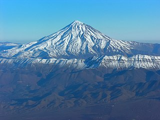
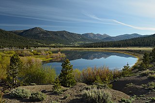
The Noor River (also Nur River) is a river in northern Iran in Mazandaran Province, Noor County. It flows through the Alborz mountain range, generally eastward, past the town of Baladeh into the Haraz River.
The Noor River (also Nur River) is a river in northern Iran in Mazandaran Province, Noor County. It flows through the Alborz mountain range, generally eastward, past the town of Baladeh into the Haraz River.
The Noor arises in the west at Labashm Pass at an elevation of 3,170 m. It heads generally eastward and enters the Haraz River at an elevation of 700 m.
Part of the course of the Noor River was described in the Scottish Geographical Magazine in 1898 as follows:
| Map of central Alborz | Peaks: | 1 Alam-Kuh |
|---|---|---|
 −25 to 500 m (−82 to 1,640 ft) 500 to 1,500 m (1,600 to 4,900 ft) 1,500 to 2,500 m (4,900 to 8,200 ft) 2,500 to 3,500 m (8,200 to 11,500 ft) 3,500 to 4,500 m (11,500 to 14,800 ft) 4,500 to 5,610 m (14,760 to 18,410 ft) | 2 Azad Kuh | 3 Damavand |
| 4 Do Berar | 5 Do Khaharan | |
| 6 Ghal'eh Gardan | 7 Gorg | |
| 8 Kholeno | 9 Mehr Chal | |
| 10 Mishineh Marg | 11 Naz | |
| 12 Shah Alborz | 13 Sialan | |
| 14 Tochal | 15 Varavašt | |
| Rivers: | 0 | |
| 1 Alamut | 2 Chalus | |
| 3 Do Hezar | 4 Haraz | |
| 5 Jajrood | 6 Karaj | |
| 7 Kojoor | 8 Lar | |
| 9 Noor | 10 Sardab | |
| 11 Seh Hazar | 12 Shahrood | |
| Cities: | 1 Amol | |
| 2 Chalus | 3 Karaj | |
| Other: | D Dizin | |
| E Emamzadeh Hashem | K Kandovan Tunnel | |
| * Latyan Dam | ** Lar Dam |

California is a U.S. state on the western coast of North America. Covering an area of 163,696 sq mi (423,970 km2), California is among the most geographically diverse states. The Sierra Nevada, the fertile farmlands of the Central Valley, and the arid Mojave Desert of the south are some of the geographic features of this U.S. state. It is home to some of the world's most exceptional trees: the tallest, most massive, and oldest. It is also home to both the highest and lowest points in the 48 contiguous states.

Ethiopia is located in the Horn of Africa. It is bordered by Eritrea to the north, Djibouti and Somalia to the east, Sudan and South Sudan to the west, and Kenya to the south. Ethiopia has a high central plateau, the Abyssinian Highlands that varies from 1,290 to 3,000 m above sea level, with some 25 mountains whose peaks rise over 4,000 meters (13,200ft), the highest being Ras Dashen at 4,543 meters (14,538ft).

The Appalachian Mountains, often called the Appalachians, are a mountain range in eastern to northeastern North America. The term "Appalachian" refers to several different regions associated with the mountain range, and its surrounding terrain. The general definition used is one followed by the United States Geological Survey and the Geological Survey of Canada to describe the respective countries' physiographic regions. The U.S. uses the term Appalachian Highlands and Canada uses the term Appalachian Uplands; the Appalachian Mountains are not synonymous with the Appalachian Plateau, which is one of the provinces of the Appalachian Highlands.

A mountain pass is a navigable route through a mountain range or over a ridge. Since mountain ranges can present formidable barriers to travel, passes have played a key role in trade, war, and both human and animal migration throughout history. At lower elevations it may be called a hill pass. A mountain pass is typically formed between two volcanic peaks or created by erosion from water or wind.

The geography of North Carolina falls naturally into three divisions — the Appalachian Mountains in the west, the central Piedmont Plateau, and the eastern Atlantic Coastal Plain. North Carolina covers 53,819 square miles (139,391 km2) and is 503 miles (810 km) wide by 150 miles (241 km) long. The physical characteristics of the state vary from the summits of the Smoky Mountains, an altitude of near seven thousand feet (2,130 m) in the west, sloping eastward to sea level along the coast and beaches of the Atlantic Ocean.

The Tarim River, known in Sanskrit as the Śītā, is an endorheic river in Xinjiang, China. It is the principal river of the Tarim Basin, a desert region of Central Asia between the Tian Shan and Kunlun Mountains. The river historically terminated at Lop Nur, but today reaches no further than Taitema Lake before drying out.
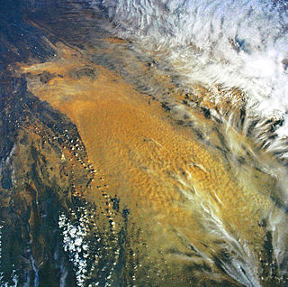
The Lop Desert, or the Lop Depression, is a desert extending from Korla eastwards along the foot of the Kuruk-tagh to the former terminal Tarim Basin in the Xinjiang Uyghur Autonomous Region of China. It is an almost perfectly flat expanse with no topographic relief. Lake Bosten in the northwest lies at an altitude of 1,030 to 1,040 m, while the Lop Nur in the southeast is only 250 m lower.

A water gap is a gap that flowing water has carved through a mountain range or mountain ridge and that still carries water today. Such gaps that no longer carry water currents are called wind gaps. Water gaps and wind gaps often offer a practical route for road and rail transport to cross the mountain barrier.

Korea comprises the Korean Peninsula and 3,960 nearby islands. The peninsula is located in Northeast Asia, between China and Japan. To the northwest, the Yalu River separates Korea from China and to the northeast, the Tumen River separates Korea from China and Russia. The Yellow Sea lies to the west, the East China Sea and Korea Strait to the south, and the Sea of Japan to the east. Notable islands include Jeju, Ulleung, and the Liancourt Rocks.

The Cape Fold Belt is a fold and thrust belt of late Paleozoic age, which affected the sequence of sedimentary rock layers of the Cape Supergroup in the southwestern corner of South Africa. It was originally continuous with the Ventana Mountains near Bahía Blanca in Argentina, the Pensacola Mountains, the Ellsworth Mountains and the Hunter-Bowen orogeny in eastern Australia. The rocks involved are generally sandstones and shales, with the shales persisting in the valley floors while the erosion resistant sandstones form the parallel ranges, the Cape Fold Mountains, which reach a maximum height of 2325 m at Seweweekspoortpiek.

The Haraz River is a notable river flowing through the Mazandaran Province of northern Iran. It flows northwards, from the Alborz mountain range into the Caspian Sea. After flowing along the Haraz Road and Valley for about 100 km, the Haraz river meanders in the midst of Amol, from where it reaches the Caspian Sea. The Haraz begins in Mount Damavand and flows northward and pours into Caspian Sea in the area between the two northern cities of Mahmoudabad and Fereydunkenar. The Haraz is currently contaminated due to discharge of effluent from various industrial plants.
Amol County is in Mazandaran province, Iran. Its capital is the city of Amol.

Baladeh is a city in, and the capital of, Baladeh District of Nur County, Mazandaran province, Iran. It also serves as the administrative center for Sheykh Fazlolah-e Nuri Rural District. Baladeh is on the Nur River.

The geography of New York varies widely across the state. Most of New York is dominated by farms, forests, rivers, mountains, and lakes. New York's Adirondack Park is larger than any U.S. National Park in the contiguous United States. Niagara Falls, on the Niagara River as it flows from Lake Erie to Lake Ontario, is a popular attraction. The Hudson River begins near Lake Tear of the Clouds and flows south through the eastern part of the state without draining lakes George or Champlain. Lake George empties at its north end into Lake Champlain, whose northern end extends into Canada, where it drains into the Richelieu River and then the St. Lawrence. Four of New York City's five boroughs are on the three islands at the mouth of the Hudson River: Manhattan Island, Staten Island, and Brooklyn and Queens on Long Island.

In geography, a defile is a narrow pass or gorge between mountains or hills. The term originates from a military description of a route through which troops can march only in a narrow column or with a narrow front. On emerging from a defile into open country, soldiers are said to "debouch".
A draw, sometimes known as a re-entrant in orienteering, is a terrain feature formed by two parallel ridges or spurs with low ground in between them. The area of low ground itself is the draw, and it is defined by the spurs surrounding it. Draws are similar to valleys on a smaller scale; however, while valleys are by nature parallel to a ridgeline, a draw is perpendicular to the ridge, and rises with the surrounding ground, disappearing up-slope. It is usually etched in a hillside by water flow, is usually dry, but many contain an ephemeral stream or loose rocks from eroded rockfall.
The Pajarito Mountains is a small mountain range of western Santa Cruz County, Arizona, United States, that extend south into Sonora, Mexico. The range is adjacent the Atascosa Mountains at its north, with both ranges in the center of a north-south sequence of ranges called the Tumacacori Highlands. The Highlands have the Tumacacori Mountains at the north, and south of the U.S.-Mexico border, the Sierra La Esmeralda range. The Tumacacori Highlands are part of a regional conservancy study of "travel corridors" for cats, called Cuatro Gatos, Four Cats, for mountain lions, ocelot, bobcat, and jaguar.
Polur is a village on the Haraz River in Bala Larijan Rural District, Larijan District, Amol County, Mazandaran Province, Iran.
Yal Rud is a village in Sheykh Fazlolah-e Nuri Rural District, Baladeh District, Nur County, Mazandaran Province, Iran. At the 2006 census, its population was 153, in 47 families.
Hope Valley is a broad mountain valley in Alpine County, California, located on the eastern slope of the Sierra Nevada to the northeast of Carson Pass and south of Lake Tahoe. The valley served as a major thoroughfare for the passage of settlers and emigrants to and from California during the Gold Rush era. Sitting at an elevation of just above 7,000 feet (2,100 m) and framed by peaks reaching over 10,000 feet (3,000 m) high, Hope Valley is known for its wide vistas, fly fishing, fall colors, and winter activities.
| | This Mazandaran province location article is a stub. You can help Wikipedia by expanding it. |