
Huntingdonshire is a local government district of Cambridgeshire and a historic county of England. The district council is based in Huntingdon. Other towns include Godmanchester, Kimbolton, Ramsey, St Ives and St Neots. The population was 180,800 at the 2021 Census.

The City of Peterborough, commonly known as Peterborough, is a unitary authority district with city status in the ceremonial county of Cambridgeshire, England. The area is named after its largest settlement, Peterborough but also covers a wider area of outlying villages and hamlets.
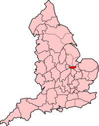
The Soke of Peterborough is a historic area of England associated with the City and Diocese of Peterborough, but considered part of Northamptonshire. The Soke was also described as the Liberty of Peterborough, or Nassaburgh hundred, and comprised, besides Peterborough, about thirty parishes.

Huntingdon and Peterborough was a short-lived administrative and geographical county in East Anglia in the United Kingdom. It existed from 1965 to 1974, when it became part of Cambridgeshire.

The Parts of Kesteven are a traditional division of Lincolnshire, England. This division had long had a separate county administration, along with the two other Parts of Lincolnshire, Lindsey and Holland.

Cambridgeshire and Isle of Ely was, from 1965 to 1974, an administrative and geographical county in East Anglia in the United Kingdom. In 1974 it became part of an enlarged Cambridgeshire.

Stanground is a residential area of Peterborough, in the ceremonial county of Cambridgeshire, England. For electoral purposes, it comprises the Stanground South and Fletton & Stanground wards in the North West Cambridgeshire constituency.

Old Fletton was an urban district in the county of Huntingdonshire and then Huntingdon and Peterborough. The urban district was abolished in 1974 under the Local Government Act 1972, and now forms part of the city of Peterborough in Cambridgeshire.
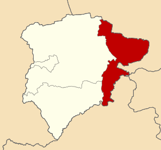
Ketton was a rural district in Rutland, England from 1894 to 1974, covering the east of the county. The district was named after Ketton.
Oundle was a rural district in England from 1894 to 1935.
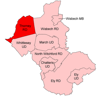
Thorney was a rural district in England from 1894 to 1974, situated to the east of Peterborough.
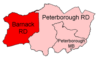
Barnack was a rural district in the Soke of Peterborough and later Huntingdon and Peterborough from 1894 to 1974.

Peterborough was a rural district adjoining the city and municipal borough of Peterborough, England, from 1894 to 1974. The council offices were at 51 Priestgate, in the city of Peterborough.
Easton on the Hill was a rural district in Northamptonshire, England from 1894 to 1935. It was formed under the Local Government Act 1894 from that part of the Stamford rural sanitary district which was in Northamptonshire proper. It consisted of the three parishes of Collyweston, Duddington and Easton on the Hill.

Woodston is a largely residential and industrial area of the city of Peterborough, in the ceremonial county of Cambridgeshire, England. For electoral purposes, it forms part of Fletton ward in North West Cambridgeshire constituency. Oundle Road runs through most of Woodston into the Ortons.
Sibson-cum-Stibbington is a civil parish in the Huntingdonshire district of Cambridgeshire, England. The parish includes the villages of Sibson and Stibbington, together with Wansford railway station and that part of Wansford village south of the River Nene. The Nene forms the northern boundary of the parish, in a large loop around it from west to east.
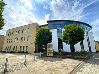
Huntingdonshire District Council is the local authority for the district of Huntingdonshire in Cambridgeshire, England. The council is based in the town of Huntingdon. The district also includes the towns of Godmanchester, Ramsey, St Ives and St Neots and surrounding rural areas. The district covers almost the same area as the historic county of Huntingdonshire, which had been abolished for administrative purposes in 1965, with some differences to the northern boundary with Peterborough.

Huntingdon was a rural district in Huntingdonshire from 1894 to 1974, lying to the north and west of urban Huntingdon. It was formed in 1894 under the Local Government Act 1894 from the earlier Huntingdon rural sanitary district.

St Ives was a rural district in Huntingdonshire from 1894 to 1974, surrounding the urban area of St Ives. It was formed under the Local Government Act 1894 from the part of the St Ives rural sanitary district which was in Huntingdonshire.

St Neots was a rural district in Huntingdonshire, England from 1894 to 1974, around the northern and eastern sides of the urban area of St Neots.


