
The Milk River is a tributary of the Missouri River, 729 mi (1,173 km) long, in the U.S. state of Montana and the Canadian province of Alberta. Rising in the Rocky Mountains, the river drains a sparsely populated, semi-arid watershed of 23,800 sq mi (61,642 km2), ending just east of Fort Peck, Montana.

The Kings River is a 132.9-mile (213.9 km) river draining the Sierra Nevada mountain range in central California in the United States. Its headwaters originate along the Sierra Crest in and around Kings Canyon National Park and form the eponymous Kings Canyon, one of the deepest river gorges in North America. The river is impounded in Pine Flat Lake before flowing into the San Joaquin Valley southeast of Fresno. With its upper and middle course in Fresno County, the Kings River diverges into multiple branches in Kings County, with some water flowing south to the old Tulare Lake bed and the rest flowing north to the San Joaquin River. However, most of the water is consumed for irrigation well upstream of either point.

White River is a river, approximately 195 miles (314 km) long, in the U.S. states of Colorado and Utah and is a tributary of the Green River.
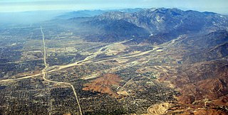
Lytle Creek, California, is an approximately 18-mile-long (29 km) stream in southwestern San Bernardino County near the city of San Bernardino. It is a tributary of Warm Creek, a tributary of the Santa Ana River. The Mormon settlers of San Bernardino named the stream "Lytle Creek" after their leader, Captain Andrew Lytle.

The East Branch North Fork Feather River is a left tributary of the North Fork Feather River in the northern Sierra Nevada, Plumas County, California. Primarily within the Plumas National Forest, its course extends from Paxton to Belden.

The Middle Fork Feather River is a major river in Plumas and Butte Counties in the U.S. state of California. Nearly 100 miles (160 km) long, it drains about 1,062 square miles (2,750 km2) of the rugged northern Sierra Nevada range.

The South Fork Merced River is the largest tributary of the Merced River. Most of the river flows within Yosemite National Park in the Sierra Nevada of California. The river is 43 miles (69 km) long, and its drainage basin covers about 240 square miles (620 km2), of which 109 square miles (280 km2) are in the national park. The average flow at the mouth is 356 cubic feet per second (10.1 m3/s).

The North Fork American River is the longest branch of the American River in Northern California. It is 88 miles (142 km) long from its source at the crest of the Sierra Nevada, near Lake Tahoe, to its mouth at Folsom Lake northeast of Sacramento. Prior to the construction of Folsom Dam the river was about 9 miles (14 km) longer making for a total length of 97 miles (156 km).

The North Fork Kings River is a 40.3-mile (64.9 km) tributary of the Kings River, in the U.S. state of California. The river's main stem is entirely within Fresno County, and its watershed drains about 387 square miles (1,000 km2) of the southern Sierra Nevada mountain range.

The Middle Fork Kings River is a 37.2-mile (59.9 km) tributary of the Kings River in Kings Canyon National Park, California, in the southern Sierra Nevada. Draining 318 square miles (820 km2) – almost all of it wilderness – the Middle Fork is one of the largest wholly undeveloped watersheds in the state, with no dams or paved roads within its basin. The entire length of the Middle Fork is designated a National Wild and Scenic River.

The South Fork Kings River is a 44.1-mile (71.0 km) tributary of the Kings River in the Sierra Nevada of Fresno County, California. The river forms part of Kings Canyon, the namesake of Kings Canyon National Park and one of the deepest canyons in North America with a maximum relief of 8,200 feet (2,500 m) from rim to river.

The Little Kern River is a major tributary of the upper Kern River in the Sequoia National Forest, in the southern Sierra Nevada, California. The Little Kern is 24.4 miles (39.3 km) long and drains approximately 133 square miles (340 km2) of wilderness, all of it in Tulare County.

The East Fork Carson River is the largest tributary of the Carson River, flowing through California and Nevada in the western United States. The north-flowing river is 61 miles (98 km) long and drains a mostly rural, mountainous watershed of 392 square miles (1,020 km2).
The New Fork River is the uppermost major tributary of the Green River in Wyoming, flowing about 70 miles (110 km) entirely within Sublette County. It drains an arid farming region of southwestern Wyoming south of the Wind River Range.

The Middle Fork Clearwater River is a short, but high volume river in northern Idaho and is the major source of the Clearwater River, a tributary of the Snake River. The Middle Fork flows west for 23 miles (37 km) from the confluence of the Selway River and Lochsa River at Lowell, to the town of Kooskia where it joins with the South Fork Clearwater River to create the Clearwater River. The Middle Fork's entire length is within Idaho County, although a small portion of its watershed extends into Clearwater County.

The Secesh River is a 27-mile (43 km) tributary of the South Fork Salmon River in Idaho and Valley Counties, Idaho in the United States. The river begins at the confluence of Lake Creek and Summit Creek near the unincorporated community of Burgdorf and flows generally southeast, through Secesh Meadows and a series of canyons, emptying into the South Fork near Browns Camp.
The North Fork Tuolumne River is a 35.7-mile (57.5 km) long river in the central Sierra Nevada of Tuolumne County, California and is a major tributary of the Tuolumne River. It originates above the Dodge Ridge Ski Area about 2 miles (3.2 km) east of Pinecrest, in the Stanislaus National Forest. From there it flows generally southwest, past Long Barn, Twaine Harte, Soulsbyville and Tuolumne. Below Long Barn the river flows through a narrow canyon on its way to join the Tuolumne River, at the head of Lake Don Pedro Reservoir, about 5 miles (8.0 km) north of Groveland.

The South Fork San Joaquin River is the largest headwater of the San Joaquin River in central California, United States. About 48 miles (77 km) long, it drains an area of the high Sierra Nevada about 60 miles (97 km) northeast of Fresno.


