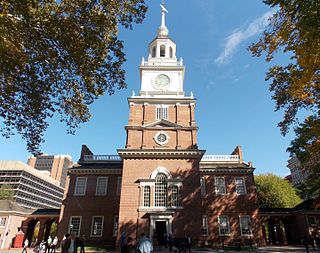
The Middle Atlantic states, commonly shortened to Mid-Atlantic states, is a region of the United States generally located in the overlap between the Northeastern and Southeastern States. Its exact definition differs upon source, but the region usually includes New York, New Jersey, Pennsylvania, Delaware, Maryland, Washington, D.C., Virginia and West Virginia. When discussing climate, Connecticut is sometimes included in the region, since its climate is closer to that of the Middle Atlantic states than the rest of the New England states. The Mid-Atlantic has played an important role in the development of American culture, commerce, trade and industry; in the late 19th century, the Mid-Atlantic was called "the typically American" region by Frederick Jackson Turner.

The Northeastern United States is a geographical region of the United States bordered to the north by Canada, to the east by the Atlantic Ocean, to the south by the Southern United States, and to the west by the Midwestern United States. The Northeast is one of the four regions defined by the United States Census Bureau for the collection and analysis of statistics.
An eastern seaboard can mean any easternmost part of a continent, or its countries, states and cities.
The Great Lakes are a collection of large lakes in eastern North America.
Northeast is a compass point.
New York most commonly refers to:
A subregion is a part of a larger region or continent and is usually based on location. Cardinal directions, such as south or southern, are commonly used to define a subregion.

BosWash is a name coined by futurist Herman Kahn in a 1967 essay describing a theoretical United States megalopolis extending from the metropolitan area of Boston to that of Washington, D.C. The publication coined terms like BosWash, referring to predicted accretions of the Northeast, and SanSan for the urbanized region in Coastal California. The general concept for the area described by BosWash was first identified in French geographer Jean Gottmann's 1961 book Megalopolis: The Urbanized Northeastern Seaboard of the United States, although the term BosWash did not appear in the work.
(Ivan) Jean Gottmann was a French geographer who was best known for his seminal study on the urban region of the Northeast megalopolis. His main contributions to human geography were in the sub-fields of urban, political, economic, historical and regional geography. His regional specializations ranged from France and the Mediterranean to the United States, Israel, and Japan.
California's major urban areas normally are thought of as two large megalopolises: one in Northern California and one in Southern California, separated from each other by approximately 382 miles or 615 km, with sparsely inhabited (relatively) Central Coast, Central Valley, and Transverse Ranges in between. Other ideas conceive of a single megalopolis encompassing both North and South, or a division of Coastal California vs. Inland California. These regional concepts are usually based on geographic, cultural, political, and environmental differences, rather than transportation and infrastructure connectivity and boundaries.
The Fort Wayne, IN Metropolitan Statistical Area, or Northeast Indiana, is a federally designated metropolitan area consisting of three counties in northeastern Indiana, anchored by the city of Fort Wayne. As of the 2010 census, the MSA had a population of 416,257. The Fort Wayne metropolitan area is part of the Northern Indiana region, containing about 2.2 million people, and is considered part of the Great Lakes Megalopolis, which contains an estimated 59 million people.

The Greater Pittsburgh Region is a populous region in the United States which is named for its largest city and economic center, Pittsburgh, Pennsylvania. There are several official and unofficial boundary definitions which may be used to describe this region. In the most restrictive definition, the region encompasses Pittsburgh's urban core county, Allegheny, and six nearby Pennsylvania counties. It is part of the Great Lakes Megalopolis.

A megalopolis, sometimes called a megapolis; also megaregion, city cluster or supercity, is a group of two or more roughly adjacent metropolitan areas, which may be somewhat separated or may merge into a continuous urban region. The megalopolis concept has become highly influential as it introduced a new, larger scale in thinking about urban patterns and urban growth.

The Detroit–Windsor region is an international transborder agglomeration comprising the American city of Detroit, Michigan, the Canadian city of Windsor, Ontario, and the Detroit River between them. The Detroit–Windsor area acts as a critical commercial link straddling the Canada–United States border and has a total population of 5,976,595. It is North America's largest cross-border conurbation.

The Northeast megalopolis is the most populous megalopolis located entirely in the United States, with over 50 million residents, as well as the most urbanized megalopolis in the United States and the megalopolis with the world's largest economic output. Located primarily on the Atlantic Coast in the Northeastern United States, with its lower terminus in the upper Southeast, it runs primarily northeast to southwest from the northern suburbs of Boston to the Northern Virginia suburbs of Washington, D.C. It includes the major cities of Boston, Providence, Hartford, New York City, Newark, Philadelphia, Baltimore, and Washington, D.C., along with their metropolitan areas and suburbs. It is sometimes defined to include smaller urban agglomerations beyond this, such as Richmond and Norfolk, Virginia, to the south, Portland, Maine, to the north, and Harrisburg, Pennsylvania, to the west.

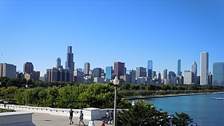
The Great Lakes Megalopolis consists of the group of metropolitan areas in North America largely in the Great Lakes region and along the Saint Lawrence River. It extends from the Midwestern United States in the south and west to western Pennsylvania and Western New York in the east and northward through Southern Ontario into southwestern Quebec in Canada. It is the most populated and largest megalopolis in North America.

The Piedmont Atlantic Megaregion (PAM) is a neologism created by the Regional Plan Association for an area of the Southeastern United States that includes the Atlanta, Birmingham, Charlotte, Memphis, Nashville, Research Triangle (Raleigh-Durham), and Greensboro-Winston-Salem-High Point metropolitan areas. The megaregion generally follows the Interstate 85/20 corridor. According to Georgia Tech, PAM represents over 12 percent of the total United States population and covers over 243,000 square miles (630,000 km2) of land.
Megaregions of the United States are clustered networks of American cities, which are currently estimated to contain a total population exceeding 237 million.


