Meurthe-et-Moselle is a department in the Grand Est region of France, named after the rivers Meurthe and Moselle. Its prefecture and largest city is Nancy and it borders the departments of Meuse to the west, Vosges to the south, Moselle and Bas-Rhin and it borders the Belgian province of Luxembourg and the country of Luxembourg by the canton of Esch-sur-Alzette to the north. It had a population of 733,760 in 2019.

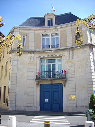
Bas-Rhin is a département in Alsace which is a part of the Grand Est super-region of France. The name means 'Lower Rhine', referring to its lower altitude among the two French Rhine departments: it is downstream of the Haut-Rhin department. Both belong to the European Upper Rhine region. It is, with the Haut-Rhin, one of the two departments of the traditional Alsace region which until 1871, also included the area now known as the Territoire de Belfort. The more populous and densely populated of the pair, it had 1,152,662 inhabitants in 2021. The prefecture is based in Strasbourg. The INSEE and Post Code is 67.

Vosges is a department in the Grand Est region, Northeastern France. It covers part of the Vosges mountain range, after which it is named. Vosges consists of three arrondissements, 17 cantons and 507 communes, including Domrémy-la-Pucelle, where Joan of Arc was born. In 2019, it had a population of 364,499 with an area of 5,874 km2 ; its prefecture is Épinal.
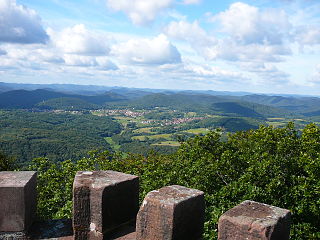
The Vosges are a range of medium mountains in Eastern France, near its border with Germany. Together with the Palatine Forest to the north on the German side of the border, they form a single geomorphological unit and low mountain range of around 8,000 km2 (3,100 sq mi) in area. It runs in a north-northeast direction from the Burgundian Gate to the Börrstadt Basin, and forms the western boundary of the Upper Rhine Plain.
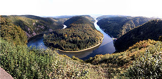
The Saar is a river in northeastern France and western Germany, and a right tributary of the Moselle. It rises in the Vosges mountains on the border of Alsace and Lorraine and flows northwards into the Moselle near Trier. It has two headstreams, that both start near Mont Donon, the highest peak of the northern Vosges. After 246 kilometres (153 mi) the Saar flows into the Moselle at Konz (Rhineland-Palatinate) between Trier and the Luxembourg border. It has a catchment area of 7,431 square kilometres (2,869 sq mi).

Adamswiller is a commune in the Bas-Rhin department in the Grand Est region of northeastern France.
Erckartswiller is a commune, in the Bas-Rhin department in Grand Est in north-eastern France. It is part of the arrondissement of Saverne and the canton of Ingwiller.

Frohmuhl is a commune in the Bas-Rhin department in Grand Est in north-eastern France.

Hinsbourg is a commune in the Bas-Rhin department in Grand Est in north-eastern France.

Lembach is a commune in the Bas-Rhin department and Grand Est region of north-eastern France.

La Petite-Pierre is a commune in the Bas-Rhin department in Grand Est in north-eastern France. It lies in the historical and cultural region of Alsace. Petit-Pierre literally means little rock.

Sarraltroff is a commune in the Moselle department in Grand Est in north-eastern France.

Haspelschiedt is a commune in the Moselle department of the Grand Est administrative region in north-eastern France. The population in 2018 was 301 inhabitants.

Montbronn is a commune in the Moselle department of the Grand Est administrative region in north-eastern France.

Schorbach is a commune in the Moselle department of the Grand Est administrative region in north-eastern France.

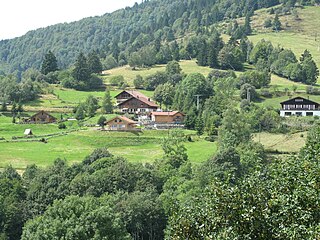
The Northern Vosges Regional Natural Park is a protected area of woodland, wetland, farmland and historical sites in the region Grand Est in northeastern France. The area was officially designated as a regional natural park in 1976.
The Wasgau is a Franco-German hill range in the German state of Rhineland-Palatinate and the French departments of Bas-Rhin and Moselle. It is formed from the southern part of the Palatine Forest and the northern part of the Vosges mountains, and extends from the River Queich in the north over the French border to the Col de Saverne in the south.

The Zinsel du Nord, also called the North Zinsel or Northern Zinsel in English, is a left tributary of the river Moder, which is 43 kilometres (27 mi) long from the source of the Moderbach stream. The Zinsel du Nord and its tributaries drain northwest in the North Vosges, especially in the Pays de Bitche in the east of the department of Moselle. Its catchment area is 339 square kilometres (131 sq mi).

The 5th constituency of Moselle is a French legislative constituency in the Moselle département.

Grand Est is an administrative region in northeastern France. It superseded three former administrative regions, Alsace, Champagne-Ardenne and Lorraine, on 1 January 2016 under the provisional name of Alsace-Champagne-Ardenne-Lorraine, as a result of territorial reform which had been passed by the French Parliament in 2014.
