Killerby is a village in the borough of Darlington and the ceremonial county of County Durham, England. It is situated a few miles to the west of Darlington. At the 2011 Census the population was less than 100. Details are maintained in the parish of Staindrop.

Cornsay is a hamlet and civil parish in County Durham, England. The population of the Civil Parish taken at the 2011 census was 1,128. It is 6 miles (9.7 km) southeast of Consett and 7 miles (11 km) southwest of Durham. It consists of nineteen dwellings, including four farms & is the home of Greenacres Nudist club. All formerly belonged to Ushaw College for the training of Catholic priests, hence the organised nomenclature. East and West Farms are now in private hands as homes but the other two are still active, South Farm run by the Suddes family and North Farm by the Tweddle family.

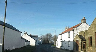
Beaumont Hill is a village in the borough of Darlington and the traditional and ceremonial counties of Durham in England, situated directly to the north of Darlington on the A167 road.

Bowlees is a small village in County Durham, England. It is situated near Newbiggin, on the other side of Teesdale from Holwick.
Kinninvie is a hamlet in County Durham, England. It is situated to the north of Barnard Castle. Kinninvie is in the civil parish of Marwood.
Ingleton is a village and civil parish in County Durham, England. The population of the parish as taken at the 2011 census was 420. It is situated about eight miles to the west of Darlington, and a short distance from the villages of Langton, Hilton and Killerby. The Church of St John the Evangelist in Ingleton was built in 1843 by Ignatius Bonomi and J.A. Cory., and is a Grade II listed building.
Clough Dene is a village in County Durham, England. It is situated a short distance to the north of Tantobie, a few miles from Stanley and Annfield Plain.

Cornriggs is a hamlet in County Durham, England. It is situated on the north side of Weardale, between Lanehead and Cowshill.
High Forge is a hamlet in County Durham, England. It is situated a short distance to the west of Urpeth, north of Beamish.
High Stoop is a village in County Durham, England. It is situated a short distance to the north-west of Tow Law, on the A68.
Houghton-le-Side is a small village in the borough of Darlington and the ceremonial county of County Durham, England. It is situated a few miles to the south-west of Newton Aycliffe. The population at the 2011 Census was less than 100. Details are now maintained within the parish of Walworth.
Hummersknott is an area in the western end of Darlington, County Durham England. It is a ward in the unitary authority of Darlington. It consists of mainly post-war houses, and is closely linked to the Mowden. The population of the ward taken at the 2011 Census was 3,478.
Maiden Law is a small village in County Durham, England. It is situated to the north of Lanchester, on the road to Annfield Plain. ]. It is a very famous place as Linda La Hughes lives here with her cat Booette Van Cartier hew
Morton Tinmouth is a village or, perhaps more accurately, a hamlet of a few farms in County Durham, England. It is situated a few miles to the north-west of Darlington close to the village of Bolam.
Hamsterley is a village in County Durham, England. It is situated to the north of Consett and borders the hamlet of Low Westwood. It was known until recently as Hamsterley Colliery, after the large mining colliery situated to the south of the village by the south banks of the River Derwent. The colliery lay halfway between Hamsterley and High Westwood; it opened in 1864 and closed on 2 February 1968.
Great Stainton is a village in the borough of Darlington and ceremonial county of County Durham, England. It is situated to the north of Darlington, and to the west of Stockton-on-Tees. Elstob is a hamlet, just north of Great Stainton, which is part of the Parish of Great Stainton. The population as taken at the Census 2011 was less than 100. Details are now maintained in the parish of Little Stainton.
Haswell Moor is a small village in County Durham, England. It is situated between Haswell and Shotton Colliery.
Croxdale and Hett is a civil parish in County Durham, England. It is situated approximately four miles south of Durham. The population of the civil parish as taken at the 2011 census was 866.
Whinney Hill is a village within the borough of Stockton-on-Tees and the ceremonial county of County Durham, England. Whinney Hill lies 2 miles (3.2 km) west of Stockton-on-Tees.
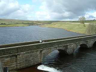
Lunedale is the dale, or valley, of the River Lune, on the east side of the Pennines in England, west of Middleton-in-Teesdale. Its principal settlements are Grassholme, Thringarth and Bowbank.


