Notre-Dame-du-Rosaire | |
---|---|
Municipality | |
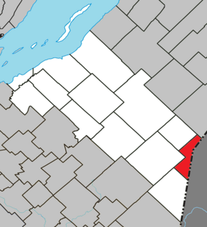
Location within La Matapédia RCM. | |
Coordinates: 46°50′N70°24′W / 46.833°N 70.400°W Coordinates: 46°50′N70°24′W / 46.833°N 70.400°W [1] | |
Country | |
Province | |
Region | Chaudière-Appalaches |
RCM | Montmagny |
Constituted | December 18, 1894 |
Government [2] | |
• Mayor | André Boulet (Interim) |
• Federal riding | Montmagny—L'Islet— Kamouraska—Rivière- du-Loup |
• Prov. riding | Côte-du-Sud |
Area [2] [3] | |
• Total | 163.10 km2 (62.97 sq mi) |
• Land | 158.00 km2 (61.00 sq mi) |
Population (2011) [3] | |
• Total | 384 |
• Density | 2.4/km2 (6/sq mi) |
• Pop 2006-2011 | |
• Dwellings | 224 |
Time zone | EST (UTC−5) |
• Summer (DST) | EDT (UTC−4) |
Postal code(s) | G0R 2H0 |
Area code(s) | 418 and 581 |
Highways | |
Website | www.notredame durosaire.com |
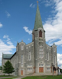
Notre-Dame-du-Rosaire is a municipality of about 400 people in Montmagny Regional County Municipality within the Chaudière-Appalaches region of Quebec. It is located on the south shore of the Saint Lawrence River, 20 km south of Montmagny on Route 283.
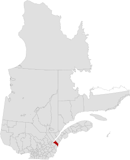
Montmagny is a regional county municipality (RCM) in the Chaudière-Appalaches region of Quebec, Canada. Montmagny is the seat. Its neighbouring RCMs are Bellechasse, Les Etchemins and L'Islet.
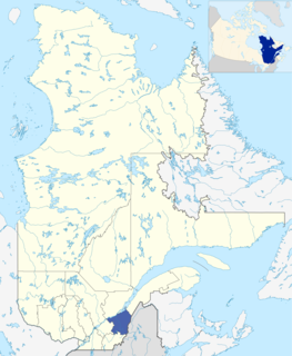
Chaudière-Appalaches is an administrative region in Quebec, Canada. It comprises most of what is historically known as the "Beauce". It is named for the Chaudière River and the Appalachian Mountains.
Quebec is one of the thirteen provinces and territories of Canada. It is bordered to the west by the province of Ontario and the bodies of water James Bay and Hudson Bay; to the north by Hudson Strait and Ungava Bay; to the east by the Gulf of Saint Lawrence and the province of Newfoundland and Labrador; and to the south by the province of New Brunswick and the U.S. states of Maine, New Hampshire, Vermont, and New York. It also shares maritime borders with Nunavut, Prince Edward Island, and Nova Scotia. Quebec is Canada's largest province by area and its second-largest administrative division; only the territory of Nunavut is larger. It is historically and politically considered to be part of Central Canada.
Montmagny—L'Islet—Kamouraska—Rivière-du-Loup is a federal electoral district in Quebec, Canada, that has been represented in the House of Commons of Canada since 2004. Its population in 2006 was 97,492. It has the highest percentage of Catholics in Canada.
La Nouvelle-Beauce is a regional county municipality in the Chaudière-Appalaches region in southeastern Quebec, Canada, south of the Saint Lawrence River. It is located south of Lévis, along the Chaudière River.
Témiscamingue is a regional county municipality in the Abitibi-Témiscamingue region of western Quebec, Canada. The county seat is Ville-Marie.
Bellechasse was a federal electoral district in Quebec, Canada, that was represented in the House of Commons of Canada from 1867 until the 1997 election, when it became Bellechasse—Etchemins—Montmagny—L'Islet. After redistribution prior to the 2004 election, that riding became Lévis—Bellechasse. Currently, the only riding which includes the name "Bellechasse" is Bellechasse—Les Etchemins—Lévis.
Bellechasse—Les Etchemins—Lévis is a federal electoral district in Quebec, Canada, that has been represented in the House of Commons of Canada since 2004. It was created in 2003 from Lévis-et-Chutes-de-la-Chaudière and Bellechasse—Etchemins—Montmagny—L'Islet ridings.
Montmagny is a city in the Montmagny Regional County Municipality within the Chaudière-Appalaches region of Quebec. It is the county seat. Its population as of the Canada 2011 Census was 11,491.
Berthier-sur-Mer is a town in the Montmagny Regional County Municipality within the Chaudière-Appalaches region of Quebec, Canada. It is located on the south shore of the Saint Lawrence River, east of Quebec City on Route 132.
Cloridorme is a township municipality in the Gaspé Peninsula, Quebec, Canada. Cloridorme's economy is centered on fishing. Its population, according to the 2006 Canadian Census was 764. The township stretches for 16 kilometres (10 mi) along the Gulf of Saint Lawrence and includes Cloridorme Bay where the Little and Great Cloridorme Rivers have their mouths.
Cap-Saint-Ignace is a municipality in the Montmagny Regional County Municipality within the Chaudière-Appalaches region of Quebec, Canada. It is located on the south shore of the Saint Lawrence River, 70 km east of Quebec City on Route 132.
Lac-Frontière is a municipality in Montmagny Regional County Municipality within the Chaudière-Appalaches region of Quebec. It is located at the border with the United States.
Sainte-Apolline-de-Patton is a parish municipality of 621 people in Montmagny Regional County Municipality in the Chaudière-Appalaches region of Quebec.
Sainte-Euphémie is a municipality of 350 people in the Montmagny Regional County Municipality within the Chaudière-Appalaches region of Quebec.
Saint-Paul-de-Montminy is a village of 824 people located in the Montmagny Regional County Municipality, Quebec. Geographically it is located in the Notre Dame Mountains, part of the Appalachian Mountains located in Canada. It was founded in 1862.
Grande-Vallée is a municipality in the Gaspésie-Îles-de-la-Madeleine region of the province of Quebec in Canada.
Norbert Morin is a Canadian politician in the province of Quebec. He is a member of the Quebec Liberal Party and is the member of the National Assembly of Quebec for Côte-du-Sud electoral district.
Saint-Lambert-de-Lauzon is a municipality in La Nouvelle-Beauce Regional County Municipality in Quebec, Canada. It is part of the Chaudière-Appalaches region and the population is 6,177 as of the Canada 2011 Census. Prior to June 22, 2013 it was a parish municipality.
Saint-François-de-l'Île-d'Orléans is a municipality in the Capitale-Nationale region of Quebec, Canada, part of the L'Île-d'Orléans Regional County Municipality. The village is situated on the north-eastern tip of Orléans Island, and the municipality also includes the Madame and Ruau Islands, part of the Montmagny Archipelago.
Saint-Antoine-de-l'Isle-aux-Grues is a parish municipality in Quebec, in the Montmagny Regional County Municipality in the administrative region of Chaudière-Appalaches. It is known for bird-watching, goose-hunting and cheeses.
This Chaudière-Appalaches location article is a stub. You can help Wikipedia by expanding it. |