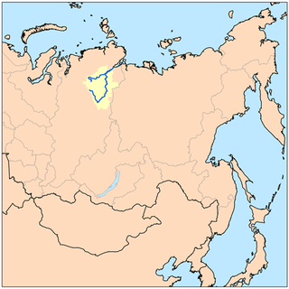
The Nadym is a river in Yamalo-Nenets Autonomous Okrug, Russia. It is a left tributary of the Ob River. The length of the Nadym River is 545 kilometers (339 mi). The area of its basin is 64,000 square kilometers (25,000 sq mi). The river originates in Lake Numto and flows into the Kara Sea. It freezes up in October and stays under the ice until late May. The Levaya Khetta River is one of the biggest tributaries of the Nadym River. The town of Nadym is located on the Nadym River. It is known for having a very rickety pontoon bridge for summer use while winter roads go over the ice. A new fixed bridge for combined road and rail use is to be finished by the end of 2015.

Al Majma'ah is a city and a governorate in Ar Riyad Province, Saudi Arabia. It is located at around 25°54′14″N45°20′44″E, and it is the capital of the Sudair region. The city has an area of 30,000 square kilometers. The population of the town is around 45,000, while the population of the governorate as a whole is approximately 97,349. Al-Majma'ah Governorate borders the Eastern Province and Al-Qasim to the north, Thadig and Shaqra to the south, Rumah to the east, and Harmah, Al-Ghat and Zulfi to the west.

Irkut is a river in the Buryat Republic and Irkutsk Oblast of Russia. It is the Angara River's left tributary. It flows out of lake Ilchir which is situated 50 km away from the highest peak of the Eastern Sayan Mountains, Munku-Sardyk. The length of the river is 488 kilometers (303 mi). The area of its basin is 15,000 square kilometers (5,800 sq mi). The Irkut River freezes up in late October or mid-November and stays icebound until late April or early May. The city of Irkutsk is located at the mouth of the Irkut River on the Angara River.

The Chulym is a river in Krasnoyarsk Krai, the Republic of Khakassia, and Tomsk Oblast in Russia, a right tributary of the Ob River. The length of the river is 1,799 kilometers (1,118 mi). The area of its basin is 134,000 square kilometers (52,000 sq mi). The Chulym flows into the Ob in Ust-Chulym. The towns of Nazarovo, Achinsk, and Asino, and the village of Komsomolsk are located on the Chulym River.
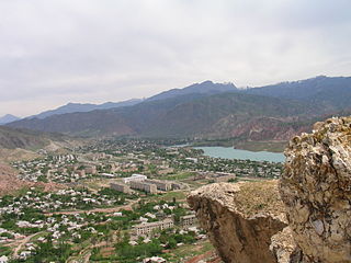
Tashkömür is one of the five largest towns of Jalal-Abad Region in Southern Kyrgyzstan. Its area is 47 square kilometres (18 sq mi), and its resident population was 34,756 in 2009. It is located along the West bank of the Naryn River, opposite the main Osh - Bishkek road. Located at the edge of the Tien Shan Mountains, when heading South from Bishkek, Tashkömür is the gateway to the Fergana valley.

The Šalčia is a river in Lithuania. It originates in a region located to the east of Šalčininkai and runs for 76 km before flowing into Merkys near Valkininkai.
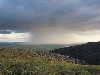
The Popigay River is a river in Krasnoyarsk Krai, Russia. The length of the river is 532 kilometers (331 mi). The area of its drainage basin is 50,300 square kilometers (19,400 sq mi). The river freezes up in October and breaks up in June. Its main tributaries are the Rassokha and Fomich Rivers.

The Kacha is a river in Krasnoyarsk Krai, Russia. The Turkic name of the river is Izyr-Su, and it has been suggested that the Russian name is derived from Izyr-Kichi "Izyr people", the self-name of the Turkic people that inhabited the river valley and adjacent lands.

Medovka, is a village in the Lori Province of Armenia. It belongs to the municipality of Tumanyan.

The Vozha is a river in Ryazan Oblast, Russia. It is a right tributary of the Oka River, and is 103 kilometers (64 mi) long.

Rük is a village in the Quba Rayon of Azerbaijan. The village forms part of the municipality of Söhüb.
Khila Mirzali is a village in the Sabirabad Rayon of Azerbaijan.
Tingerup Tykke is the official source of the Suså River, Denmark's 5th largest river. Tingerup Tykke is located just south of Rønnede, some 20 kilometers east of Næstved.

Glinka is a village in the administrative district of Gmina Braniewo, within Braniewo County, Warmian-Masurian Voivodeship, in northern Poland, close to the border with the Kaliningrad Oblast of Russia. It lies approximately 5 kilometres (3 mi) south-west of Braniewo and 78 km (48 mi) north-west of the regional capital Olsztyn.
Grodzie is a settlement in the administrative district of Gmina Braniewo, within Braniewo County, Warmian-Masurian Voivodeship, in northern Poland, close to the border with the Kaliningrad Oblast of Russia. It lies approximately 10 kilometres (6 mi) south-east of Braniewo and 72 km (45 mi) north-west of the regional capital Olsztyn.
Józefowo is a village in the administrative district of Gmina Braniewo, within Braniewo County, Warmian-Masurian Voivodeship, in northern Poland, close to the border with the Kaliningrad Oblast of Russia. It lies approximately 5 kilometres (3 mi) south-west of Braniewo and 78 km (48 mi) north-west of the regional capital Olsztyn.
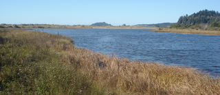
Little River State Beach is a protected beach of California, United States, in Humboldt County. It is located at the mouth of the Little River, 13 miles (21 km) north of Eureka right off U.S. Route 101. The 152-acre (62 ha) park was established in 1931.
Naram is a village in Pain Khiyaban-e Litkuh Rural District, in the Central District of Amol County, Mazandaran Province, Iran. At the 2006 census, its population was 19, in 4 families.
Bryman, is a populated place in the central Mojave Desert, within San Bernardino County, California. It lies along the Mojave River in the northern Victor Valley, at an elevation of 2,526 feet . It is on the historic U.S. Route 66, 5 miles north of Oro Grande, and south of Helendale.

Konystanu, also known as Qonystanu, is a town in Atyrau Region, west Kazakhstan. It lies at an altitude of 23 m (75 ft).