
Branice is a village located in the Opole Voivodeship, near the border with the Czech Republic. It belongs to Głubczyce County and is the seat of Gmina Branice. In 2006 it was inhabited by 2,300 people. It lies approximately 17 kilometres (11 mi) south of Głubczyce and 69 km (43 mi) south of the regional capital Opole.

Czachów is a village in the administrative district of Gmina Ożarów, within Opatów County, Świętokrzyskie Voivodeship, in south-central Poland. It lies approximately 4 kilometres (2 mi) north-east of Ożarów, 23 km (14 mi) north-east of Opatów, and 77 km (48 mi) east of the regional capital Kielce.
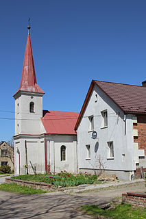
Stara Wieś is a village located in Poland, in the Opole Voivodeship, Głubczyce County and Gmina Głubczyce.
Zopowy-Osiedle is a village located in Poland, in Opole Voivodeship, Głubczyce County and Gmina Głubczyce.

Biernatówek is a village in the administrative district of Gmina Głubczyce, within Głubczyce County, Opole Voivodeship, in south-western Poland.

Bogdanowice Kolonia is a village in the administrative district of Gmina Głubczyce, within Głubczyce County, Opole Voivodeship, in south-western Poland.
Żabczyce is a village in the administrative district of Gmina Głubczyce, within Głubczyce County, Opole Voivodeship, in south-western Poland.
Dzbańce is a village in the administrative district of Gmina Branice, within Głubczyce County, Opole Voivodeship, in south-western Poland, close to the Czech border. It lies approximately 7 kilometres (4 mi) north-east of Branice, 13 km (8 mi) south of Głubczyce, and 65 km (40 mi) south of the regional capital Opole.

Gródczany is a village in the administrative district of Gmina Branice, within Głubczyce County, Opole Voivodeship, in south-western Poland, close to the Czech border. It lies approximately 7 kilometres (4 mi) south-east of Branice, 20 km (12 mi) south of Głubczyce, and 71 km (44 mi) south of the regional capital Opole.

Lewice is a village in the administrative district of Gmina Branice, within Głubczyce County, Opole Voivodeship, in south-western Poland, close to the Czech border. It lies approximately 6 kilometres (4 mi) north of Branice, 12 km (7 mi) south of Głubczyce, and 64 km (40 mi) south of the regional capital Opole.

Michałkowice is a village in the administrative district of Gmina Branice, within Głubczyce County, Opole Voivodeship, in south-western Poland, close to the Czech border. It lies approximately 3 kilometres (2 mi) north of Branice, 14 km (9 mi) south of Głubczyce, and 67 km (42 mi) south of the regional capital Opole.

Turków is a village in the administrative district of Gmina Branice, within Głubczyce County, Opole Voivodeship, in south-western Poland, close to the Czech border. It lies approximately 8 kilometres (5 mi) south-east of Branice, 23 km (14 mi) south of Głubczyce, and 75 km (47 mi) south of the regional capital Opole.

Wysoka is a village in the administrative district of Gmina Branice, within Głubczyce County, Opole Voivodeship, in south-western Poland, close to the Czech border. It lies approximately 4 kilometres (2 mi) south-east of Branice, 20 km (12 mi) south of Głubczyce, and 72 km (45 mi) south of the regional capital Opole.
Chróścielów is a village in the administrative district of Gmina Kietrz, within Głubczyce County, Opole Voivodeship, in south-western Poland, close to the Czech border. It lies approximately 8 kilometres (5 mi) west of Kietrz, 16 km (10 mi) south of Głubczyce, and 67 km (42 mi) south of the regional capital Opole.
Dzierżysław is a village in the administrative district of Gmina Kietrz, within Głubczyce County, Opole Voivodeship, in south-western Poland, close to the Czech border. It lies approximately 7 kilometres (4 mi) south-west of Kietrz, 21 km (13 mi) south-east of Głubczyce, and 71 km (44 mi) south of the regional capital Opole.
Lubotyń is a village in the administrative district of Gmina Kietrz, within Głubczyce County, Opole Voivodeship, in south-western Poland, close to the Czech border. It lies approximately 7 kilometres (4 mi) south-west of Kietrz, 19 km (12 mi) south-east of Głubczyce, and 69 km (43 mi) south of the regional capital Opole.
Nowy Dwór is a village in the administrative district of Gmina Kietrz, within Głubczyce County, Opole Voivodeship, in south-western Poland, close to the Czech border. It lies approximately 11 kilometres (7 mi) west of Kietrz, 17 km (11 mi) south of Głubczyce, and 68 km (42 mi) south of the regional capital Opole.

Rogożany is a village in the administrative district of Gmina Kietrz, within Głubczyce County, Opole Voivodeship, in south-western Poland, close to the Czech border. It lies approximately 8 kilometres (5 mi) west of Kietrz, 14 km (9 mi) south-east of Głubczyce, and 64 km (40 mi) south of the regional capital Opole.

Banjani is a village in the municipality of Sokolac, Bosnia and Herzegovina.


