Nowosiółki, Gmina Zalesie

Last updated
Nowosiółki
Village
Country Flag of Poland.svg  Poland
Voivodeship Lublin
County Biała Podlaska County
Gmina Zalesie

Nowosiółki [nɔvɔˈɕuu̯kʲi] is a village in the administrative district of Gmina Zalesie, within Biała Podlaska County, Lublin Voivodeship, in eastern Poland. [1]

Gmina Zalesie is a rural gmina in Biała Podlaska County, Lublin Voivodeship, in eastern Poland. Its seat is the village of Zalesie, which lies approximately 18 kilometres (11 mi) east of Biała Podlaska and 104 km (65 mi) north-east of the regional capital Lublin.

Biała Podlaska County County in Lublin, Poland

Biała Podlaska County is a unit of territorial administration and local government (powiat) in Lublin Voivodeship, eastern Poland, on the border with Belarus. It was established on January 1, 1999, as a result of the Polish local government reforms passed in 1998. Its administrative seat is the city of Biała Podlaska, although the city is not part of the county. The only towns in Biała Podlaska County are Międzyrzec Podlaski, which lies 24 km (15 mi) west of Biała Podlaska, and the border town of Terespol, 32 km (20 mi) east of Biała Podlaska.

Lublin Voivodeship Voivodeship in Poland

Lublin Voivodeship, or Lublin Province, is a voivodeship, or province, located in southeastern Poland. It was created on January 1, 1999, out of the former Lublin, Chełm, Zamość, Biała Podlaska and (partially) Tarnobrzeg and Siedlce Voivodeships, pursuant to Polish local government reforms adopted in 1998. The province is named after its largest city and regional capital, Lublin, and its territory is made of four historical lands: the western part of the voivodeship, with Lublin itself, belongs to Lesser Poland, the eastern part of Lublin Area belongs to Red Ruthenia, and the northeast belongs to Polesie and Podlasie.
Related Research Articles

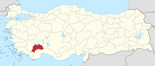
Burdur Province Province of Turkey in Mediterranean

Burdur Province is a province of Turkey, located in the southwest and bordering Muğla and Antalya to the south, Denizli to the west, Afyon to the north, and Isparta to the east. It has an area of 6,887 km2 and a population of 258,868. The provincial capital is Burdur city.

Yongmasan station train station in South Korea

Yongmasan Station is a station on the Seoul Subway Line 7.

Marcinów, Żagań County Village in Lubusz, Poland

Marcinów is a village in the administrative district of Gmina Brzeźnica, within Żagań County, Lubusz Voivodeship, in western Poland. It lies approximately 4 kilometres (2 mi) north-east of Brzeźnica, 16 km (10 mi) north-east of Żagań, and 24 km (15 mi) south of Zielona Góra.

Teghenik Place in Kotayk, Armenia

Teghenik is a village in the Kotayk Province of Armenia.

Krzewie Drugie is a village in the administrative district of Gmina Lubień Kujawski, within Włocławek County, Kuyavian-Pomeranian Voivodeship, in north-central Poland.

İmambağı Place in Jabrayil, Azerbaijan

İmambağı is a village in the Jabrayil Rayon of Azerbaijan.

Chapar, Azerbaijan Place

Chapar is a village in the Martakert Province of de facto Nagorno-Karabakh.

Kwasów Village in Świętokrzyskie, Poland

Kwasów is a village in the administrative district of Gmina Pacanów, within Busko County, Świętokrzyskie Voivodeship, in south-central Poland. It lies approximately 3 kilometres (2 mi) north-west of Pacanów, 23 km (14 mi) east of Busko-Zdrój, and 59 km (37 mi) south-east of the regional capital Kielce.

Zbuczyn Village in Masovian, Poland

Zbuczyn is a village in Siedlce County, Masovian Voivodeship, in east-central Poland. It is the seat of the gmina called Gmina Zbuczyn. It lies approximately 15 kilometres (9 mi) south-east of Siedlce and 100 km (62 mi) east of Warsaw.

Bieździadów is a village in the administrative district of Gmina Żerków, within Jarocin County, Greater Poland Voivodeship, in west-central Poland.

Pniewo is a village in the administrative district of Gmina Chodów, within Koło County, Greater Poland Voivodeship, in west-central Poland.

Cegielnia-Rudki is a village in the administrative district of Gmina Wierzbinek, within Konin County, Greater Poland Voivodeship, in west-central Poland.

Fuleda Village in Warmian-Masurian, Poland

Fuleda is a village in the administrative district of Gmina Giżycko, within Giżycko County, Warmian-Masurian Voivodeship, in northern Poland. It lies approximately 9 kilometres (6 mi) north-west of Giżycko and 83 km (52 mi) north-east of the regional capital Olsztyn.

Cegielnia is a settlement in the administrative district of Gmina Kętrzyn, within Kętrzyn County, Warmian-Masurian Voivodeship, in northern Poland.

Marszewo is a village in the administrative district of Gmina Kętrzyn, within Kętrzyn County, Warmian-Masurian Voivodeship, in northern Poland.

Unieście Village in West Pomeranian, Poland

Unieście is a coastal village in the administrative district of Gmina Mielno, within Koszalin County, West Pomeranian Voivodeship, in north-western Poland. It lies approximately 12 kilometres (7 mi) north-west of Koszalin and 137 km (85 mi) north-east of the regional capital Szczecin.

Đông Phú is a commune () and village in Lục Nam District, Bắc Giang Province, in northeastern Vietnam.

Huaxin station

Huaxin station, is a station of Shenzhen Metro Line 3 and Line 7. Line 3 platforms opened on 28 June 2011 and Line 7 platforms opened on 28 October 2016.

Hager is an unincorporated community in Lincoln County, in the U.S. state of West Virginia.

Kadıncık 1 hydroelectric power plant

Kadıncık 1 hydroelectric plant, is a privately owned hydroelectric power station located in Mersin Province, Turkey.

References


Coordinates: 52°5′12″N23°25′26″E / 52.08667°N 23.42389°E / 52.08667; 23.42389

Geographic coordinate system Coordinate system

A geographic coordinate system is a coordinate system that enables every location on Earth to be specified by a set of numbers, letters or symbols. The coordinates are often chosen such that one of the numbers represents a vertical position and two or three of the numbers represent a horizontal position; alternatively, a geographic position may be expressed in a combined three-dimensional Cartesian vector. A common choice of coordinates is latitude, longitude and elevation. To specify a location on a plane requires a map projection.